

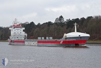
VIRGINIABORG
General Cargo

Current Trip
| Time Travelled | 17 h, 51 mins |
|---|---|
| Remaining Time | --- |
| Distance Travelled | 203.73 nm |
| Remaining Distance | --- |
| AVG Speed | 11.4 Knots |
| MAX Speed | 12.2 Knots |
| AVG Wind | 21.2 knots |
| MAX Wind | 27.7 knots |
| MIN Temp | 2.6°C / 36.68°F |
| MAX Temp | 4.1°C / 39.38°F |
| Draught | 7.6 m |
| Position Received | 1 m ago |
Current Position
| Longitude | --- |
|---|---|
| Latitude | --- |
| Status | Under way using engine |
| Speed | 11.5 Knots |
| Course | 209.6° |
| Area | Baltic Sea |
| Station | T-AIS |
| Position Received | 1 m ago |
Information
The current position of VIRGINIABORG is in Baltic Sea with coordinates 59.43210° / 19.86254° as reported on 2025-03-18 12:58 by AIS to our vessel tracker app. The vessel's current speed is 11.5 Knots and is heading at the port of ALICANTE. The estimated time of arrival as calculated by MyShipTracking vessel tracking app is 2025-03-30 08:00 LT
The vessel VIRGINIABORG (IMO: 9234290, MMSI: 244632000) is a General Cargo that was built in 2001 ( 24 years old ). It's sailing under the flag of [NL] Netherlands.
In this page you can find informations about the vessels current position, last detected port calls, and current voyage information. If the vessels is not in coverage by AIS you will find the latest position.
The current position of VIRGINIABORG is detected by our AIS receivers and we are not responsible for the reliability of the data. The last position was recorded while the vessel was in Coverage by the Ais receivers of our vessel tracking app.
The current draught of VIRGINIABORG as reported by AIS is 7.6 meters
Weather
| Temperature | 4.1°C / 39.38°F |
|---|---|
| Wind Speed | 12 knots |
| Direction | 303° WNW |
| Pressure | 1018.1 hPa |
| Humidity | 78.5 % |
| Cloud Coverage | 74 % |


Featured Company
Last Port Calls
| Port | Arrival | Departure | Time In Port |
|---|---|---|---|
| 2025-03-15 15:10 | 2025-03-17 20:09 | 2 d | |
| 2025-03-11 16:06 | 2025-03-14 16:45 | 3 d | |
| 2025-03-01 10:13 | 2025-03-06 07:05 | 4 d | |
| 2025-02-06 08:21 | 2025-02-13 12:22 | 7 d | |
| 2025-02-05 03:03 | 2025-02-06 06:14 | 1 d | |
| 2025-01-28 17:32 | 2025-01-28 22:12 | 4 h | |
| 2025-01-17 14:19 | 2025-01-20 07:43 | 2 d | |
| 2025-01-07 12:46 | 2025-01-08 18:44 | 1 d | |
| 2025-01-02 19:15 | 2025-01-04 04:15 | 1 d |
Most Visited Ports (Last year)
| Port | Arrivals | |
|---|---|---|
| 3 | ||
| 2 | ||
| 2 | ||
| 2 | ||
| 2 | ||
| 1 |
Last Trips
| Origin | Departure | Destination | Arrival | Distance | |
|---|---|---|---|---|---|
| 2025-03-14 16:45 | 2025-03-15 15:10 | 237.64 nm | |||
| 2025-03-06 07:05 | 2025-03-11 16:06 | 1016.88 nm | |||
| 2025-02-13 12:22 | 2025-03-01 10:13 | 2607.19 nm | |||
| 2025-02-06 06:14 | 2025-02-06 08:21 | 19.27 nm | |||
| 2025-01-28 22:12 | 2025-02-05 03:03 | 1440.93 nm | |||
| 2025-01-20 07:43 | 2025-01-28 17:32 | 1816.41 nm | |||
| 2025-01-08 18:44 | 2025-01-17 14:19 | 269.71 nm | |||
| 2025-01-04 04:15 | 2025-01-07 12:46 | 218.97 nm | |||
| 2024-12-31 14:24 | 2025-01-02 19:15 | 636.23 nm |
Events
| Time | Event | Details | Position / Dest | Info |
|---|---|---|---|---|
| 2025-03-18 12:10 | Change Sea Area | Swedish part of the Baltic Sea Finnish part of the Baltic Sea |
59.56991 / 19.96835
Baltic Sea
ESALC
|
Speed: 11.3 kn Course: 184.4° |
| 2025-03-18 12:06 | Status Changed | Under way using engine Default |
59.58450 / 19.96833
ESALC
|
Speed: 11.4 kn Course: 150° |
| 2025-03-18 11:58 | Status Changed | Default Under way using engine |
59.60609 / 19.94402
ESALC
|
Speed: 11.4 kn Course: 149.8° |
| 2025-03-18 10:40 | Change Sea Area | Finnish part of the Baltic Sea Swedish part of the Gulf of Bothnia |
59.80012 / 19.64647
Baltic Sea
ESALC
|
Speed: 11.8 kn Course: 137.2° |
| 2025-03-18 05:41 | Status Changed | Under way using engine Default |
60.63656 / 18.89207
ESALC
|
Speed: 11.5 kn Course: 163° |
| 2025-03-18 05:34 | Status Changed | Default Under way using engine |
60.65746 / 18.87881
ESALC
|
Speed: 11.5 kn Course: 161.7° |
| 2025-03-18 04:58 | Status Changed | Under way using engine Default |
60.76649 / 18.81158
ESALC
|
Speed: 11.5 kn Course: 167° |
| 2025-03-18 04:58 | IN Coverage |
60.76649 / 18.81158
Gulf of Bothnia
ESALC
|
Speed: 11.5 kn Course: 164.7° |
|
| 2025-03-18 01:30 | Status Changed | Default Under way using engine |
61.39947 / 18.40362
ESALC
|
Speed: 11.5 kn Course: 161° |
| 2025-03-18 01:25 | OUT of Coverage |
61.41412 / 18.39306
Gulf of Bothnia
ESALC
|
Speed: 11.5 kn Course: 161° |