
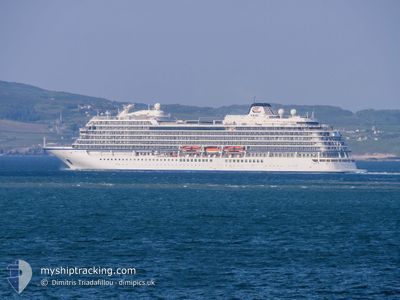
VIKING STAR
Passenger
Current Trip
| Time Travelled | 7 h, 33 mins |
|---|---|
| Remaining Time | --- |
| Distance Travelled | 67.71 nm |
| Remaining Distance | --- |
| AVG Speed | 11.8 Knots |
| MAX Speed | 14.2 Knots |
| AVG Wind | 13.1 knots |
| MAX Wind | 19.9 knots |
| MIN Temp | 15.3°C / 59.54°F |
| MAX Temp | 18.4°C / 65.12°F |
| Draught | 6.6 m |
| Position Received | 12 m ago |
Current Position
| Longitude | -4.91662° |
|---|---|
| Latitude | 53.57859° |
| Status | Under way using engine |
| Speed | 9.5 Knots |
| Course | 239.2° |
| Area | Irish Sea and St. George's Channel |
| Station | T-AIS |
| Position Received | 12 m ago |
Info
Information
The current position of VIKING STAR is in Irish Sea and St. George's Channel with coordinates 53.57859° / -4.91662° as reported on 2024-09-21 00:35 by AIS to our vessel tracker app. The vessel's current speed is 9.5 Knots and is heading at the port of DUN LAOGHAIRE. The estimated time of arrival as calculated by MyShipTracking vessel tracking app is 2024-09-21 06:00 LT
The vessel VIKING STAR (IMO: 9650418, MMSI: 257903000) is a Passenger It's sailing under the flag of [NO] Norway.
In this page you can find informations about the vessels current position, last detected port calls, and current voyage information. If the vessels is not in coverage by AIS you will find the latest position.
The current position of VIKING STAR is detected by our AIS receivers and we are not responsible for the reliability of the data. The last position was recorded while the vessel was in Coverage by the Ais receivers of our vessel tracking app.
The current draught of VIKING STAR as reported by AIS is 6.6 meters
Weather
| Temperature | 15.1°C / 59.18°F |
|---|---|
| Wind Speed | 19 knots |
| Direction | 64° ENE |
| Pressure | 1023.1 hPa |
| Humidity | 88.8 % |
| Cloud Coverage | 52 % |
Featured Company
Last Port Calls
| Port | Arrival | Departure | Time In Port |
|---|---|---|---|
| 2024-09-20 07:49 | 2024-09-20 18:14 | 10 h | |
| 2024-09-17 18:01 | |||
| 2024-09-12 07:59 | 2024-09-12 19:42 | 11 h | |
| 2024-09-11 11:06 | 2024-09-11 19:45 | 8 h | |
| 2024-09-04 08:06 | 2024-09-04 17:12 | 9 h | |
| 2024-09-02 05:31 | 2024-09-02 17:52 | 12 h | |
| 2024-08-31 07:10 | 2024-08-31 17:06 | 9 h | |
| 2024-08-30 06:31 | 2024-08-30 15:15 | 8 h | |
| 2024-08-23 08:49 | 2024-08-24 13:38 | 1 d | |
| 2024-08-22 05:15 | 2024-08-22 15:34 | 10 h |
Most Visited Ports (Last year)
| Port | Arrivals | |
|---|---|---|
| 6 | ||
| 6 | ||
| 6 | ||
| 5 | ||
| 5 | ||
| 5 |
Last Trips
| Origin | Departure | Destination | Arrival | Distance | |
|---|---|---|---|---|---|
| 2024-09-17 18:01 | 2024-09-20 07:49 | 953.53 nm | |||
| 2024-09-11 19:45 | 2024-09-12 07:59 | 180.63 nm | |||
| 2024-09-04 17:12 | 2024-09-11 11:06 | 2086.65 nm | |||
| 2024-09-02 17:52 | 2024-09-04 08:06 | 601.95 nm | |||
| 2024-08-31 17:06 | 2024-09-02 05:31 | 591.14 nm | |||
| 2024-08-30 15:15 | 2024-08-31 07:10 | 251.41 nm | |||
| 2024-08-24 13:38 | 2024-08-30 06:31 | 1974.46 nm | |||
| 2024-08-22 15:34 | 2024-08-23 08:49 | 224.72 nm | |||
| 2024-08-20 15:51 | 2024-08-22 05:15 | 310.28 nm | |||
| 2024-08-19 21:45 | 2024-08-20 08:59 | 148.93 nm |
Events
| Time | Event | Details | Position / Dest | Info |
|---|---|---|---|---|
| 2024-09-21 00:39 | Status Changed | Default Under way using engine |
53.57302 / -4.93245
DUN LAOGHAIRE
|
Speed: 9.5 kn Course: 239.2° |
| 2024-09-21 00:39 | IN Coverage |
53.57860 / -4.91662
Irish Sea and St. George's Channel
DUN LAOGHAIRE
|
Speed: 9.5 kn Course: 239.2° |
|
| 2024-09-21 00:35 | Status Changed | Under way using engine Default |
53.57880 / -4.91606
DUN LAOGHAIRE
|
Speed: 9.5 kn Course: 240° |
| 2024-09-20 23:39 | Status Changed | Default Under way using engine |
53.65378 / -4.69189
DUN LAOGHAIRE
|
Speed: 10.2 kn Course: 270.4° |
| 2024-09-20 23:34 | OUT of Coverage |
53.65426 / -4.66872
Irish Sea and St. George's Channel
DUN LAOGHAIRE
|
Speed: 10.2 kn Course: 270.4° |
|
| 2024-09-20 23:27 | Status Changed | Under way using engine Default |
53.65437 / -4.63280
DUN LAOGHAIRE
|
Speed: 9.7 kn Course: 270° |
| 2024-09-20 23:11 | Status Changed | Default Under way using engine |
53.65453 / -4.56154
DUN LAOGHAIRE
|
Speed: 10.3 kn Course: 270° |
| 2024-09-20 23:05 | Status Changed | Under way using engine Default |
53.65455 / -4.53284
DUN LAOGHAIRE
|
Speed: 10.3 kn Course: 269° |
| 2024-09-20 22:55 | Status Changed | Default Under way using engine |
53.65451 / -4.48508
DUN LAOGHAIRE
|
Speed: 9.8 kn Course: 270.1° |
| 2024-09-20 22:47 | Status Changed | Under way using engine Default |
53.65443 / -4.45009
DUN LAOGHAIRE
|
Speed: 9.9 kn Course: 271° |