

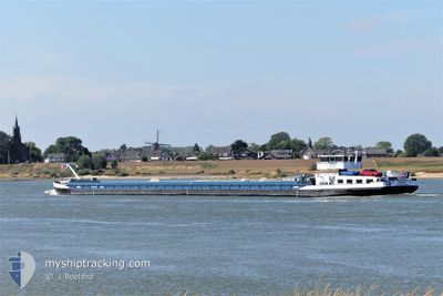
VIENTO
Cargo

Current Trip
VIENTO is out of coverage. Learn how you can join the community and extend the coverage to your area by clicking here!
RAAMSDONKSVEER
Unknown Port
ETA*
---
| Time Travelled | 1 day |
|---|---|
| Remaining Time | --- |
| Distance Travelled | 23.65 nm |
| Remaining Distance | --- |
| AVG Speed | 4.7 Knots |
| MAX Speed | 5.7 Knots |
| AVG Wind | 11.2 knots |
| MAX Wind | 14.2 knots |
| MIN Temp | 5.7°C / 42.26°F |
| MAX Temp | 12.9°C / 55.22°F |
| Draught | 0 m |
| Position Received | 16 h, 54 m ago |
Current Position
| Longitude | --- |
|---|---|
| Latitude | --- |
| Status | Under way using engine |
| Speed | 4.6 Knots |
| Course | 225° |
| Area | North Sea |
| Station | T-AIS |
| Position Received | 16 h, 54 m ago |
Information
The current position of VIENTO is in North Sea with coordinates 50.77592° / 3.47495° as reported on 2025-02-20 13:46 by AIS to our vessel tracker app. The vessel's current speed is 4.6 Knots
The vessel VIENTO (MMSI: 244969909) is a Cargo It's sailing under the flag of [NL] Netherlands.
In this page you can find informations about the vessels current position, last detected port calls, and current voyage information. If the vessels is not in coverage by AIS you will find the latest position.
The current position of VIENTO is detected by our AIS receivers and we are not responsible for the reliability of the data. The last position was recorded while the vessel was in Coverage by the Ais receivers of our vessel tracking app.
Weather
| Temperature | 12.5°C / 54.5°F |
|---|---|
| Wind Speed | 14 knots |
| Direction | 206° SSW |
| Pressure | 1019.4 hPa |
| Humidity | 78.6 % |
| Cloud Coverage | 100 % |


Featured Company
Limited time offer - Install a base station receiver to your area and list your company on MyShipTracking Free forever!
Last Port Calls
| Port | Arrival | Departure | Time In Port |
|---|---|---|---|
| 2025-02-19 19:53 | 2025-02-20 05:59 | 10 h | |
| 2025-02-19 16:37 | 2025-02-19 18:54 | 2 h | |
| 2025-02-19 09:17 | 2025-02-19 13:13 | 3 h | |
| 2025-02-15 08:24 | 2025-02-15 10:45 | 2 h | |
| 2025-02-14 19:25 | 2025-02-15 03:06 | 7 h | |
| 2025-02-13 21:17 | 2025-02-13 22:05 | 48 m | |
| 2025-02-13 12:11 | 2025-02-13 20:06 | 7 h | |
| 2025-02-12 20:22 | 2025-02-13 11:05 | 14 h | |
| 2025-02-11 21:16 | 2025-02-12 15:19 | 18 h | |
| 2025-02-09 20:30 | 2025-02-10 06:39 | 10 h |
Last Trips
| Origin | Departure | Destination | Arrival | Distance | |
|---|---|---|---|---|---|
| 2025-02-19 19:54 | 2025-02-19 20:53 | 8.02 nm | |||
| 2025-02-19 14:13 | 2025-02-19 17:37 | 22.77 nm | |||
| 2025-02-15 11:45 | 2025-02-19 10:17 | 132.22 nm | |||
| 2025-02-15 04:06 | 2025-02-15 09:24 | 37.66 nm | |||
| 2025-02-13 23:05 | 2025-02-14 20:25 | 42.39 nm | |||
| 2025-02-13 21:06 | 2025-02-13 22:17 | 9.90 nm | |||
| 2025-02-13 12:05 | 2025-02-13 13:11 | 9.14 nm | |||
| 2025-02-12 16:19 | 2025-02-12 21:22 | 33.99 nm | |||
| 2025-02-10 07:39 | 2025-02-11 22:16 | 104.84 nm | |||
| 2025-02-09 21:10 | 2025-02-09 21:30 | 0.90 nm |
Events
| Time | Event | Details | Position / Dest | Info |
|---|---|---|---|---|
| 2025-02-20 13:46 | OUT of Coverage |
50.77592 / 3.47495
North Sea
|
Speed: 4.6 kn Course: 227.2° |
|
| 2025-02-20 13:32 | START Moving | 2.41 nm, North East of AVELGEM |
50.78834 / 3.49225
RAAMSDONKSVEER
|
Speed: 3.6 kn Course: 225° |
| 2025-02-20 13:18 | STOP Moving | 2.54 nm, North East of AVELGEM |
50.78991 / 3.49458
RAAMSDONKSVEER
|
Speed: 0.2 kn Course: 223° |
| 2025-02-20 11:52 | START Moving | 8.23 nm, North East of AVELGEM |
50.84717 / 3.61472
RAAMSDONKSVEER
|
Speed: 3.8 kn Course: 222° |
| 2025-02-20 11:33 | STOP Moving | 8.49 nm, North East of AVELGEM |
50.85070 / 3.61916
RAAMSDONKSVEER
|
Speed: 0.1 kn Course: 220° |
| 2025-02-20 10:18 | START Moving | 7.07 nm, South East of DEINZE |
50.91561 / 3.66957
RAAMSDONKSVEER
|
Speed: 3.3 kn Course: 122° |
| 2025-02-20 09:54 | Status Changed | Under way using engine Moored |
50.91814 / 3.66377
RAAMSDONKSVEER
|
Speed: 0.5 kn Course: 124° |
| 2025-02-20 08:56 | Status Changed | Moored Under way using engine |
50.91962 / 3.66106
RAAMSDONKSVEER
|
Speed: 0.1 kn Course: 139° |
| 2025-02-20 08:29 | STOP Moving | 6.66 nm, South East of DEINZE |
50.91964 / 3.66105
RAAMSDONKSVEER
|
Speed: 0.1 kn Course: 138° |
| 2025-02-20 07:47 | Status Changed | Under way using engine Default |
50.95384 / 3.65084
RAAMSDONKSVEER
|
Speed: 4.1 kn Course: 237° |