

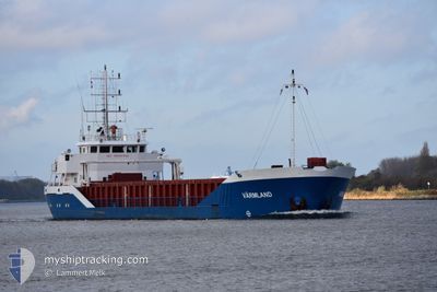
VARMLAND
General Cargo

Current Trip
SESSR
| Time Travelled | 6 days |
|---|---|
| Remaining Time | --- |
| Distance Travelled | 1010.69 nm |
| Remaining Distance | --- |
| AVG Speed | 9.6 Knots |
| MAX Speed | 12.2 Knots |
| AVG Wind | 14.1 knots |
| MAX Wind | 26.8 knots |
| MIN Temp | -1.3°C / 29.66°F |
| MAX Temp | 4.5°C / 40.1°F |
| Draught | 6.5 m |
| Position Received | 3 h, 24 m ago |
Current Position
| Longitude | --- |
|---|---|
| Latitude | --- |
| Status | Under way using engine |
| Speed | 10.2 Knots |
| Course | 298.4° |
| Area | Gulf of Bothnia |
| Station | T-AIS |
| Position Received | 3 h, 24 m ago |
Information
The current position of VARMLAND is in Gulf of Bothnia with coordinates 60.56011° / 18.78612° as reported on 2025-02-27 12:11 by AIS to our vessel tracker app. The vessel's current speed is 10.2 Knots
The vessel VARMLAND (IMO: 9191943, MMSI: 255806444) is a General Cargo that was built in 2007 ( 18 years old ). It's sailing under the flag of [PT] Portugal.
In this page you can find informations about the vessels current position, last detected port calls, and current voyage information. If the vessels is not in coverage by AIS you will find the latest position.
The current position of VARMLAND is detected by our AIS receivers and we are not responsible for the reliability of the data. The last position was recorded while the vessel was in Coverage by the Ais receivers of our vessel tracking app.
The current draught of VARMLAND as reported by AIS is 6.5 meters
Weather
| Temperature | 3°C / 37.4°F |
|---|---|
| Wind Speed | 9 knots |
| Direction | 208° SSW |
| Pressure | 1015.6 hPa |
| Humidity | 76.7 % |
| Cloud Coverage | 74 % |


Featured Company
Last Port Calls
| Port | Arrival | Departure | Time In Port |
|---|---|---|---|
| 2025-02-20 06:01 | 2025-02-21 08:40 | 1 d | |
| 2025-02-16 08:06 | 2025-02-17 05:24 | 21 h | |
| 2025-02-13 19:19 | 2025-02-14 11:34 | 16 h | |
| 2025-02-07 12:57 | 2025-02-08 10:17 | 21 h | |
| 2025-02-04 22:17 | 2025-02-06 01:29 | 1 d | |
| 2025-02-02 12:33 | 2025-02-03 16:57 | 1 d | |
| 2025-01-31 23:59 | 2025-02-02 04:27 | 1 d | |
| 2025-01-30 13:53 | 2025-01-31 16:45 | 1 d | |
| 2025-01-27 07:05 | 2025-01-29 00:53 | 1 d | |
| 2025-01-23 10:13 | 2025-01-25 18:05 | 2 d |
Last Trips
| Origin | Departure | Destination | Arrival | Distance | |
|---|---|---|---|---|---|
| 2025-02-17 07:24 | 2025-02-20 08:01 | 638.66 nm | |||
| 2025-02-14 13:34 | 2025-02-16 10:06 | 133.20 nm | |||
| 2025-02-08 12:17 | 2025-02-13 21:19 | 711.49 nm | |||
| 2025-02-06 03:29 | 2025-02-07 14:57 | 358.41 nm | |||
| 2025-02-03 18:57 | 2025-02-05 00:17 | 273.19 nm | |||
| 2025-02-02 06:27 | 2025-02-02 14:33 | 78.48 nm | |||
| 2025-01-29 02:53 | 2025-01-30 15:53 | 360.86 nm | |||
| 2025-01-25 20:05 | 2025-01-27 09:05 | 359.01 nm | |||
| 2025-01-23 04:04 | 2025-01-23 12:13 | 78.95 nm | |||
| 2025-01-21 20:45 | 2025-01-22 06:55 | 81.34 nm |
Events
| Time | Event | Details | Position / Dest | Info |
|---|---|---|---|---|
| 2025-02-27 12:18 | Status Changed | Default Under way using engine |
60.56822 / 18.75496
SESSR
|
Speed: 10.2 kn Course: 298.4° |
| 2025-02-27 12:11 | Status Changed | Under way using engine Default |
60.56011 / 18.78612
SESSR
|
Speed: 10.2 kn Course: 297° |
| 2025-02-27 12:11 | OUT of Coverage |
60.56011 / 18.78612
Gulf of Bothnia
SESSR
|
Speed: 10.2 kn Course: 298.4° |
|
| 2025-02-27 12:10 | Status Changed | Default Under way using engine |
60.55781 / 18.79513
SESSR
|
Speed: 10.2 kn Course: 295.5° |
| 2025-02-27 11:10 | ETA Changed | 2025/02/27 16:15 2025/02/27 16:30 |
60.45498 / 19.02613
SESSR
|
Speed: 9.8 kn Course: 356.9° |
| 2025-02-27 09:34 | Detected in Sea | Swedish part of the Gulf of Bothnia |
60.20222 / 19.08635
Gulf of Bothnia
SESSR
|
Speed: 9.7 kn Course: 320.4° |
| 2025-02-27 06:19 | Change Sea Area | Finnish part of the Gulf of Bothnia Finnish part of the Baltic Sea |
59.78441 / 19.77510
Gulf of Bothnia
SESSR
|
Speed: 9.8 kn Course: 322.5° |
| 2025-02-27 04:29 | Draught Changed | 6.5 4.1 |
59.55978 / 20.17662
SESSR
|
Speed: 10 kn Course: 343.3° |
| 2025-02-27 04:29 | Destination Changed | SESSR LVRIX |
59.55978 / 20.17662
SESSR
|
Speed: 10 kn Course: 343.3° |
| 2025-02-27 04:29 | ETA Changed | 2025/02/27 16:30 2025/02/25 06:00 |
59.55978 / 20.17662
SESSR
|
Speed: 10 kn Course: 343.3° |