
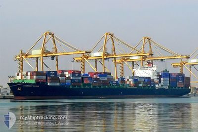
VARADA
Container Ship
Current Trip
EG AIS
| Time Travelled | 16 days |
|---|---|
| Remaining Time | --- |
| Distance Travelled | 6360.93 nm |
| Remaining Distance | --- |
| AVG Speed | 16 Knots |
| MAX Speed | 18.7 Knots |
| AVG Wind | 6.9 knots |
| MAX Wind | 18 knots |
| MIN Temp | 21.2°C / 70.16°F |
| MAX Temp | 31.7°C / 89.06°F |
| Draught | 10.9 m |
| Position Received | 2 h, 17 m ago |
Current Position
| Longitude | 121.48205° |
|---|---|
| Latitude | 27.13075° |
| Status | Under way using engine |
| Speed | 17.1 Knots |
| Course | 22° |
| Area | Eastern China Sea |
| Station | T-AIS |
| Position Received | 2 h, 17 m ago |
Info
Information
The current position of VARADA is in Eastern China Sea with coordinates 27.13075° / 121.48205° as reported on 2024-05-07 03:29 by AIS to our vessel tracker app. The vessel's current speed is 17.1 Knots
The vessel VARADA (IMO: 9295206, MMSI: 419001386) is a Container Ship that was built in 2004 ( 20 years old ). It's sailing under the flag of [IN] India.
In this page you can find informations about the vessels current position, last detected port calls, and current voyage information. If the vessels is not in coverage by AIS you will find the latest position.
The current position of VARADA is detected by our AIS receivers and we are not responsible for the reliability of the data. The last position was recorded while the vessel was in Coverage by the Ais receivers of our vessel tracking app.
The current draught of VARADA as reported by AIS is 10.9 meters
Weather
| Temperature | 21.3°C / 70.34°F |
|---|---|
| Wind Speed | 2 knots |
| Direction | 92° E |
| Pressure | 1015.7 hPa |
| Humidity | 74.5 % |
| Cloud Coverage | 100 % |
Featured Company
Last Port Calls
| Port | Arrival | Departure | Time In Port |
|---|---|---|---|
| 2024-04-20 17:26 | |||
| 2024-04-14 05:17 | 2024-04-14 22:46 | 17 h | |
| 2024-04-05 22:21 | 2024-04-07 01:39 | 1 d | |
| 2024-03-27 23:41 | 2024-03-31 20:35 | 3 d | |
| 2024-03-25 06:41 | 2024-03-26 15:37 | 1 d | |
| 2024-03-23 17:45 | 2024-03-24 07:41 | 13 h | |
| 2024-03-21 16:35 | 2024-03-23 10:48 | 1 d | |
| 2024-03-18 07:06 | |||
| 2024-03-12 19:41 | 2024-03-13 09:58 | 14 h | |
| 2024-03-08 18:21 | 2024-03-09 23:10 | 1 d |
Most Visited Ports (Last year)
| Port | Arrivals | |
|---|---|---|
| 15 | ||
| 15 | ||
| 15 | ||
| 11 | ||
| 9 | ||
| 8 |
Last Trips
| Origin | Departure | Destination | Arrival | Distance | |
|---|---|---|---|---|---|
| 2024-04-07 05:39 | 2024-04-14 07:17 | 2015.84 nm | |||
| 2024-03-31 23:35 | 2024-04-06 02:21 | 1462.58 nm | |||
| 2024-03-26 19:37 | 2024-03-28 02:41 | 491.93 nm | |||
| 2024-03-24 11:41 | 2024-03-25 10:41 | 50.37 nm | |||
| 2024-03-23 14:48 | 2024-03-23 21:45 | 47.96 nm | |||
| 2024-03-18 12:36 | 2024-03-21 20:35 | 951.42 nm | |||
| 2024-03-10 03:10 | 2024-03-13 01:11 | 979.70 nm | |||
| 2024-03-06 19:24 | 2024-03-08 22:21 | 256.28 nm | |||
| 2024-02-28 02:49 | 2024-03-04 07:02 | 1355.74 nm |
Events
| Time | Event | Details | Position / Dest | Info |
|---|---|---|---|---|
| 2024-05-07 03:37 | Status Changed | Default Under way using engine |
27.16048 / 121.49966
EG AIS
|
Speed: 17.1 kn Course: 22° |
| 2024-05-07 03:29 | OUT of Coverage |
27.13075 / 121.48205
Eastern China Sea
|
Speed: 17.1 kn Course: 22° |
|
| 2024-05-07 03:11 | Status Changed | Under way using engine Default |
27.05108 / 121.44371
EG AIS
|
Speed: 17.2 kn Course: 26° |
| 2024-05-07 02:16 | Status Changed | Default Under way using engine |
26.82120 / 121.30292
EG AIS
|
Speed: 16.9 kn Course: 28° |
| 2024-05-07 02:07 | Status Changed | Under way using engine Default |
26.78245 / 121.28025
EG AIS
|
Speed: 16.8 kn Course: 27° |
| 2024-05-07 01:56 | Status Changed | Default Under way using engine |
26.73805 / 121.25279
EG AIS
|
Speed: 16.9 kn Course: 33° |
| 2024-05-07 00:38 | Change Sea Area | Chinese part of the Eastern China Sea Chinese part of the South China Sea |
26.43013 / 121.02927
Eastern China Sea
|
Speed: 16.9 kn Course: 33° |
| 2024-05-07 00:37 | IN Coverage |
26.43013 / 121.02927
Eastern China Sea
|
Speed: 16.9 kn Course: 33° |
|
| 2024-05-07 00:35 | Status Changed | Under way using engine Default |
26.41878 / 121.02041
EG AIS
|
Speed: 16.9 kn Course: 35° |
| 2024-05-06 11:43 | OUT of Coverage |
23.91823 / 118.49851
South China Sea
|
Speed: 17.3 kn Course: 50° |