

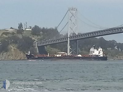
UTAH VOYAGER
Tanker

Current Trip
| Time Travelled | 9 days |
|---|---|
| Remaining Time | --- |
| Distance Travelled | 2575.25 nm |
| Remaining Distance | --- |
| AVG Speed | 11.8 Knots |
| MAX Speed | 15.3 Knots |
| AVG Wind | 11.5 knots |
| MAX Wind | 26 knots |
| MIN Temp | 19.8°C / 67.64°F |
| MAX Temp | 31.9°C / 89.42°F |
| Draught | 11.8 m |
| Position Received | 2 d ago |
Current Position
| Longitude | --- |
|---|---|
| Latitude | --- |
| Status | Under way using engine |
| Speed | 14.3 Knots |
| Course | 224.6° |
| Area | North Pacific Ocean |
| Station | T-AIS |
| Position Received | 2 d ago |
Information
The current position of UTAH VOYAGER is in North Pacific Ocean with coordinates 6.99674° / -80.21245° as reported on 2025-03-25 12:53 by AIS to our vessel tracker app. The vessel's current speed is 14.3 Knots and is heading at the port of CRISTOBAL. The estimated time of arrival as calculated by MyShipTracking vessel tracking app is 2025-03-23 12:00 LT
The vessel UTAH VOYAGER (IMO: 9747584, MMSI: 369225000) is a Tanker It's sailing under the flag of [US] USA.
In this page you can find informations about the vessels current position, last detected port calls, and current voyage information. If the vessels is not in coverage by AIS you will find the latest position.
The current position of UTAH VOYAGER is detected by our AIS receivers and we are not responsible for the reliability of the data. The last position was recorded while the vessel was in Coverage by the Ais receivers of our vessel tracking app.
The current draught of UTAH VOYAGER as reported by AIS is 11.8 meters
Weather
| Temperature | 28.8°C / 83.84°F |
|---|---|
| Wind Speed | 3 knots |
| Direction | 157° SSE |
| Pressure | 1011.4 hPa |
| Humidity | 65.5 % |
| Cloud Coverage | 94 % |


Featured Company
Last Port Calls
| Port | Arrival | Departure | Time In Port |
|---|---|---|---|
| 2025-03-15 18:29 | 2025-03-18 16:26 | 2 d | |
| 2025-03-07 17:43 | 2025-03-08 06:35 | 12 h | |
| 2025-02-24 07:36 | 2025-03-06 20:59 | 10 d | |
| 2025-02-23 12:21 | 2025-02-24 05:45 | 17 h | |
| 2025-02-15 07:03 | 2025-02-18 20:28 | 3 d | |
| 2025-01-28 22:07 | 2025-01-31 16:35 | 2 d | |
| 2025-01-24 17:43 | 2025-01-26 10:26 | 1 d | |
| 2025-01-02 19:47 | 2025-01-03 10:35 | 14 h | |
| 2025-01-01 04:15 | 2025-01-02 19:32 | 1 d | |
| 2025-01-01 03:35 |
Most Visited Ports (Last year)
| Port | Arrivals | |
|---|---|---|
| 27 | ||
| 17 | ||
| 3 | ||
| 2 | ||
| 2 | ||
| 1 |
Last Trips
| Origin | Departure | Destination | Arrival | Distance | |
|---|---|---|---|---|---|
| 2025-03-08 06:35 | 2025-03-15 18:29 | 583.96 nm | |||
| 2025-03-06 20:59 | 2025-03-07 17:43 | 92.44 nm | |||
| 2025-02-24 05:45 | 2025-02-24 07:36 | 16.83 nm | |||
| 2025-02-18 20:28 | 2025-02-23 12:21 | 1414.37 nm | |||
| 2025-01-31 16:35 | 2025-02-15 07:03 | 3426.36 nm | |||
| 2025-01-26 10:26 | 2025-01-28 22:07 | 34.86 nm | |||
| 2025-01-03 10:35 | 2025-01-24 17:43 | 4877.72 nm | |||
| 2025-01-02 19:32 | 2025-01-02 19:47 | 1.58 nm | |||
| 2025-01-01 03:35 | 2025-01-01 04:15 | 2.13 nm |
Events
| Time | Event | Details | Position / Dest | Info |
|---|---|---|---|---|
| 2025-03-25 12:57 | Status Changed | Default Under way using engine |
6.98560 / -80.22369
PA CTB
|
Speed: 14.3 kn Course: 224.6° |
| 2025-03-25 12:53 | OUT of Coverage |
6.99674 / -80.21245
North Pacific Ocean
|
Speed: 14.3 kn Course: 224.6° |
|
| 2025-03-25 12:52 | Status Changed | Under way using engine Default |
7.00146 / -80.20771
PA CTB
|
Speed: 14.3 kn Course: 226° |
| 2025-03-25 12:40 | Status Changed | Default Under way using engine |
7.03514 / -80.17382
PA CTB
|
Speed: 14.6 kn Course: 225.2° |
| 2025-03-25 12:33 | Status Changed | Under way using engine Default |
7.05340 / -80.15533
PA CTB
|
Speed: 14.7 kn Course: 224° |
| 2025-03-25 12:31 | IN Coverage |
7.05340 / -80.15533
North Pacific Ocean
|
Speed: 14.6 kn Course: 225.2° |
|
| 2025-03-25 11:09 | Status Changed | Default Under way using engine |
7.29120 / -79.89912
PA CTB
|
Speed: 14.8 kn Course: 226.1° |
| 2025-03-25 11:04 | Status Changed | Under way using engine Default |
7.30505 / -79.88430
PA CTB
|
Speed: 14.8 kn Course: 228° |
| 2025-03-25 11:04 | OUT of Coverage |
7.30505 / -79.88430
North Pacific Ocean
|
Speed: 14.8 kn Course: 226.1° |
|
| 2025-03-25 10:33 | Status Changed | Default Under way using engine |
7.39076 / -79.79037
PA CTB
|
Speed: 14.6 kn Course: 227.4° |