
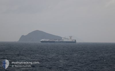
ULUSOY-15
Ro-Ro Cargo
Current Trip
| Time Travelled | 10 h, 52 mins |
|---|---|
| Remaining Time | 1 day |
| Distance Travelled | 160.40 nm |
| Remaining Distance | 786.60 nm |
| AVG Speed | 15.8 Knots |
| MAX Speed | 16.7 Knots |
| AVG Wind | 16.3 knots |
| MAX Wind | 22 knots |
| MIN Temp | 14.9°C / 58.82°F |
| MAX Temp | 17.3°C / 63.14°F |
| Draught | 6.5 m |
| Position Received | 1 h, 11 m ago |
Current Position
| Longitude | --- |
|---|---|
| Latitude | --- |
| Status | Under way using engine |
| Speed | 16.4 Knots |
| Course | 238.3° |
| Area | Aegean Sea |
| Station | T-AIS |
| Position Received | 1 h, 11 m ago |
Info
Information
The current position of ULUSOY-15 is in Aegean Sea with coordinates 36.73337° / 23.85284° as reported on 2025-03-17 06:49 by AIS to our vessel tracker app. The vessel's current speed is 16.4 Knots and is heading at the port of TRIESTE. The estimated time of arrival as calculated by MyShipTracking vessel tracking app is 2025-03-19 08:58 LT
The vessel ULUSOY-15 (IMO: 9506265, MMSI: 271043165) is a Ro-Ro Cargo that was built in 2013 ( 12 years old ). It's sailing under the flag of [TR] Turkey.
In this page you can find informations about the vessels current position, last detected port calls, and current voyage information. If the vessels is not in coverage by AIS you will find the latest position.
The current position of ULUSOY-15 is detected by our AIS receivers and we are not responsible for the reliability of the data. The last position was recorded while the vessel was in Coverage by the Ais receivers of our vessel tracking app.
The current draught of ULUSOY-15 as reported by AIS is 6.5 meters
Weather
| Temperature | 15.9°C / 60.62°F |
|---|---|
| Wind Speed | 19 knots |
| Direction | 255° WSW |
| Pressure | 1011.8 hPa |
| Humidity | 74.5 % |
| Cloud Coverage | 100 % |
Featured Company
Last Port Calls
| Port | Arrival | Departure | Time In Port |
|---|---|---|---|
| 2025-03-16 16:59 | 2025-03-17 00:08 | 7 h | |
| 2025-03-16 13:26 | 2025-03-16 16:45 | 3 h | |
| 2025-03-12 09:16 | 2025-03-13 22:24 | 1 d | |
| 2025-03-09 12:21 | 2025-03-09 22:25 | 10 h | |
| 2025-03-05 09:43 | 2025-03-06 22:26 | 1 d | |
| 2025-03-02 22:13 | 2025-03-03 00:04 | 1 h | |
| 2025-03-02 13:02 | 2025-03-02 22:06 | 9 h | |
| 2025-02-26 11:30 | 2025-02-27 23:55 | 1 d | |
| 2025-02-23 13:36 | 2025-02-24 04:40 | 15 h | |
| 2025-02-19 10:17 | 2025-02-21 00:27 | 1 d |
Last Trips
| Origin | Departure | Destination | Arrival | Distance | |
|---|---|---|---|---|---|
| 2025-03-16 16:45 | 2025-03-16 16:59 | 0.56 nm | |||
| 2025-03-13 22:24 | 2025-03-16 13:26 | 961.47 nm | |||
| 2025-03-09 22:25 | 2025-03-12 09:16 | 950.11 nm | |||
| 2025-03-06 22:26 | 2025-03-09 12:21 | 963.61 nm | |||
| 2025-03-03 00:04 | 2025-03-05 09:43 | 950.33 nm | |||
| 2025-03-02 22:06 | 2025-03-02 22:13 | 1.18 nm | |||
| 2025-02-27 23:55 | 2025-03-02 13:02 | 962.34 nm | |||
| 2025-02-24 04:40 | 2025-02-26 11:30 | 950.87 nm | |||
| 2025-02-21 00:27 | 2025-02-23 13:36 | 961.78 nm | |||
| 2025-02-17 01:07 | 2025-02-19 10:17 | 951.41 nm |
Events
| Time | Event | Details | Position / Dest | Info |
|---|---|---|---|---|
| 2025-03-17 06:51 | Status Changed | Default Under way using engine |
36.72667 / 23.83943
ITTRS
|
Speed: 16.4 kn Course: 238.3° |
| 2025-03-17 06:49 | OUT of Coverage |
36.73337 / 23.85284
Aegean Sea
ITTRS
|
Speed: 16.4 kn Course: 238.3° |
|
| 2025-03-17 06:37 | Status Changed | Under way using engine Default |
36.76165 / 23.90960
ITTRS
|
Speed: 16.3 kn Course: 238° |
| 2025-03-17 06:27 | Status Changed | Default Under way using engine |
36.78519 / 23.95572
ITTRS
|
Speed: 16.3 kn Course: 234.9° |
| 2025-03-16 23:55 | Status Changed | Under way using engine Default |
37.82814 / 25.68628
ITTRS
|
Speed: 15.1 kn Course: 216° |
| 2025-03-16 23:48 | Status Changed | Default Under way using engine |
37.84935 / 25.70666
ITTRS
|
Speed: 15.2 kn Course: 225.6° |
| 2025-03-16 23:23 | Status Changed | Under way using engine Default |
37.92616 / 25.80092
ITTRS
|
Speed: 16 kn Course: 226° |
| 2025-03-16 23:09 | Status Changed | Default Under way using engine |
37.96923 / 25.85678
ITTRS
|
Speed: 16.3 kn Course: 226.3° |
| 2025-03-16 23:07 | Status Changed | Under way using engine Default |
37.97561 / 25.86530
ITTRS
|
Speed: 16 kn Course: 226° |
| 2025-03-16 22:23 | Status Changed | Default Under way using engine |
38.11234 / 26.04768
ITTRS
|
Speed: 16.3 kn Course: 218.7° |