

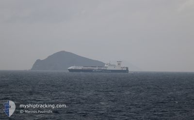
ULUSOY-15
Ro-Ro Cargo

Current Trip
| Time Travelled | 20 h, 23 mins |
|---|---|
| Remaining Time | 1 day |
| Distance Travelled | 301.25 nm |
| Remaining Distance | 654.60 nm |
| AVG Speed | 16.3 Knots |
| MAX Speed | 17.1 Knots |
| AVG Wind | 6.8 knots |
| MAX Wind | 12 knots |
| MIN Temp | 5.3°C / 41.54°F |
| MAX Temp | 12.7°C / 54.86°F |
| Dybgang | 6.7 m |
| Position Modtaget | 1 h, 48 m siden |
Current Position
| Longitude | --- |
|---|---|
| Latitude | --- |
| Status | Under way using engine |
| Fart | 16.6 Knots |
| Kurs | 138° |
| Område | Adriatic Sea |
| Station | T-AIS |
| Position Modtaget | 1 h, 48 m siden |
Information
The current position of ULUSOY-15 is in Adriatic Sea with coordinates 41.81463° / 16.70119° as reported on 2025-02-28 17:30 by AIS to our vessel tracker app. The vessel's current speed is 16.6 Knots and is heading at the port of CESME. The estimated time of arrival as calculated by MyShipTracking vessel tracking app is 2025-03-02 09:12 LT
The vessel ULUSOY-15 (IMO: 9506265, MMSI: 271043165) is a Ro-Ro Cargo that was built in 2013 ( 12 år gamle ). It's sailing under the flag of [TR] Turkey.
In this page you can find informations about the vessels current position, last detected port calls, and current voyage information. If the vessels is not in coverage by AIS you will find the latest position.
The current position of ULUSOY-15 is detected by our AIS receivers and we are not responsible for the reliability of the data. The last position was recorded while the vessel was in Coverage by the Ais receivers of our vessel tracking app.
The current draught of ULUSOY-15 as reported by AIS is 6.7 meters
Weather
| Temperature | 12.6°C / 54.68°F |
|---|---|
| Wind Speed | 3 knots |
| Direction | 88° E |
| Pressure | 1019.4 hPa |
| Humidity | 72.5 % |
| Cloud Coverage | 100 % |


Featured Company
Last Port Calls
| Port | Arrival | Departure | Time In Port |
|---|---|---|---|
| 2025-02-26 10:30 | 2025-02-27 22:55 | 1 d | |
| 2025-02-23 10:36 | 2025-02-24 01:40 | 15 h | |
| 2025-02-19 09:17 | 2025-02-20 23:27 | 1 d | |
| 2025-02-16 11:47 | 2025-02-16 22:07 | 10 h | |
| 2025-02-12 09:32 | 2025-02-13 23:14 | 1 d | |
| 2025-02-09 13:02 | 2025-02-09 23:33 | 10 h | |
| 2025-02-05 10:14 | 2025-02-06 23:49 | 1 d | |
| 2025-02-02 09:44 | 2025-02-02 20:17 | 10 h | |
| 2025-01-29 20:03 | 2025-01-30 22:43 | 1 d | |
| 2025-01-29 18:08 | 2025-01-29 19:57 | 1 h |
Last Trips
| Origin | Departure | Destination | Arrival | Distance | |
|---|---|---|---|---|---|
| 2025-02-24 04:40 | 2025-02-26 11:30 | 950.87 nm | |||
| 2025-02-21 00:27 | 2025-02-23 13:36 | 961.78 nm | |||
| 2025-02-17 01:07 | 2025-02-19 10:17 | 951.41 nm | |||
| 2025-02-14 00:14 | 2025-02-16 14:47 | 962.32 nm | |||
| 2025-02-10 02:33 | 2025-02-12 10:32 | 952.15 nm | |||
| 2025-02-07 00:49 | 2025-02-09 16:02 | 962.40 nm | |||
| 2025-02-02 23:17 | 2025-02-05 11:14 | 951.67 nm | |||
| 2025-01-30 23:43 | 2025-02-02 12:44 | 983.75 nm | |||
| 2025-01-29 20:57 | 2025-01-29 21:03 | 0.52 nm | |||
| 2025-01-29 18:51 | 2025-01-29 19:08 | 0.77 nm |
Events
| Tid | Hændelsen | Detaljer | Position / Dest | Info |
|---|---|---|---|---|
| 2025-02-28 17:30 | Udenfor Dækning |
41.81463 / 16.70119
Adriatic Sea
TRCES
|
Fart: 16.6 kn Kurs: 138° |
|
| 2025-02-28 16:42 | Status er ændret | Under way using engine Default |
41.96593 / 16.49173
TRCES
|
Fart: 16.5 kn Kurs: 132° |
| 2025-02-28 16:32 | Status er ændret | Default Under way using engine |
41.99623 / 16.44768
TRCES
|
Fart: 16.4 kn Kurs: 133° |
| 2025-02-28 15:34 | Ændre havområde | Italian part of the Adriatic Sea Croatian part of the Adriatic Sea |
42.18594 / 16.19495
Adriatic Sea
TRCES
|
Fart: 16.6 kn Kurs: 135.3° |
| 2025-02-28 14:42 | Ændre havområde | Croatian part of the Adriatic Sea Italian part of the Adriatic Sea |
42.36281 / 15.97787
Adriatic Sea
TRCES
|
Fart: 16.2 kn Kurs: 138.3° |
| 2025-02-28 14:13 | Ændre havområde | Italian part of the Adriatic Sea Croatian part of the Adriatic Sea |
42.46288 / 15.85496
Adriatic Sea
TRCES
|
Fart: 17 kn Kurs: 136.3° |
| 2025-02-28 11:45 | Status er ændret | Under way using engine Default |
42.97561 / 15.24214
TRCES
|
Fart: 16.6 kn Kurs: 139° |
| 2025-02-28 11:37 | Indenfor Dækning |
42.97561 / 15.24214
Adriatic Sea
TRCES
|
Fart: 16.8 kn Kurs: 138.6° |
|
| 2025-02-28 08:01 | Status er ændret | Default Under way using engine |
43.79389 / 14.38238
TRCES
|
Fart: 16.5 kn Kurs: 140° |
| 2025-02-28 07:56 | Udenfor Dækning |
43.81475 / 14.35823
Adriatic Sea
TRCES
|
Fart: 16.5 kn Kurs: 140° |