
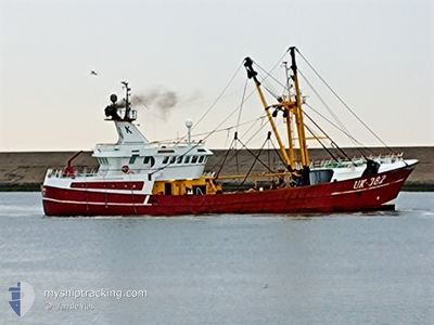
UK382 JANSSIEN
Trawler
Current Trip
HARLINGEN
| Time Travelled | 4 days |
|---|---|
| Remaining Time | --- |
| Distance Travelled | 292.25 nm |
| Remaining Distance | --- |
| AVG Speed | 7.1 Knots |
| MAX Speed | 14 Knots |
| AVG Wind | 16.4 knots |
| MAX Wind | 23 knots |
| MIN Temp | 4.9°C / 40.82°F |
| MAX Temp | 6.8°C / 44.24°F |
| Draught | 0 m |
| Position Received | 15 h, 53 m ago |
Current Position
| Longitude | --- |
|---|---|
| Latitude | --- |
| Status | Engaged in Fishing |
| Speed | 6.2 Knots |
| Course | 169.7° |
| Area | North Sea |
| Station | T-AIS |
| Position Received | 15 h, 53 m ago |
Info
Information
The current position of UK382 JANSSIEN is in North Sea with coordinates 54.12564° / 5.18752° as reported on 2025-03-06 17:18 by AIS to our vessel tracker app. The vessel's current speed is 6.2 Knots
The vessel UK382 JANSSIEN (IMO: 9102629, MMSI: 245999000) is a Trawler that was built in 1994 ( 31 years old ). It's sailing under the flag of [NL] Netherlands.
In this page you can find informations about the vessels current position, last detected port calls, and current voyage information. If the vessels is not in coverage by AIS you will find the latest position.
The current position of UK382 JANSSIEN is detected by our AIS receivers and we are not responsible for the reliability of the data. The last position was recorded while the vessel was in Coverage by the Ais receivers of our vessel tracking app.
Weather
| Temperature | 6.8°C / 44.24°F |
|---|---|
| Wind Speed | 13 knots |
| Direction | 196° SSW |
| Pressure | 1014.2 hPa |
| Humidity | 88.3 % |
| Cloud Coverage | 23 % |
Featured Company
Last Port Calls
| Port | Arrival | Departure | Time In Port |
|---|---|---|---|
| 2025-02-27 23:05 | 2025-03-03 00:37 | 3 d | |
| 2025-02-21 02:08 | 2025-02-24 00:28 | 2 d | |
| 2025-02-07 01:04 | 2025-02-17 00:31 | 9 d | |
| 2025-01-31 16:56 | 2025-02-03 00:53 | 2 d | |
| 2025-01-22 21:12 | 2025-01-27 01:32 | 4 d | |
| 2025-01-09 17:56 | 2025-01-13 11:12 | 3 d | |
| 2025-01-02 10:39 |
Last Trips
| Origin | Departure | Destination | Arrival | Distance | |
|---|---|---|---|---|---|
| 2025-02-24 01:28 | 2025-02-28 00:05 | 81.47 nm | |||
| 2025-02-17 01:31 | 2025-02-21 03:08 | 68.12 nm | |||
| 2025-02-03 01:53 | 2025-02-07 02:04 | 155.09 nm | |||
| 2025-01-27 02:32 | 2025-01-31 17:56 | 98.24 nm | |||
| 2025-01-13 12:12 | 2025-01-22 22:12 | 940.68 nm | |||
| 2025-01-02 11:39 | 2025-01-09 18:56 | 84.48 nm |
Events
| Time | Event | Details | Position / Dest | Info |
|---|---|---|---|---|
| 2025-03-06 17:18 | OUT of Coverage |
54.12564 / 5.18752
North Sea
|
Speed: 6.2 kn Course: 169.7° |
|
| 2025-03-06 15:29 | START Moving |
54.06094 / 5.14856
HARLINGEN
|
Speed: 5 kn Course: 10.7° |
|
| 2025-03-06 15:22 | STOP Moving |
54.05915 / 5.14949
HARLINGEN
|
Speed: 0.1 kn Course: 271° |
|
| 2025-03-06 04:29 | START Moving |
54.18852 / 5.15097
HARLINGEN
|
Speed: 4.8 kn Course: 17° |
|
| 2025-03-06 04:23 | STOP Moving |
54.18635 / 5.15246
HARLINGEN
|
Speed: 0.3 kn Course: 2° |
|
| 2025-03-05 15:32 | START Moving |
54.18485 / 5.14949
HARLINGEN
|
Speed: 4.4 kn Course: 78° |
|
| 2025-03-05 15:22 | STOP Moving |
54.18454 / 5.14603
HARLINGEN
|
Speed: 0.3 kn Course: 99° |
|
| 2025-03-05 05:01 | IN Coverage |
54.15298 / 5.02966
North Sea
|
Speed: 6.7 kn Course: 262.3° |
|
| 2025-03-04 22:15 | OUT of Coverage |
54.12298 / 4.93513
North Sea
|
Speed: 6 kn Course: 258.4° |
|
| 2025-03-04 20:45 | IN Coverage |
54.13889 / 5.11954
North Sea
|
Speed: 6.5 kn Course: 94.7° |