

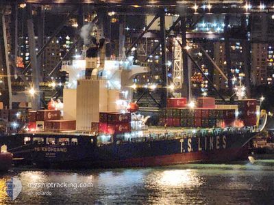
TS KAOHSIUNG
Cargo D

Current Trip
| Time Travelled | 1 day |
|---|---|
| Remaining Time | --- |
| Distance Travelled | 636.60 nm |
| Remaining Distance | 52.56 nm |
| AVG Speed | 14.7 Knots |
| MAX Speed | 18 Knots |
| AVG Wind | 15.1 knots |
| MAX Wind | 25.4 knots |
| MIN Temp | 17.1°C / 62.78°F |
| MAX Temp | 30.1°C / 86.18°F |
| Draught | 9 m |
| Position Received | 4 d ago |
Current Position
| Longitude | --- |
|---|---|
| Latitude | --- |
| Status | Under way using engine |
| Speed | 3.5 Knots |
| Course | 1° |
| Area | South China Sea |
| Station | T-AIS |
| Position Received | 4 d ago |
Information
The current position of TS KAOHSIUNG is in South China Sea with coordinates 14.53011° / 120.87128° as reported on 2025-02-16 05:55 by AIS to our vessel tracker app. The vessel's current speed is 3.5 Knots and is heading at the port of NANSHA. The estimated time of arrival as calculated by MyShipTracking vessel tracking app is 2025-02-13 23:30 LT
The vessel TS KAOHSIUNG (IMO: 9810068, MMSI: 538007728) is a Cargo D It's sailing under the flag of [MH] Marshall Is.
In this page you can find informations about the vessels current position, last detected port calls, and current voyage information. If the vessels is not in coverage by AIS you will find the latest position.
The current position of TS KAOHSIUNG is detected by our AIS receivers and we are not responsible for the reliability of the data. The last position was recorded while the vessel was in Coverage by the Ais receivers of our vessel tracking app.
The current draught of TS KAOHSIUNG as reported by AIS is 9 meters
Weather
| Temperature | 17.1°C / 62.78°F |
|---|---|
| Wind Speed | 16 knots |
| Direction | 69° ENE |
| Pressure | 1022.8 hPa |
| Humidity | 83.7 % |
| Cloud Coverage | 98 % |


Featured Company
Last Port Calls
| Port | Arrival | Departure | Time In Port |
|---|---|---|---|
| 2025-02-17 10:59 | 2025-02-19 04:13 | 1 d | |
| 2025-02-14 01:53 | 2025-02-14 09:05 | 7 h | |
| 2025-02-12 14:05 | 2025-02-13 02:28 | 12 h | |
| 2025-02-11 05:29 | 2025-02-11 14:15 | 8 h | |
| 2025-02-07 05:09 | 2025-02-08 17:29 | 1 d | |
| 2025-02-03 23:57 | 2025-02-04 14:30 | 14 h | |
| 2025-01-31 23:05 | 2025-02-01 07:57 | 8 h | |
| 2025-01-30 04:55 | 2025-01-30 19:53 | 14 h | |
| 2025-01-25 23:50 | 2025-01-27 14:53 | 1 d | |
| 2025-01-22 06:02 | 2025-01-22 13:46 | 7 h |
Last Trips
| Origin | Departure | Destination | Arrival | Distance | |
|---|---|---|---|---|---|
| 2025-02-14 17:05 | 2025-02-17 18:59 | 686.10 nm | |||
| 2025-02-13 10:28 | 2025-02-14 09:53 | 148.99 nm | |||
| 2025-02-11 22:15 | 2025-02-12 22:05 | 327.04 nm | |||
| 2025-02-09 01:29 | 2025-02-11 13:29 | 707.33 nm | |||
| 2025-02-04 22:30 | 2025-02-07 13:09 | 687.57 nm | |||
| 2025-02-01 15:57 | 2025-02-04 07:57 | 189.79 nm | |||
| 2025-01-31 03:53 | 2025-02-01 07:05 | 325.20 nm | |||
| 2025-01-27 22:53 | 2025-01-30 12:55 | 700.99 nm | |||
| 2025-01-22 21:46 | 2025-01-26 07:50 | 651.75 nm | |||
| 2025-01-20 21:05 | 2025-01-22 14:02 | 117.65 nm |
Events
| Time | Event | Details | Position / Dest | Info |
|---|---|---|---|---|
| 2025-02-19 04:13 | PORT DEPARTURE |
|
14.60468 / 120.92258
CN NSA
|
Speed: 9.4 kn Course: 274° |
| 2025-02-19 04:05 | START Moving |
14.60303 / 120.94301
[PH] MANILA
|
Speed: 7.4 kn Course: 281° |
|
| 2025-02-17 11:26 | STOP Moving |
14.60083 / 120.95221
[PH] MANILA
|
Speed: 0.1 kn Course: 80° |
|
| 2025-02-17 10:59 | PORT ARRIVAL |
|
14.60077 / 120.95201
[PH] MANILA
|
Speed: 6.7 kn Course: 92° |
| 2025-02-17 09:37 | START Moving | 6.9 nm, West of MANILA |
14.61312 / 120.82697
CN NSA
|
Speed: 3.2 kn Course: 110° |
| 2025-02-16 09:04 | STOP Moving | 7.08 nm, West of MANILA |
14.60813 / 120.82425
CN NSA
|
Speed: 0.2 kn Course: 13° |
| 2025-02-16 08:09 | START Moving | 6.31 nm, West of MANILA SOUTH HARBOR |
14.53803 / 120.87048
CN NSA
|
Speed: 4.6 kn Course: 320° |
| 2025-02-16 06:09 | STOP Moving | 6.33 nm, West of MANILA SOUTH HARBOR |
14.53407 / 120.87128
CN NSA
|
Speed: 0.3 kn Course: 24° |
| 2025-02-16 06:01 | Status Changed | Default Under way using engine |
14.53481 / 120.87152
CN NSA
|
Speed: 3.5 kn Course: 1° |
| 2025-02-16 05:55 | OUT of Coverage |
14.53011 / 120.87128
South China Sea
|
Speed: 3.5 kn Course: 2.6° |