
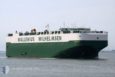
TRAVIATA
Cargo
Current Trip
| Time Travelled | 3 days |
|---|---|
| Remaining Time | --- |
| Distance Travelled | 1255.78 nm |
| Remaining Distance | --- |
| AVG Speed | 16.3 Knots |
| MAX Speed | 19.7 Knots |
| AVG Wind | 13.9 knots |
| MAX Wind | 26.8 knots |
| MIN Temp | 15.2°C / 59.36°F |
| MAX Temp | 21.1°C / 69.98°F |
| Draught | 9.8 m |
| Position Received | 3 d ago |
Current Position
| Longitude | --- |
|---|---|
| Latitude | --- |
| Status | Under way using engine |
| Speed | 17.4 Knots |
| Course | 126.6° |
| Area | North Atlantic Ocean |
| Station | T-AIS |
| Position Received | 3 d ago |
Info
Information
The current position of TRAVIATA is in North Atlantic Ocean with coordinates 32.30328° / -79.09628° as reported on 2025-02-14 06:19 by AIS to our vessel tracker app. The vessel's current speed is 17.4 Knots and is heading at the port of ZEEBRUGGE. The estimated time of arrival as calculated by MyShipTracking vessel tracking app is 2025-02-26 20:00 LT
The vessel TRAVIATA (IMO: 9700524, MMSI: 265012000) is a Cargo It's sailing under the flag of [SE] Sweden.
In this page you can find informations about the vessels current position, last detected port calls, and current voyage information. If the vessels is not in coverage by AIS you will find the latest position.
The current position of TRAVIATA is detected by our AIS receivers and we are not responsible for the reliability of the data. The last position was recorded while the vessel was in Coverage by the Ais receivers of our vessel tracking app.
The current draught of TRAVIATA as reported by AIS is 9.8 meters
Weather
| Temperature | 17.9°C / 64.22°F |
|---|---|
| Wind Speed | 10 knots |
| Direction | 200° SSW |
| Pressure | 1022.6 hPa |
| Humidity | 66.3 % |
| Cloud Coverage | 1 % |
Featured Company
Last Port Calls
| Port | Arrival | Departure | Time In Port |
|---|---|---|---|
| 2025-02-13 10:47 | 2025-02-14 02:55 | 16 h | |
| 2025-02-10 16:13 | 2025-02-12 21:05 | 2 d | |
| 2025-02-07 08:58 | 2025-02-08 05:59 | 21 h | |
| 2025-02-04 14:05 | 2025-02-05 16:14 | 1 d | |
| 2025-01-23 07:35 | 2025-01-23 18:42 | 11 h | |
| 2025-01-20 20:46 | 2025-01-22 15:58 | 1 d | |
| 2025-01-18 01:56 | 2025-01-19 19:31 | 1 d | |
| 2025-01-13 17:56 | 2025-01-16 17:33 | 2 d | |
| 2025-01-08 23:55 | 2025-01-12 12:36 | 3 d | |
| 2024-12-24 18:18 | 2024-12-26 23:30 | 2 d |
Most Visited Ports (Last year)
| Port | Arrivals | |
|---|---|---|
| 5 | ||
| 4 | ||
| 3 | ||
| 3 | ||
| 2 | ||
| 2 |
Last Trips
| Origin | Departure | Destination | Arrival | Distance | |
|---|---|---|---|---|---|
| 2025-02-12 16:05 | 2025-02-13 05:47 | 163.76 nm | |||
| 2025-02-08 00:59 | 2025-02-10 11:13 | 769.98 nm | |||
| 2025-02-05 12:14 | 2025-02-07 03:58 | 594.21 nm | |||
| 2025-01-23 18:42 | 2025-02-04 10:05 | 4158.69 nm | |||
| 2025-01-22 16:58 | 2025-01-23 07:35 | 202.93 nm | |||
| 2025-01-19 20:31 | 2025-01-20 21:46 | 332.61 nm | |||
| 2025-01-16 18:33 | 2025-01-18 02:56 | 391.98 nm | |||
| 2025-01-12 13:36 | 2025-01-13 18:56 | 380.00 nm | |||
| 2024-12-26 18:30 | 2025-01-09 00:55 | 4355.56 nm | |||
| 2024-12-24 00:25 | 2024-12-24 13:18 | 164.01 nm |
Events
| Time | Event | Details | Position / Dest | Info |
|---|---|---|---|---|
| 2025-02-14 06:31 | Status Changed | Default Under way using engine |
32.27038 / -79.04351
BEZEE
|
Speed: 17.4 kn Course: 126.6° |
| 2025-02-14 06:19 | OUT of Coverage |
32.30328 / -79.09628
North Atlantic Ocean
BEZEE
|
Speed: 17.4 kn Course: 126.6° |
|
| 2025-02-14 06:13 | Status Changed | Under way using engine Default |
32.32124 / -79.12511
BEZEE
|
Speed: 17.3 kn Course: 126° |
| 2025-02-14 06:03 | Status Changed | Default Under way using engine |
32.34868 / -79.16901
BEZEE
|
Speed: 17.4 kn Course: 126.1° |
| 2025-02-14 05:47 | Status Changed | Under way using engine Default |
32.39373 / -79.24179
BEZEE
|
Speed: 17.5 kn Course: 126° |
| 2025-02-14 05:47 | IN Coverage |
32.39175 / -79.23854
North Atlantic Ocean
BEZEE
|
Speed: 17.4 kn Course: 126.2° |
|
| 2025-02-14 04:39 | Status Changed | Default Under way using engine |
32.56338 / -79.51884
BEZEE
|
Speed: 9.7 kn Course: 125.4° |
| 2025-02-14 04:33 | OUT of Coverage |
32.57264 / -79.53391
North Atlantic Ocean
BEZEE
|
Speed: 9.7 kn Course: 125.4° |
|
| 2025-02-14 04:27 | Status Changed | Under way using engine Default |
32.58243 / -79.54969
BEZEE
|
Speed: 9.7 kn Course: 126° |
| 2025-02-14 04:23 | Status Changed | Default Under way using engine |
32.58858 / -79.55952
BEZEE
|
Speed: 9.7 kn Course: 126.9° |