

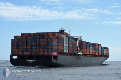
TONSBERG
Container Ship

Current Trip
| Time Travelled | 8 h, 30 mins |
|---|---|
| Remaining Time | 10 h, 22 mins |
| Distance Travelled | 139.85 nm |
| Remaining Distance | 180.03 nm |
| AVG Speed | 16.4 Knots |
| MAX Speed | 17.4 Knots |
| AVG Wind | 8.8 knots |
| MAX Wind | 12 knots |
| MIN Temp | 23.9°C / 75.02°F |
| MAX Temp | 24.9°C / 76.82°F |
| Draught | 12 m |
| Position Received | 1 m ago |
Current Position
| Longitude | --- |
|---|---|
| Latitude | --- |
| Status | Moored |
| Speed | 16.4 Knots |
| Course | 317° |
| Area | Persian Gulf |
| Station | T-AIS |
| Position Received | 1 m ago |
Information
The current position of TONSBERG is in Persian Gulf with coordinates 26.36167° / 52.99267° as reported on 2025-03-21 07:22 by AIS to our vessel tracker app. The vessel's current speed is 16.4 Knots and is heading at the port of DAMMAM. The estimated time of arrival as calculated by MyShipTracking vessel tracking app is 2025-03-21 20:45 LT
The vessel TONSBERG (IMO: 9216999, MMSI: 636020348) is a Container Ship that was built in 2001 ( 24 years old ). It's sailing under the flag of [LR] Liberia.
In this page you can find informations about the vessels current position, last detected port calls, and current voyage information. If the vessels is not in coverage by AIS you will find the latest position.
The current position of TONSBERG is detected by our AIS receivers and we are not responsible for the reliability of the data. The last position was recorded while the vessel was in Coverage by the Ais receivers of our vessel tracking app.
The current draught of TONSBERG as reported by AIS is 12 meters
Weather
| Temperature | 23.9°C / 75.02°F |
|---|---|
| Wind Speed | 10 knots |
| Direction | 127° SE |
| Pressure | 1017.4 hPa |
| Humidity | 76.4 % |
| Cloud Coverage | 100 % |


Featured Company
Last Port Calls
| Port | Arrival | Departure | Time In Port |
|---|---|---|---|
| 2025-03-18 20:09 | 2025-03-21 02:53 | 2 d | |
| 2025-03-13 00:04 | 2025-03-13 18:27 | 18 h | |
| 2025-03-05 14:37 | 2025-03-06 11:17 | 20 h | |
| 2025-03-02 23:41 | 2025-03-03 13:42 | 14 h | |
| 2025-02-26 02:09 | 2025-02-28 07:21 | 2 d | |
| 2025-02-21 20:21 | 2025-02-22 19:01 | 22 h | |
| 2025-02-09 06:48 | 2025-02-11 17:42 | 2 d | |
| 2025-02-02 01:31 | 2025-02-02 20:43 | 19 h | |
| 2025-01-24 19:25 | 2025-01-25 19:33 | 1 d | |
| 2025-01-20 09:20 | 2025-01-21 11:08 | 1 d |
Most Visited Ports (Last year)
| Port | Arrivals | |
|---|---|---|
| 16 | ||
| 11 | ||
| 9 | ||
| 5 | ||
| 5 | ||
| 5 |
Last Trips
| Origin | Departure | Destination | Arrival | Distance | |
|---|---|---|---|---|---|
| 2025-03-13 18:27 | 2025-03-18 20:09 | 1261.70 nm | |||
| 2025-03-06 11:17 | 2025-03-13 00:04 | 2316.42 nm | |||
| 2025-03-03 13:42 | 2025-03-05 14:37 | 199.01 nm | |||
| 2025-02-28 07:21 | 2025-03-02 23:41 | 907.39 nm | |||
| 2025-02-22 19:01 | 2025-02-26 02:09 | 1047.31 nm | |||
| 2025-02-11 17:42 | 2025-02-21 20:21 | 3344.57 nm | |||
| 2025-02-02 20:43 | 2025-02-09 06:48 | 969.80 nm | |||
| 2025-01-25 19:33 | 2025-02-02 01:31 | 2639.60 nm | |||
| 2025-01-21 11:08 | 2025-01-24 19:25 | 937.16 nm | |||
| 2025-01-14 01:09 | 2025-01-20 09:20 | 1986.40 nm |
Events
| Time | Event | Details | Position / Dest | Info |
|---|---|---|---|---|
| 2025-03-21 07:09 | Status Changed | Moored Default |
26.31667 / 53.03650
SADMM
|
Speed: 16.7 kn Course: 322° |
| 2025-03-21 06:53 | IN Coverage |
26.32200 / 53.03167
Persian Gulf
SADMM
|
Speed: 16.7 kn Course: 321° |
|
| 2025-03-21 04:30 | Status Changed | Default Moored |
25.81867 / 53.65900
SADMM
|
Speed: 17 kn Course: 311° |
| 2025-03-21 04:21 | OUT of Coverage |
25.79217 / 53.69267
Persian Gulf
SADMM
|
Speed: 17 kn Course: 311° |
|
| 2025-03-21 03:25 | Change Sea Area | Iranian part of the Persian Gulf United Arab Emirates part of the Persian Gulf |
25.62283 / 53.91583
Persian Gulf
SADMM
|
Speed: 17.2 kn Course: 313° |
| 2025-03-20 22:53 | PORT DEPARTURE |
|
25.03283 / 55.03517
SADMM
|
Speed: 8.7 kn Course: 316° |
| 2025-03-20 22:29 | START Moving |
24.99283 / 55.05367
[AE] JEBEL ALI
|
Speed: 3.1 kn Course: 327° |
|
| 2025-03-20 20:52 | Status Changed | Moored At anchor |
24.99350 / 55.05033
[AE] JEBEL ALI
|
Speed: Course: 160° |
| 2025-03-20 20:50 | Draught Changed | 12 13.1 |
24.99383 / 55.05017
[AE] JEBEL ALI
|
Speed: Course: 160° |
| 2025-03-20 20:50 | Destination Changed | SADMM AEJEA |
24.99383 / 55.05017
[AE] JEBEL ALI
|
Speed: Course: 160° |