
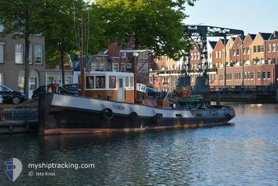
TONIJN
Tug
Current Trip
| Trip Time | 1 h, 52 mins |
|---|---|
| Trip Distance | 4.36 nm |
| AVG Speed | 3.5 Knots |
| MAX Speed | 5.1 Knots |
| Draught | 0.3 m |
| AVG Wind | 12.5 knots |
| MAX Wind | 12.9 knots |
| MIN Temp | 10.9°C / 51.62°F |
| MAX Temp | 11.4°C / 52.52°F |
| Position Received | 6 d ago |
Current Position
| Longitude | --- |
|---|---|
| Latitude | --- |
| Status | Moored |
| Speed | |
| Course | --- |
| Area | North Sea |
| Station | T-AIS |
| Position Received | 6 d ago |
Info
Information
The current position of TONIJN is in North Sea with coordinates 51.92127° / 4.25194° as reported on 2024-11-16 09:33 by AIS to our vessel tracker app. The vessel's current speed is 0 Knots and is currently inside the port of MAASSLUIS.
The vessel TONIJN (MMSI: 244750217) is a Tug It's sailing under the flag of [NL] Netherlands.
In this page you can find informations about the vessels current position, last detected port calls, and current voyage information. If the vessels is not in coverage by AIS you will find the latest position.
The current position of TONIJN is detected by our AIS receivers and we are not responsible for the reliability of the data. The last position was recorded while the vessel was in Coverage by the Ais receivers of our vessel tracking app.
The current draught of TONIJN as reported by AIS is 0.3 meters
Weather
| Temperature | 11.4°C / 52.52°F |
|---|---|
| Wind Speed | 12 knots |
| Direction | 258° WSW |
| Pressure | 1018.4 hPa |
| Humidity | 71.3 % |
| Cloud Coverage | 100 % |
Featured Company
Events
| Time | Event | Details | Position / Dest | Info |
|---|---|---|---|---|
| 2024-11-16 09:33 | OUT of Coverage |
51.92127 / 4.25194
North Sea
[NL] MAASSLUIS
|
Speed: Course: 0° |
|
| 2024-11-16 09:29 | Status Changed | Moored Under way using engine |
51.92129 / 4.25201
[NL] MAASSLUIS
|
Speed: Course: 511° |
| 2024-11-16 09:05 | STOP Moving |
51.92090 / 4.25176
[NL] MAASSLUIS
|
Speed: 0.2 kn Course: 511° |
|
| 2024-11-16 09:05 | PORT ARRIVAL |
|
51.92090 / 4.25176
[NL] MAASSLUIS
|
Speed: 1.6 kn Course: 511° |
| 2024-11-16 08:35 | START Moving | 0.62 nm, West of MAASSLUIS |
51.92212 / 4.23456
MAASSLUIS
|
Speed: 3.5 kn Course: 133° |
| 2024-11-16 07:42 | STOP Moving | 1.59 nm, East of ROTTERDAM |
51.93719 / 4.21002
MAASSLUIS
|
Speed: 0.3 kn Course: 511° |
| 2024-11-16 07:13 | PORT DEPARTURE |
|
51.91788 / 4.24040
MAASSLUIS
|
Speed: 2.9 kn Course: 511° |
| 2024-11-16 07:05 | START Moving |
51.91873 / 4.24948
[NL] MAASSLUIS
|
Speed: 3.1 kn Course: 215.2° |
|
| 2024-11-16 06:29 | IN Coverage |
51.92123 / 4.25209
North Sea
[NL] MAASSLUIS
|
Speed: Course: 295.3° |