
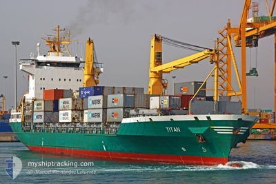
TITAN
Container Ship
Current Trip
| Time Travelled | 1 day |
|---|---|
| Remaining Time | 11 days |
| Distance Travelled | 365.85 nm |
| Remaining Distance | 612.54 nm |
| AVG Speed | 12 Knots |
| MAX Speed | 14.1 Knots |
| AVG Wind | 14.1 knots |
| MAX Wind | 23.5 knots |
| MIN Temp | 6.9°C / 44.42°F |
| MAX Temp | 15.1°C / 59.18°F |
| Draught | 8.6 m |
| Position Received | Now |
Current Position
| Longitude | --- |
|---|---|
| Latitude | --- |
| Status | Under way using engine |
| Speed | 1 Knots |
| Course | 32° |
| Area | Sea of Marmara |
| Station | T-AIS |
| Position Received | Now |
Info
Information
The current position of TITAN is in Sea of Marmara with coordinates 40.77082° / 28.57767° as reported on 2025-02-04 05:46 by AIS to our vessel tracker app. The vessel's current speed is 1 Knots and is heading at the port of POTI. The estimated time of arrival as calculated by MyShipTracking vessel tracking app is 2025-02-15 10:01 LT
The vessel TITAN (IMO: 9126998, MMSI: 304496000) is a Container Ship that was built in 1996 ( 29 years old ). It's sailing under the flag of [AG] Antigua Barbuda.
In this page you can find informations about the vessels current position, last detected port calls, and current voyage information. If the vessels is not in coverage by AIS you will find the latest position.
The current position of TITAN is detected by our AIS receivers and we are not responsible for the reliability of the data. The last position was recorded while the vessel was in Coverage by the Ais receivers of our vessel tracking app.
The current draught of TITAN as reported by AIS is 8.6 meters
Weather
| Temperature | 7°C / 44.6°F |
|---|---|
| Wind Speed | 23 knots |
| Direction | 44° NE |
| Pressure | 1025.4 hPa |
| Humidity | 66.2 % |
| Cloud Coverage | 100 % |
Featured Company
Last Port Calls
| Port | Arrival | Departure | Time In Port |
|---|---|---|---|
| 2025-02-01 22:11 | 2025-02-02 13:34 | 15 h | |
| 2025-01-29 12:43 | 2025-01-30 10:40 | 21 h | |
| 2025-01-28 17:56 | 2025-01-29 05:28 | 11 h | |
| 2025-01-24 04:33 | 2025-01-25 12:05 | 1 d | |
| 2025-01-11 21:06 | 2025-01-13 07:56 | 1 d | |
| 2025-01-01 08:08 | 2025-01-03 01:13 | 1 d | |
| 2024-12-26 21:07 | 2024-12-28 23:13 | 2 d | |
| 2024-12-11 16:40 | 2024-12-13 00:06 | 1 d | |
| 2024-12-02 21:47 | 2024-12-08 14:09 | 5 d |
Last Trips
| Origin | Departure | Destination | Arrival | Distance | |
|---|---|---|---|---|---|
| 2025-01-30 13:40 | 2025-02-02 00:11 | 358.61 nm | |||
| 2025-01-29 08:28 | 2025-01-29 15:43 | 67.72 nm | |||
| 2025-01-25 16:05 | 2025-01-28 20:56 | 686.28 nm | |||
| 2025-01-13 09:56 | 2025-01-24 08:33 | 1045.30 nm | |||
| 2025-01-03 02:13 | 2025-01-11 23:06 | 1191.81 nm | |||
| 2024-12-29 00:13 | 2025-01-01 09:08 | 356.88 nm | |||
| 2024-12-13 01:06 | 2024-12-26 22:07 | 849.12 nm | |||
| 2024-12-08 15:09 | 2024-12-11 17:40 | 246.65 nm | |||
| 2024-11-21 01:13 | 2024-12-02 22:47 | 568.65 nm |
Events
| Time | Event | Details | Position / Dest | Info |
|---|---|---|---|---|
| 2025-02-04 01:47 | START Moving | 12.42 nm, South West of AMBARLI |
40.77067 / 28.56288
GEPTI
|
Speed: 3.1 kn Course: 110° |
| 2025-02-03 19:19 | STOP Moving | 12.35 nm, South of AMBARLI |
40.76922 / 28.57117
GEPTI
|
Speed: 0.3 kn Course: 64° |
| 2025-02-03 11:09 | Status Changed | Under way using engine Default |
40.59143 / 27.23050
GEPTI
|
Speed: 13.1 kn Course: 66° |
| 2025-02-03 11:09 | IN Coverage |
40.59143 / 27.23050
Sea of Marmara
GEPTI
|
Speed: 12.7 kn Course: 84.8° |
|
| 2025-02-03 08:34 | Status Changed | Default Under way using engine |
40.31445 / 26.60342
GEPTI
|
Speed: 13 kn Course: 49.5° |
| 2025-02-03 08:27 | OUT of Coverage |
40.29868 / 26.57975
Sea of Marmara
GEPTI
|
Speed: 13 kn Course: 49.5° |
|
| 2025-02-03 06:18 | Detected in Sea | Turkish part of the Sea of Marmara |
40.01892 / 26.19015
Sea of Marmara
GEPTI
|
Speed: 8.3 kn Course: 76.1° |
| 2025-02-03 06:07 | Status Changed | Under way using engine Default |
40.01425 / 26.16540
GEPTI
|
Speed: 8.1 kn Course: 74° |
| 2025-02-03 06:00 | Status Changed | Default Under way using engine |
40.01092 / 26.14962
GEPTI
|
Speed: 8.1 kn Course: 74.5° |
| 2025-02-03 05:54 | Change Sea Area | Turkish part of the Aegean Sea Greek part of the Aegean Sea |
40.00688 / 26.13003
Aegean Sea
GEPTI
|
Speed: 8.5 kn Course: 76.6° |