
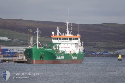
THUN BRITAIN
Tanker
Current Trip
| Trip Time | 11 h, 5 mins |
|---|---|
| Trip Distance | 103.88 nm |
| AVG Speed | 9.3 Knots |
| MAX Speed | 14.6 Knots |
| Draught | 4.6 m |
| AVG Wind | 6.6 knots |
| MAX Wind | 9.5 knots |
| MIN Temp | 6.2°C / 43.16°F |
| MAX Temp | 7.3°C / 45.14°F |
| Position Received | 11 h, 39 m ago |
Current Position
| Longitude | -4.02635° |
|---|---|
| Latitude | 58.65349° |
| Status | Under way using engine |
| Speed | 10 Knots |
| Course | 274.7° |
| Area | North Atlantic Ocean |
| Station | T-AIS |
| Position Received | 11 h, 39 m ago |
Info
Information
The current position of THUN BRITAIN is in North Atlantic Ocean with coordinates 58.65349° / -4.02635° as reported on 2024-04-26 12:22 by AIS to our vessel tracker app. The vessel's current speed is 10 Knots and is currently inside the port of STORNOWAY.
The vessel THUN BRITAIN (IMO: 9897482, MMSI: 244329000) is a Tanker It's sailing under the flag of [NL] Netherlands.
In this page you can find informations about the vessels current position, last detected port calls, and current voyage information. If the vessels is not in coverage by AIS you will find the latest position.
The current position of THUN BRITAIN is detected by our AIS receivers and we are not responsible for the reliability of the data. The last position was recorded while the vessel was in Coverage by the Ais receivers of our vessel tracking app.
The current draught of THUN BRITAIN as reported by AIS is 4.6 meters
Weather
| Temperature | 5°C / 41°F |
|---|---|
| Wind Speed | 5 knots |
| Direction | 343° NNW |
| Pressure | 1007.3 hPa |
| Humidity | 89.9 % |
| Cloud Coverage | 100 % |
Featured Company
Last Port Calls
| Port | Arrival | Departure | Time In Port |
|---|---|---|---|
| 2024-04-26 21:46 | |||
| 2024-04-26 04:54 | 2024-04-26 10:41 | 5 h | |
| 2024-04-22 12:38 | 2024-04-23 13:26 | 1 d | |
| 2024-04-19 00:53 | 2024-04-20 06:48 | 1 d | |
| 2024-04-17 08:26 | 2024-04-18 00:55 | 16 h | |
| 2024-04-16 10:18 | 2024-04-16 17:42 | 7 h | |
| 2024-04-13 15:52 | 2024-04-14 09:08 | 17 h | |
| 2024-04-12 09:16 | 2024-04-12 22:24 | 13 h | |
| 2024-04-09 17:33 | 2024-04-10 17:30 | 23 h | |
| 2024-04-04 18:40 | 2024-04-08 19:34 | 4 d |
Last Trips
| Origin | Departure | Destination | Arrival | Distance | |
|---|---|---|---|---|---|
| 2024-04-26 11:41 | 2024-04-26 22:46 | 103.88 nm | |||
| 2024-04-23 14:26 | 2024-04-26 05:54 | 586.47 nm | |||
| 2024-04-20 07:48 | 2024-04-22 13:38 | 270.84 nm | |||
| 2024-04-18 01:55 | 2024-04-19 01:53 | 262.08 nm | |||
| 2024-04-16 18:42 | 2024-04-17 09:26 | 119.13 nm | |||
| 2024-04-14 10:08 | 2024-04-16 11:18 | 520.41 nm | |||
| 2024-04-12 23:24 | 2024-04-13 16:52 | 145.15 nm | |||
| 2024-04-10 18:30 | 2024-04-12 10:16 | 451.03 nm | |||
| 2024-04-08 20:34 | 2024-04-09 18:33 | 150.89 nm | |||
| 2024-04-03 11:56 | 2024-04-04 19:40 | 147.45 nm |
Events
| Time | Event | Details | Position / Dest | Info |
|---|---|---|---|---|
| 2024-04-26 22:22 | STOP Moving |
58.20632 / -6.38853
[GB] STORNOWAY
|
Speed: 0.3 kn Course: 358° |
|
| 2024-04-26 21:46 | PORT ARRIVAL |
|
58.19047 / -6.36167
[GB] STORNOWAY
|
Speed: 4.6 kn Course: 335° |
| 2024-04-26 12:26 | Status Changed | Default Under way using engine |
58.65432 / -4.05039
GB STO
|
Speed: 10 kn Course: 274.7° |
| 2024-04-26 12:22 | OUT of Coverage |
58.65349 / -4.02635
North Atlantic Ocean
GB STO
|
Speed: 10 kn Course: 274.7° |
|
| 2024-04-26 11:54 | Destination Changed | GB STO GB SCR |
58.64783 / -3.87051
GB STO
|
Speed: 11.1 kn Course: 280.4° |
| 2024-04-26 11:54 | ETA Changed | 2024/04/26 21:30 2024/04/26 05:00 |
58.64783 / -3.87051
GB STO
|
Speed: 11.1 kn Course: 280.4° |
| 2024-04-26 11:10 | Status Changed | Under way using engine Default |
58.63900 / -3.61678
GB SCR
|
Speed: 10.3 kn Course: 270° |
| 2024-04-26 11:02 | Status Changed | Default Under way using engine |
58.63782 / -3.57874
GB SCR
|
Speed: 10 kn Course: 274.5° |
| 2024-04-26 10:41 | PORT DEPARTURE |
|
58.61026 / -3.52922
GB SCR
|
Speed: 8.1 kn Course: 76° |
| 2024-04-26 10:38 | START Moving |
58.60879 / -3.54174
[GB] SCRABSTER
|
Speed: 3.3 kn Course: 71° |