
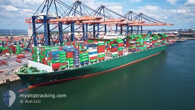
THALASSA MANA
Container Ship
Current Trip
| Time Travelled | 5 days |
|---|---|
| Remaining Time | --- |
| Distance Travelled | 2015.69 nm |
| Remaining Distance | --- |
| AVG Speed | 18.6 Knots |
| MAX Speed | 23.5 Knots |
| AVG Wind | 10.2 knots |
| MAX Wind | 21 knots |
| MIN Temp | 22.6°C / 72.68°F |
| MAX Temp | 31.9°C / 89.42°F |
| Draught | 11.4 m |
| Position Received | 53 m ago |
Current Position
| Longitude | -107.41885° |
|---|---|
| Latitude | 20.30865° |
| Status | Under way using engine |
| Speed | 19.4 Knots |
| Course | 306.9° |
| Area | North Pacific Ocean |
| Station | T-AIS |
| Position Received | 53 m ago |
Info
Information
The current position of THALASSA MANA is in North Pacific Ocean with coordinates 20.30865° / -107.41885° as reported on 2024-04-28 22:18 by AIS to our vessel tracker app. The vessel's current speed is 19.4 Knots and is heading at the port of QINGDAO. The estimated time of arrival as calculated by MyShipTracking vessel tracking app is 2024-05-13 23:00 LT
The vessel THALASSA MANA (IMO: 9667150, MMSI: 636018700) is a Container Ship that was built in 2014 ( 10 years old ). It's sailing under the flag of [LR] Liberia.
In this page you can find informations about the vessels current position, last detected port calls, and current voyage information. If the vessels is not in coverage by AIS you will find the latest position.
The current position of THALASSA MANA is detected by our AIS receivers and we are not responsible for the reliability of the data. The last position was recorded while the vessel was in Coverage by the Ais receivers of our vessel tracking app.
The current draught of THALASSA MANA as reported by AIS is 11.4 meters
Weather
| Temperature | 22.5°C / 72.5°F |
|---|---|
| Wind Speed | 6 knots |
| Direction | 332° NNW |
| Pressure | 1010.3 hPa |
| Humidity | 68.5 % |
| Cloud Coverage | 66 % |
Featured Company
Last Port Calls
| Port | Arrival | Departure | Time In Port |
|---|---|---|---|
| 2024-04-20 13:42 | 2024-04-23 00:44 | 2 d | |
| 2024-04-14 09:45 | 2024-04-16 01:14 | 1 d | |
| 2024-04-11 07:07 | 2024-04-12 06:53 | 23 h | |
| 2024-04-07 13:53 | 2024-04-08 08:56 | 19 h | |
| 2024-04-04 18:41 | 2024-04-06 20:49 | 2 d | |
| 2024-03-29 02:41 | 2024-03-30 12:05 | 1 d | |
| 2024-03-25 21:06 | 2024-03-26 14:43 | 17 h | |
| 2024-03-18 17:57 | 2024-03-19 14:45 | 20 h | |
| 2024-02-18 13:39 | 2024-02-19 04:42 | 15 h | |
| 2024-02-16 02:11 | 2024-02-17 10:07 | 1 d |
Last Trips
| Origin | Departure | Destination | Arrival | Distance | |
|---|---|---|---|---|---|
| 2024-04-15 21:14 | 2024-04-20 08:42 | 2048.90 nm | |||
| 2024-04-12 02:53 | 2024-04-14 05:45 | 447.55 nm | |||
| 2024-04-08 04:56 | 2024-04-11 03:07 | 902.03 nm | |||
| 2024-04-06 16:49 | 2024-04-07 09:53 | 129.53 nm | |||
| 2024-03-30 07:05 | 2024-04-04 14:41 | 1600.54 nm | |||
| 2024-03-26 09:43 | 2024-03-28 21:41 | 86.54 nm | |||
| 2024-03-19 09:45 | 2024-03-25 16:06 | 19.60 nm | |||
| 2024-02-19 13:42 | 2024-03-18 12:57 | 8256.29 nm | |||
| 2024-02-17 18:07 | 2024-02-18 22:39 | 479.40 nm | |||
| 2024-02-08 20:26 | 2024-02-16 10:11 | 884.29 nm |
Events
| Time | Event | Details | Position / Dest | Info |
|---|---|---|---|---|
| 2024-04-28 22:21 | Status Changed | Default Under way using engine |
20.32067 / -107.43286
PAPAN>CNTAO
|
Speed: 19.4 kn Course: 306.9° |
| 2024-04-28 16:30 | Status Changed | Under way using engine Default |
19.28806 / -105.71128
PAPAN>CNTAO
|
Speed: 20.4 kn Course: 302° |
| 2024-04-28 16:30 | IN Coverage |
19.29099 / -105.71636
North Pacific Ocean
PAPAN>CNTAO
|
Speed: 20.3 kn Course: 300.9° |
|
| 2024-04-27 02:30 | Status Changed | Default Under way using engine |
13.01056 / -94.39285
PAPAN>CNTAO
|
Speed: 19.4 kn Course: 300.5° |
| 2024-04-27 02:25 | OUT of Coverage |
12.99771 / -94.37081
North Pacific Ocean
PAPAN>CNTAO
|
Speed: 19.4 kn Course: 300.5° |
|
| 2024-04-27 01:55 | Change Sea Area | Mexican part of the North Pacific Ocean Panamanian part of the North Pacific Ocean |
12.91639 / -94.22852
North Pacific Ocean
PAPAN>CNTAO
|
Speed: 19.8 kn Course: 300.4° |
| 2024-04-27 01:55 | Status Changed | Under way using engine Default |
12.91639 / -94.22852
PAPAN>CNTAO
|
Speed: 19 kn Course: 300° |
| 2024-04-27 01:44 | IN Coverage |
12.91639 / -94.22852
North Pacific Ocean
PAPAN>CNTAO
|
Speed: 19.8 kn Course: 300.4° |
|
| 2024-04-24 22:30 | Status Changed | Default Under way using engine |
8.66741 / -79.45000
PAPAN>CNTAO
|
Speed: 14.4 kn Course: 178.7° |
| 2024-04-24 22:22 | OUT of Coverage |
8.70175 / -79.45069
North Pacific Ocean
PAPAN>CNTAO
|
Speed: 14.4 kn Course: 178.7° |