

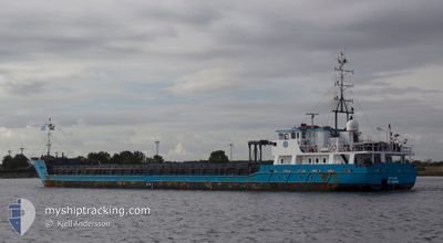
SYLVIA
General Cargo

Current Trip
| Time Travelled | 6 days |
|---|---|
| Remaining Time | 22 h, 5 mins |
| Distance Travelled | 1284.40 nm |
| Remaining Distance | 384.37 nm |
| AVG Speed | 8.5 Knots |
| MAX Speed | 12.6 Knots |
| AVG Wind | 10.3 knots |
| MAX Wind | 23 knots |
| MIN Temp | -1.8°C / 28.76°F |
| MAX Temp | 12.4°C / 54.32°F |
| Draught | 4.3 m |
| Position Received | 1 d ago |
Current Position
| Longitude | --- |
|---|---|
| Latitude | --- |
| Status | Under way using engine |
| Speed | 7.8 Knots |
| Course | 234.5° |
| Area | Celtic Sea |
| Station | T-AIS |
| Position Received | 1 d ago |
Information
The current position of SYLVIA is in Celtic Sea with coordinates 49.08910° / -5.24635° as reported on 2025-02-18 20:41 by AIS to our vessel tracker app. The vessel's current speed is 7.8 Knots and is heading at the port of PASAJES. The estimated time of arrival as calculated by MyShipTracking vessel tracking app is 2025-02-20 22:02 LT
The vessel SYLVIA (IMO: 9454383, MMSI: 305288000) is a General Cargo that was built in 2008 ( 17 years old ). It's sailing under the flag of [AG] Antigua Barbuda.
In this page you can find informations about the vessels current position, last detected port calls, and current voyage information. If the vessels is not in coverage by AIS you will find the latest position.
The current position of SYLVIA is detected by our AIS receivers and we are not responsible for the reliability of the data. The last position was recorded while the vessel was in Coverage by the Ais receivers of our vessel tracking app.
The current draught of SYLVIA as reported by AIS is 4.3 meters
Weather
| Temperature | 12.4°C / 54.32°F |
|---|---|
| Wind Speed | 14 knots |
| Direction | 213° SSW |
| Pressure | 1017 hPa |
| Humidity | 88 % |
| Cloud Coverage | 98 % |


Featured Company
Last Port Calls
| Port | Arrival | Departure | Time In Port |
|---|---|---|---|
| 2025-02-10 14:57 | 2025-02-13 16:41 | 3 d | |
| 2025-02-05 08:25 | 2025-02-07 09:13 | 2 d | |
| 2025-02-03 17:44 | 2025-02-03 18:50 | 1 h | |
| 2025-01-30 08:45 | 2025-01-31 18:05 | 1 d | |
| 2025-01-25 09:47 | 2025-01-28 13:22 | 3 d | |
| 2025-01-23 05:28 | 2025-01-24 14:11 | 1 d | |
| 2025-01-20 10:40 | 2025-01-20 11:05 | 25 m | |
| 2025-01-17 16:43 | 2025-01-17 17:46 | 1 h | |
| 2025-01-14 06:49 | 2025-01-15 13:16 | 1 d | |
| 2025-01-11 01:01 | 2025-01-11 09:38 | 8 h |
Last Trips
| Origin | Departure | Destination | Arrival | Distance | |
|---|---|---|---|---|---|
| 2025-02-07 10:13 | 2025-02-10 15:57 | 423.98 nm | |||
| 2025-02-03 19:50 | 2025-02-05 09:25 | 135.90 nm | |||
| 2025-01-31 19:05 | 2025-02-03 18:44 | 107.37 nm | |||
| 2025-01-28 14:22 | 2025-01-30 09:45 | 336.20 nm | |||
| 2025-01-24 15:11 | 2025-01-25 10:47 | 159.35 nm | |||
| 2025-01-20 12:05 | 2025-01-23 06:28 | 504.52 nm | |||
| 2025-01-17 18:46 | 2025-01-20 11:40 | 2.55 nm | |||
| 2025-01-15 14:16 | 2025-01-17 17:43 | 470.71 nm | |||
| 2025-01-11 10:38 | 2025-01-14 07:49 | 416.26 nm | |||
| 2025-01-08 23:38 | 2025-01-11 02:01 | 410.01 nm |
Events
| Time | Event | Details | Position / Dest | Info |
|---|---|---|---|---|
| 2025-02-18 20:47 | Status Changed | Default Under way using engine |
49.08117 / -5.26456
ESPAS
|
Speed: 7.8 kn Course: 234.5° |
| 2025-02-18 20:41 | OUT of Coverage |
49.08910 / -5.24635
Celtic Sea
ESPAS
|
Speed: 7.8 kn Course: 234.5° |
|
| 2025-02-18 20:40 | Status Changed | Under way using engine Default |
49.09019 / -5.24386
ESPAS
|
Speed: 7.6 kn Course: 237° |
| 2025-02-18 20:15 | Status Changed | Default Under way using engine |
49.11877 / -5.17640
ESPAS
|
Speed: 7.4 kn Course: 237.6° |
| 2025-02-18 20:10 | Status Changed | Under way using engine Default |
49.12429 / -5.16211
ESPAS
|
Speed: 7.5 kn Course: 238° |
| 2025-02-18 19:27 | Status Changed | Default Under way using engine |
49.17393 / -5.04498
ESPAS
|
Speed: 7.8 kn Course: 237.6° |
| 2025-02-18 19:17 | Change Sea Area | French part of the Celtic Sea French part of the English Channel |
49.18641 / -5.01561
Celtic Sea
ESPAS
|
Speed: 7.9 kn Course: 238.5° |
| 2025-02-18 18:57 | ETA Changed | 2025/02/20 20:00 2025/02/21 20:00 |
49.21004 / -4.96012
ESPAS
|
Speed: 7.7 kn Course: 237.2° |
| 2025-02-18 18:41 | Status Changed | Under way using engine Default |
49.22736 / -4.91747
ESPAS
|
Speed: 7.4 kn Course: 239° |
| 2025-02-18 18:39 | Status Changed | Default Under way using engine |
49.22950 / -4.91167
ESPAS
|
Speed: 7.6 kn Course: 240.1° |