
SWEDISH STREAM
Reefer
Current Trip
| Time Travelled | 18 days |
|---|---|
| Remaining Time | 1 day |
| Distance Travelled | 4301.27 nm |
| Remaining Distance | 727.51 nm |
| AVG Speed | 13.3 Knots |
| MAX Speed | 19.2 Knots |
| AVG Wind | 11.7 knots |
| MAX Wind | 29 knots |
| MIN Temp | -5.6°C / 21.92°F |
| MAX Temp | 28.8°C / 83.84°F |
| Draught | 8 m |
| Position Received | 1 d ago |
Current Position
| Longitude | --- |
|---|---|
| Latitude | --- |
| Status | Under way using engine |
| Speed | 14.2 Knots |
| Course | 180.3° |
| Area | North Atlantic Ocean |
| Station | T-AIS |
| Position Received | 1 d ago |
Info
Information
The current position of SWEDISH STREAM is in North Atlantic Ocean with coordinates 22.78538° / -74.67843° as reported on 2026-01-08 04:35 by AIS to our vessel tracker app. The vessel's current speed is 14.2 Knots and is heading at the port of CRISTOBAL. The estimated time of arrival as calculated by MyShipTracking vessel tracking app is 2026-01-10 15:21 LT
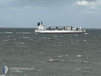
The vessel SWEDISH STREAM (IMO: 9030149, MMSI: 308126000) is a Reefer that was built in 1992 ( 34 years old ). It's sailing under the flag of [BS] Bahamas.
In this page you can find informations about the vessels current position, last detected port calls, and current voyage information. If the vessels is not in coverage by AIS you will find the latest position.
The current position of SWEDISH STREAM is detected by our AIS receivers and we are not responsible for the reliability of the data. The last position was recorded while the vessel was in Coverage by the Ais receivers of our vessel tracking app.
The current draught of SWEDISH STREAM as reported by AIS is 8 meters
Weather
| Temperature | 26.3°C / 79.34°F |
|---|---|
| Wind Speed | 15 knots |
| Direction | 62° ENE |
| Pressure | 1016.1 hPa |
| Humidity | 69.6 % |
| Cloud Coverage | 3 % |
Featured Company
Most Visited Ports (Last year)
| Port | Arrivals | |
|---|---|---|
| 3 | ||
| 2 | ||
| 2 | ||
| 2 | ||
| 2 | ||
| 2 |
Events
| Time | Event | Details | Position / Dest | Info |
|---|---|---|---|---|
| 2026-01-08 04:40 | Status Changed | Default Under way using engine |
22.76392 / -74.67849
PA CTB
|
Speed: 14.2 kn Course: 180.3° |
| 2026-01-08 04:35 | OUT of Coverage |
22.78538 / -74.67843
North Atlantic Ocean
PA CTB
|
Speed: 14.2 kn Course: 180.3° |
|
| 2026-01-08 01:58 | Change Sea Area | Bahamas part of the North Atlantic Ocean United States part of the North Atlantic Ocean |
23.41491 / -74.68175
North Atlantic Ocean
PA CTB
|
Speed: 14.5 kn Course: 180.4° |
| 2026-01-08 01:55 | Status Changed | Under way using engine Default |
23.42878 / -74.68169
PA CTB
|
Speed: 14 kn Course: 179° |
| 2026-01-08 01:55 | IN Coverage |
23.41491 / -74.68175
North Atlantic Ocean
PA CTB
|
Speed: 14.5 kn Course: 180.4° |
|
| 2026-01-05 14:49 | Status Changed | Default Under way using engine |
38.06272 / -74.71809
PA CTB
|
Speed: 15.8 kn Course: 179° |
| 2026-01-05 14:43 | OUT of Coverage |
38.08807 / -74.71868
North Atlantic Ocean
PA CTB
|
Speed: 15.8 kn Course: 179° |
|
| 2026-01-05 12:28 | Status Changed | Under way using engine Default |
38.59611 / -74.86486
PA CTB
|
Speed: 8.5 kn Course: 144° |
| 2026-01-05 12:22 | Status Changed | Default Under way using engine |
38.60599 / -74.87424
PA CTB
|
Speed: 8.5 kn Course: 143.4° |
| 2026-01-05 12:11 | Status Changed | Under way using engine Default |
38.62770 / -74.89382
PA CTB
|
Speed: 8.9 kn Course: 146° |