
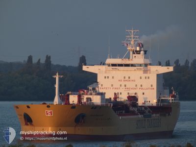
STOLT SAGALAND
Oil/Chemical Tanker
Current Trip
| Trip Time | 9 days |
|---|---|
| Trip Distance | 1472.15 nm |
| AVG Speed | 12.6 Knots |
| MAX Speed | 15.9 Knots |
| Draught | 8.8 m |
| AVG Wind | 12.1 knots |
| MAX Wind | 21.5 knots |
| MIN Temp | 12.6°C / 54.68°F |
| MAX Temp | 27.2°C / 80.96°F |
| Position Received | 2 d ago |
Current Position
| Longitude | 129.38170° |
|---|---|
| Latitude | 35.38215° |
| Status | Under way using engine |
| Speed | 11.7 Knots |
| Course | 322.5° |
| Area | Japan Sea |
| Station | T-AIS |
| Position Received | 2 d ago |
Info
Information
The current position of STOLT SAGALAND is in Japan Sea with coordinates 35.38215° / 129.38170° as reported on 2024-05-18 04:11 by AIS to our vessel tracker app. The vessel's current speed is 11.7 Knots and is currently inside the port of ONSAN.
The vessel STOLT SAGALAND (IMO: 9352200, MMSI: 319282000) is a Oil/Chemical Tanker that was built in 2007 ( 17 years old ). It's sailing under the flag of [KY] Cayman Is.
In this page you can find informations about the vessels current position, last detected port calls, and current voyage information. If the vessels is not in coverage by AIS you will find the latest position.
The current position of STOLT SAGALAND is detected by our AIS receivers and we are not responsible for the reliability of the data. The last position was recorded while the vessel was in Coverage by the Ais receivers of our vessel tracking app.
The current draught of STOLT SAGALAND as reported by AIS is 8.8 meters
Weather
| Temperature | 17.8°C / 64.04°F |
|---|---|
| Wind Speed | 11 knots |
| Direction | 45° NE |
| Pressure | 1014.7 hPa |
| Humidity | 77.7 % |
| Cloud Coverage | 80 % |
Featured Company
Last Port Calls
| Port | Arrival | Departure | Time In Port |
|---|---|---|---|
| 2024-05-18 04:53 | |||
| 2024-05-08 08:52 | 2024-05-09 01:40 | 16 h | |
| 2024-05-06 22:32 | 2024-05-07 13:52 | 15 h | |
| 2024-04-30 20:52 | 2024-05-01 20:12 | 23 h | |
| 2024-04-28 09:04 | 2024-04-29 09:24 | 1 d | |
| 2024-04-27 07:27 | 2024-04-28 08:30 | 1 d | |
| 2024-04-25 15:29 | 2024-04-26 07:17 | 15 h | |
| 2024-03-11 00:08 | 2024-03-12 12:18 | 1 d | |
| 2024-03-07 07:36 | 2024-03-10 15:56 | 3 d | |
| 2024-03-02 04:01 | 2024-03-03 12:30 | 1 d |
Most Visited Ports (Last year)
| Port | Arrivals | |
|---|---|---|
| 6 | ||
| 5 | ||
| 5 | ||
| 3 | ||
| 2 | ||
| 2 |
Last Trips
| Origin | Departure | Destination | Arrival | Distance | |
|---|---|---|---|---|---|
| 2024-05-09 09:40 | 2024-05-18 13:53 | 1472.15 nm | |||
| 2024-05-07 21:52 | 2024-05-08 16:52 | 241.89 nm | |||
| 2024-05-02 04:12 | 2024-05-07 06:32 | 1634.74 nm | |||
| 2024-04-29 17:24 | 2024-05-01 04:52 | 17.63 nm | |||
| 2024-04-28 16:30 | 2024-04-28 17:04 | 1.69 nm | |||
| 2024-04-26 15:17 | 2024-04-27 15:27 | 19.31 nm | |||
| 2024-03-12 07:18 | 2024-04-25 23:29 | 13319.26 nm | |||
| 2024-03-10 10:56 | 2024-03-10 19:08 | 95.24 nm | |||
| 2024-03-03 06:30 | 2024-03-07 01:36 | 48.86 nm | |||
| 2024-02-29 18:25 | 2024-03-01 22:01 | 234.67 nm |
Events
| Time | Event | Details | Position / Dest | Info |
|---|---|---|---|---|
| 2024-05-18 04:53 | STOP Moving |
35.44170 / 129.37889
[KR] ONSAN
|
Speed: Course: 203° |
|
| 2024-05-18 04:53 | PORT ARRIVAL |
|
35.44170 / 129.37889
[KR] ONSAN
|
Speed: 0.7 kn Course: 203° |
| 2024-05-18 04:17 | Status Changed | Default Under way using engine |
35.39936 / 129.37866
KRUSN
|
Speed: 11.7 kn Course: 322.5° |
| 2024-05-18 04:11 | OUT of Coverage |
35.38215 / 129.38170
Japan Sea
[KR] ONSAN
|
Speed: 11.7 kn Course: 322.5° |
|
| 2024-05-18 04:04 | Draught Changed | 8.8 9 |
35.36759 / 129.40248
KRUSN
|
Speed: 6.4 kn Course: 294.5° |
| 2024-05-18 01:50 | Change Sea Area | South Korean part of the Japan Sea Japanese part of the Japan Sea |
34.99103 / 129.44598
Japan Sea
KRUSN
|
Speed: 15.6 kn Course: 39.8° |
| 2024-05-18 00:44 | Draught Changed | 9 10.4 |
34.75048 / 129.24393
KRUSN
|
Speed: 15.7 kn Course: 28.3° |
| 2024-05-18 00:44 | Destination Changed | KRUSN CNNBG |
34.75048 / 129.24393
KRUSN
|
Speed: 15.7 kn Course: 28.3° |
| 2024-05-18 00:44 | ETA Changed | 2024/05/18 04:00 2024/05/10 02:00 |
34.75048 / 129.24393
KRUSN
|
Speed: 15.7 kn Course: 28.3° |
| 2024-05-17 23:34 | Status Changed | Under way using engine Default |
34.49168 / 129.07193
CNNBG
|
Speed: 15.2 kn Course: 32° |