
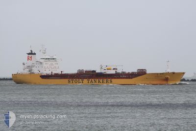
STOLT ISLAND
Oil/Chemical Tanker
Current Trip
| Time Travelled | 11 days |
|---|---|
| Remaining Time | --- |
| Distance Travelled | 987.97 nm |
| Remaining Distance | --- |
| AVG Speed | 10.2 Knots |
| MAX Speed | 15.1 Knots |
| AVG Wind | 9.4 knots |
| MAX Wind | 20.9 knots |
| MIN Temp | 13.1°C / 55.58°F |
| MAX Temp | 23.9°C / 75.02°F |
| Draught | 8.9 m |
| Position Received | 10 d ago |
Current Position
| Longitude | 124.74198° |
|---|---|
| Latitude | 35.53717° |
| Status | Under way using engine |
| Speed | 12.4 Knots |
| Course | 219.4° |
| Area | Yellow Sea |
| Station | T-AIS |
| Position Received | 10 d ago |
Info
Information
The current position of STOLT ISLAND is in Yellow Sea with coordinates 35.53717° / 124.74198° as reported on 2024-05-02 23:13 by AIS to our vessel tracker app. The vessel's current speed is 12.4 Knots and is heading at the port of ZHANGJIAGANG. The estimated time of arrival as calculated by MyShipTracking vessel tracking app is 2024-05-03 23:00 LT
The vessel STOLT ISLAND (IMO: 9414058, MMSI: 319963000) is a Oil/Chemical Tanker that was built in 2009 ( 15 years old ). It's sailing under the flag of [KY] Cayman Is.
In this page you can find informations about the vessels current position, last detected port calls, and current voyage information. If the vessels is not in coverage by AIS you will find the latest position.
The current position of STOLT ISLAND is detected by our AIS receivers and we are not responsible for the reliability of the data. The last position was recorded while the vessel was in Coverage by the Ais receivers of our vessel tracking app.
The current draught of STOLT ISLAND as reported by AIS is 8.9 meters
Weather
| Temperature | 14.7°C / 58.46°F |
|---|---|
| Wind Speed | 1 knots |
| Direction | 27° NNE |
| Pressure | 1015.7 hPa |
| Humidity | 66.2 % |
| Cloud Coverage | 38 % |
Featured Company
Most Visited Ports (Last year)
| Port | Arrivals | |
|---|---|---|
| 4 | ||
| 3 | ||
| 3 | ||
| 2 | ||
| 2 | ||
| 2 |
Events
| Time | Event | Details | Position / Dest | Info |
|---|---|---|---|---|
| 2024-05-10 03:32 | STOP Moving | 3.54 nm, South East of ZHOUSHAN |
29.93952 / 122.26030
CN ZJG
|
Speed: Course: 107° |
| 2024-05-10 02:41 | START Moving | 4.02 nm, South of ZHOUSHAN |
29.90357 / 122.22555
CN ZJG
|
Speed: 6.5 kn Course: 285° |
| 2024-05-09 04:02 | STOP Moving | 4.25 nm, South East of ZHOUSHAN |
29.90129 / 122.23137
CN ZJG
|
Speed: 0.3 kn Course: 70° |
| 2024-05-08 09:37 | START Moving |
29.52812 / 123.51686
CN ZJG
|
Speed: 3.1 kn Course: 287° |
|
| 2024-05-08 00:29 | STOP Moving |
29.73823 / 123.55207
CN ZJG
|
Speed: Course: 288° |
|
| 2024-05-07 00:36 | START Moving | 9.16 nm, South East of TAICANG |
31.57380 / 121.34032
CN ZJG
|
Speed: 6 kn Course: 163° |
| 2024-05-06 12:32 | STOP Moving | 9.12 nm, South East of TAICANG |
31.57610 / 121.34139
CN ZJG
|
Speed: 0.1 kn Course: 313° |
| 2024-05-06 07:25 | START Moving | 1.62 nm, East of ZHANGJIAGANG |
31.97667 / 120.44388
CN ZJG
|
Speed: 6.6 kn Course: 43° |
| 2024-05-05 08:04 | STOP Moving | 1.5 nm, East of ZHANGJIAGANG |
31.97316 / 120.44131
CN ZJG
|
Speed: 0.2 kn Course: 238° |
| 2024-05-05 01:36 | START Moving | 8.71 nm, South East of TAICANG |
31.57848 / 121.33357
CN ZJG
|
Speed: 6.6 kn Course: 260° |