

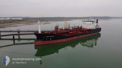
STOLT FULMAR
Oil/Chemical Tanker

Current Trip
| Time Travelled | 19 h, 32 mins |
|---|---|
| Remaining Time | 1 day |
| Distance Travelled | 212.64 nm |
| Remaining Distance | 508.79 nm |
| AVG Speed | 10.9 Knots |
| MAX Speed | 13.6 Knots |
| AVG Wind | 15 knots |
| MAX Wind | 30.2 knots |
| MIN Temp | 9°C / 48.2°F |
| MAX Temp | 13.4°C / 56.12°F |
| Draught | 4.9 m |
| Position Received | 11 h, 3 m ago |
Current Position
| Longitude | --- |
|---|---|
| Latitude | --- |
| Status | Under way using engine |
| Speed | 6.8 Knots |
| Course | 201.6° |
| Area | Irish Sea and St. George's Channel |
| Station | T-AIS |
| Position Received | 11 h, 3 m ago |
Information
The current position of STOLT FULMAR is in Irish Sea and St. George's Channel with coordinates 53.18664° / -5.07145° as reported on 2025-03-27 17:51 by AIS to our vessel tracker app. The vessel's current speed is 6.8 Knots and is heading at the port of ROTTERDAM. The estimated time of arrival as calculated by MyShipTracking vessel tracking app is 2025-03-29 23:27 LT
The vessel STOLT FULMAR (IMO: 9148972, MMSI: 255806426) is a Oil/Chemical Tanker that was built in 2000 ( 25 years old ). It's sailing under the flag of [PT] Portugal.
In this page you can find informations about the vessels current position, last detected port calls, and current voyage information. If the vessels is not in coverage by AIS you will find the latest position.
The current position of STOLT FULMAR is detected by our AIS receivers and we are not responsible for the reliability of the data. The last position was recorded while the vessel was in Coverage by the Ais receivers of our vessel tracking app.
The current draught of STOLT FULMAR as reported by AIS is 4.9 meters
Weather
| Temperature | 9.2°C / 48.56°F |
|---|---|
| Wind Speed | 19 knots |
| Direction | 292° WNW |
| Pressure | 1012.4 hPa |
| Humidity | 83.1 % |
| Cloud Coverage | 75 % |


Featured Company
Last Port Calls
| Port | Arrival | Departure | Time In Port |
|---|---|---|---|
| 2025-03-25 08:07 | 2025-03-27 09:23 | 2 d | |
| 2025-03-20 21:20 | 2025-03-22 12:05 | 1 d | |
| 2025-03-15 10:16 | 2025-03-17 16:55 | 2 d | |
| 2025-03-12 08:37 | 2025-03-12 09:18 | 40 m | |
| 2025-03-10 10:22 | 2025-03-12 08:11 | 1 d | |
| 2025-03-10 09:18 | 2025-03-10 09:56 | 38 m | |
| 2025-03-09 00:02 | 2025-03-10 06:02 | 1 d | |
| 2025-03-07 12:39 | 2025-03-08 15:05 | 1 d | |
| 2025-03-06 23:41 | 2025-03-07 10:47 | 11 h | |
| 2025-03-03 12:24 | 2025-03-05 03:10 | 1 d |
Most Visited Ports (Last year)
| Port | Arrivals | |
|---|---|---|
| 15 | ||
| 10 | ||
| 9 | ||
| 7 | ||
| 6 | ||
| 5 |
Last Trips
| Origin | Departure | Destination | Arrival | Distance | |
|---|---|---|---|---|---|
| 2025-03-22 12:05 | 2025-03-25 08:07 | 707.17 nm | |||
| 2025-03-17 16:55 | 2025-03-20 21:20 | 362.43 nm | |||
| 2025-03-12 09:18 | 2025-03-15 10:16 | 779.52 nm | |||
| 2025-03-12 08:11 | 2025-03-12 08:37 | 1.92 nm | |||
| 2025-03-10 09:56 | 2025-03-10 10:22 | 1.44 nm | |||
| 2025-03-08 15:05 | 2025-03-10 09:18 | 110.14 nm | |||
| 2025-03-08 15:05 | 2025-03-09 00:02 | 80.80 nm | |||
| 2025-03-05 03:10 | 2025-03-07 12:39 | 532.80 nm | |||
| 2025-03-05 03:10 | 2025-03-06 23:41 | 512.07 nm | |||
| 2025-03-01 15:19 | 2025-03-03 12:24 | 224.67 nm |
Events
| Time | Event | Details | Position / Dest | Info |
|---|---|---|---|---|
| 2025-03-27 17:56 | Status Changed | Default Under way using engine |
53.17695 / -5.07783
NLRTM
|
Speed: 6.8 kn Course: 201.6° |
| 2025-03-27 17:51 | OUT of Coverage |
53.18664 / -5.07145
Irish Sea and St. George's Channel
NLRTM
|
Speed: 6.8 kn Course: 201.6° |
|
| 2025-03-27 16:52 | Status Changed | Under way using engine Default |
53.30267 / -4.99320
NLRTM
|
Speed: 8.6 kn Course: 204° |
| 2025-03-27 16:44 | Status Changed | Default Under way using engine |
53.32126 / -4.98010
NLRTM
|
Speed: 8.7 kn Course: 203.6° |
| 2025-03-27 16:25 | Status Changed | Under way using engine Default |
53.36311 / -4.94825
NLRTM
|
Speed: 9.4 kn Course: 207° |
| 2025-03-27 16:24 | Status Changed | Default Under way using engine |
53.36704 / -4.94517
NLRTM
|
Speed: 9.4 kn Course: 205° |
| 2025-03-27 15:34 | Status Changed | Under way using engine Default |
53.48362 / -4.82367
NLRTM
|
Speed: 10.3 kn Course: 219° |
| 2025-03-27 14:44 | Status Changed | Default Under way using engine |
53.56307 / -4.62428
NLRTM
|
Speed: 12.2 kn Course: 262.8° |
| 2025-03-27 14:36 | Status Changed | Under way using engine Default |
53.56704 / -4.58021
NLRTM
|
Speed: 12.2 kn Course: 263° |
| 2025-03-27 14:16 | Status Changed | Default Under way using engine |
53.57254 / -4.46331
NLRTM
|
Speed: 12.9 kn Course: 267.6° |