

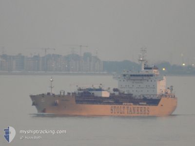
STOLT EBONY
Tanker

Current Trip
| Time Travelled | 2 days |
|---|---|
| Remaining Time | --- |
| Distance Travelled | 193.31 nm |
| Remaining Distance | --- |
| AVG Speed | 9.7 Knots |
| MAX Speed | 15.6 Knots |
| AVG Wind | 7.6 knots |
| MAX Wind | 11.8 knots |
| MIN Temp | 24.6°C / 76.28°F |
| MAX Temp | 31.8°C / 89.24°F |
| Draught | 7.1 m |
| Position Received | 1 d ago |
Current Position
| Longitude | --- |
|---|---|
| Latitude | --- |
| Status | Under way using engine |
| Speed | 11.7 Knots |
| Course | 293.7° |
| Area | Singapore Strait |
| Station | T-AIS |
| Position Received | 1 d ago |
Information
The current position of STOLT EBONY is in Singapore Strait with coordinates 1.19495° / 103.52150° as reported on 2025-03-26 15:03 by AIS to our vessel tracker app. The vessel's current speed is 11.7 Knots
The vessel STOLT EBONY (IMO: 9744908, MMSI: 255806423) is a Tanker It's sailing under the flag of [PT] Portugal.
In this page you can find informations about the vessels current position, last detected port calls, and current voyage information. If the vessels is not in coverage by AIS you will find the latest position.
The current position of STOLT EBONY is detected by our AIS receivers and we are not responsible for the reliability of the data. The last position was recorded while the vessel was in Coverage by the Ais receivers of our vessel tracking app.
The current draught of STOLT EBONY as reported by AIS is 7.1 meters
Weather
| Temperature | 24.9°C / 76.82°F |
|---|---|
| Wind Speed | 9 knots |
| Direction | 279° W |
| Pressure | 1006.6 hPa |
| Humidity | 92.5 % |
| Cloud Coverage | 32 % |


Featured Company
Last Port Calls
| Port | Arrival | Departure | Time In Port |
|---|---|---|---|
| 2025-03-24 20:44 | 2025-03-25 08:54 | 12 h | |
| 2025-03-23 21:27 | 2025-03-24 19:58 | 22 h | |
| 2025-03-22 23:13 | 2025-03-23 20:23 | 21 h | |
| 2025-03-22 07:08 | 2025-03-22 22:30 | 15 h | |
| 2025-03-20 11:07 | 2025-03-21 09:42 | 22 h | |
| 2025-03-14 12:05 | 2025-03-15 13:53 | 1 d | |
| 2025-02-20 18:14 | 2025-02-22 14:18 | 1 d | |
| 2025-01-04 01:27 | 2025-01-10 18:20 | 6 d | |
| 2025-01-03 08:19 |
Last Trips
| Origin | Departure | Destination | Arrival | Distance | |
|---|---|---|---|---|---|
| 2025-03-24 19:58 | 2025-03-24 20:44 | 5.70 nm | |||
| 2025-03-23 20:23 | 2025-03-23 21:27 | 4.72 nm | |||
| 2025-03-22 22:30 | 2025-03-22 23:13 | 2.41 nm | |||
| 2025-03-21 09:42 | 2025-03-22 07:08 | 14.44 nm | |||
| 2025-03-15 13:53 | 2025-03-20 11:07 | 1427.39 nm | |||
| 2025-02-22 14:18 | 2025-03-14 12:05 | 3016.79 nm | |||
| 2025-01-10 18:20 | 2025-02-20 18:14 | 10500.29 nm | |||
| 2025-01-03 08:19 | 2025-01-04 01:27 | 60.34 nm |
Events
| Time | Event | Details | Position / Dest | Info |
|---|---|---|---|---|
| 2025-03-27 14:50 | STOP Moving | 10.94 nm, East of DUMAI |
1.66117 / 101.63702
PELINTUNG
|
Speed: Course: 71° |
| 2025-03-27 12:58 | START Moving | 1.99 nm, North East of DUMAI |
1.70521 / 101.48564
PELINTUNG
|
Speed: 3.7 kn Course: 154° |
| 2025-03-27 07:01 | STOP Moving | 1.85 nm, North East of DUMAI |
1.70791 / 101.48094
PELINTUNG
|
Speed: 0.3 kn Course: 86° |
| 2025-03-27 02:28 | START Moving |
1.92122 / 101.84804
PELINTUNG
|
Speed: 3.4 kn Course: 160° |
|
| 2025-03-27 01:40 | STOP Moving |
1.93355 / 101.84618
PELINTUNG
|
Speed: 0.1 kn Course: 302° |
|
| 2025-03-26 15:10 | Status Changed | Default Under way using engine |
1.20436 / 103.50014
PELINTUNG
|
Speed: 11.7 kn Course: 293.7° |
| 2025-03-26 15:03 | OUT of Coverage |
1.19495 / 103.52150
Singapore Strait
PELINTUNG
|
Speed: 11.7 kn Course: 293.7° |
|
| 2025-03-26 14:46 | Change Sea Area | Malaysian part of the Singapore Strait Indonesian part of the Singapore Strait |
1.18304 / 103.57422
Singapore Strait
PELINTUNG
|
Speed: 12 kn Course: 281.7° |
| 2025-03-26 14:20 | Change Sea Area | Indonesian part of the Singapore Strait Singaporean part of the Singapore Strait |
1.18551 / 103.65858
Singapore Strait
PELINTUNG
|
Speed: 10.3 kn Course: 273.6° |
| 2025-03-26 14:03 | START Moving | 4.2 nm, South of JURONG ISLAND |
1.19017 / 103.68601
PELINTUNG
|
Speed: 3.1 kn Course: 234° |