
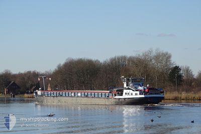
SPREE
Cargo
Current Trip
MAASTRICHT
| Time Travelled | 10 days |
|---|---|
| Remaining Time | --- |
| Distance Travelled | 360.50 nm |
| Remaining Distance | --- |
| AVG Speed | 7.6 Knots |
| MAX Speed | 10.9 Knots |
| AVG Wind | 7.3 knots |
| MAX Wind | 16 knots |
| MIN Temp | 3.8°C / 38.84°F |
| MAX Temp | 11.5°C / 52.7°F |
| Draught | 2.5 m |
| Position Received | 2 d ago |
Current Position
| Longitude | --- |
|---|---|
| Latitude | --- |
| Status | Under way using engine |
| Speed | 5.3 Knots |
| Course | 200° |
| Area | North Sea |
| Station | T-AIS |
| Position Received | 2 d ago |
Info
Information
The current position of SPREE is in North Sea with coordinates 50.99308° / 5.76999° as reported on 2025-12-20 11:49 by AIS to our vessel tracker app. The vessel's current speed is 5.3 Knots
The vessel SPREE (MMSI: 211471640) is a Cargo It's sailing under the flag of [DE] Germany.
In this page you can find informations about the vessels current position, last detected port calls, and current voyage information. If the vessels is not in coverage by AIS you will find the latest position.
The current position of SPREE is detected by our AIS receivers and we are not responsible for the reliability of the data. The last position was recorded while the vessel was in Coverage by the Ais receivers of our vessel tracking app.
The current draught of SPREE as reported by AIS is 2.5 meters
Weather
| Temperature | 7.4°C / 45.32°F |
|---|---|
| Wind Speed | 6 knots |
| Direction | 85° E |
| Pressure | 1016.2 hPa |
| Humidity | 78.7 % |
| Cloud Coverage | 100 % |
Featured Company
Last Port Calls
| Port | Arrival | Departure | Time In Port |
|---|---|---|---|
| 2025-12-11 13:25 | 2025-12-12 06:10 | 16 h | |
| 2025-12-11 11:18 | 2025-12-11 12:06 | 48 m | |
| 2025-12-10 14:15 | 2025-12-11 08:35 | 18 h | |
| 2025-12-06 13:15 | |||
| 2025-12-05 15:57 | 2025-12-06 09:14 | 17 h | |
| 2025-12-05 05:53 | 2025-12-05 15:01 | 9 h | |
| 2025-12-03 11:47 | 2025-12-05 05:26 | 1 d | |
| 2025-12-02 18:34 | 2025-12-03 07:45 | 13 h | |
| 2025-12-02 10:44 | 2025-12-02 13:34 | 2 h | |
| 2025-11-27 00:21 | 2025-11-28 14:16 | 1 d |
Last Trips
| Origin | Departure | Destination | Arrival | Distance | |
|---|---|---|---|---|---|
| 2025-12-11 12:06 | 2025-12-11 13:25 | 11.81 nm | |||
| 2025-12-11 08:35 | 2025-12-11 11:18 | 16.59 nm | |||
| 2025-12-11 08:35 | 2025-12-10 14:15 | 16.59 nm | |||
| 2025-12-06 09:14 | 2025-12-06 13:15 | 16.51 nm | |||
| 2025-12-05 15:01 | 2025-12-05 15:57 | 4.51 nm | |||
| 2025-12-05 05:26 | 2025-12-05 05:53 | 4.03 nm | |||
| 2025-12-03 07:45 | 2025-12-03 11:47 | 15.05 nm | |||
| 2025-12-02 13:34 | 2025-12-02 18:34 | 2.00 nm | |||
| 2025-11-28 14:16 | 2025-12-02 10:44 | 193.84 nm | |||
| 2025-11-26 17:57 | 2025-11-27 00:21 | 52.17 nm |
Events
| Time | Event | Details | Position / Dest | Info |
|---|---|---|---|---|
| 2025-12-20 11:49 | OUT of Coverage |
50.99308 / 5.76999
North Sea
|
Speed: 5.3 kn Course: 200° |
|
| 2025-12-20 11:18 | START Moving | 1.71 nm, South of BARGE TERMINAL BORN |
51.03361 / 5.79822
MAASTRICHT
|
Speed: 3.2 kn Course: 196.8° |
| 2025-12-20 11:04 | STOP Moving | 1.58 nm, South of BARGE TERMINAL BORN |
51.03567 / 5.79929
MAASTRICHT
|
Speed: Course: 511° |
| 2025-12-20 10:40 | IN Coverage |
51.05267 / 5.80594
North Sea
|
Speed: 6.2 kn Course: 198° |
|
| 2025-12-19 12:08 | OUT of Coverage |
51.43847 / 6.15348
North Sea
|
Speed: 6.1 kn Course: 180° |
|
| 2025-12-19 10:05 | Status Changed | Under way using engine Default |
51.59246 / 6.02930
MAASTRICHT
|
Speed: Course: -1° |
| 2025-12-19 10:05 | START Moving | 1.39 nm, North of MAASHEES |
51.59246 / 6.02930
MAASTRICHT
|
Speed: 6.1 kn Course: 138.9° |
| 2025-12-19 10:05 | IN Coverage |
51.59246 / 6.02930
North Sea
|
Speed: 6.1 kn Course: 138.9° |
|
| 2025-12-19 09:25 | STOP Moving | 1.95 nm, South East of BOXMEER |
51.64028 / 5.98167
MAASTRICHT
|
Speed: Course: -1° |
| 2025-12-19 08:45 | OUT of Coverage |
51.66607 / 5.96384
North Sea
|
Speed: 5.8 kn Course: 186.1° |