
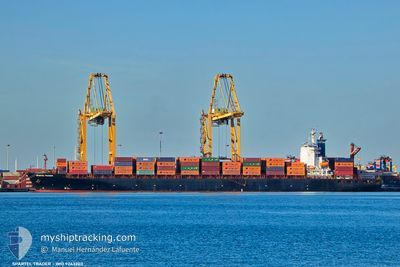
SPARTEL TRADER
Container Ship
Current Trip
| Trip Time | 22 days |
|---|---|
| Trip Distance | 3657.58 nm |
| AVG Speed | 12.3 Knots |
| MAX Speed | 15.3 Knots |
| Draught | 11 m |
| AVG Wind | 10.8 knots |
| MAX Wind | 22 knots |
| MIN Temp | 10.9°C / 51.62°F |
| MAX Temp | 28.3°C / 82.94°F |
| Position Received | 14 d ago |
Current Position
| Longitude | --- |
|---|---|
| Latitude | --- |
| Status | Under way using engine |
| Speed | 13.7 Knots |
| Course | 148.4° |
| Area | North Atlantic Ocean |
| Station | T-AIS |
| Position Received | 14 d ago |
Info
Information
The current position of SPARTEL TRADER is in North Atlantic Ocean with coordinates 10.07338° / -17.02387° as reported on 2025-12-06 10:16 by AIS to our vessel tracker app. The vessel's current speed is 13.7 Knots and is currently inside the port of LAGOS.
The vessel SPARTEL TRADER (IMO: 9243203, MMSI: 636021056) is a Container Ship that was built in 2003 ( 22 years old ). It's sailing under the flag of [LR] Liberia.
In this page you can find informations about the vessels current position, last detected port calls, and current voyage information. If the vessels is not in coverage by AIS you will find the latest position.
The current position of SPARTEL TRADER is detected by our AIS receivers and we are not responsible for the reliability of the data. The last position was recorded while the vessel was in Coverage by the Ais receivers of our vessel tracking app.
The current draught of SPARTEL TRADER as reported by AIS is 11 meters
Weather
| Temperature | 31.9°C / 89.42°F |
|---|---|
| Wind Speed | 2 knots |
| Direction | 138° SE |
| Pressure | 1011 hPa |
| Humidity | 51.7 % |
| Cloud Coverage | 5 % |
Featured Company
Last Port Calls
| Port | Arrival | Departure | Time In Port |
|---|---|---|---|
| 2025-12-18 02:10 | |||
| 2025-11-24 23:43 | 2025-11-26 00:51 | 1 d | |
| 2025-11-17 14:41 | 2025-11-19 05:59 | 1 d | |
| 2025-11-15 20:42 | 2025-11-17 01:12 | 1 d | |
| 2025-11-09 16:33 | 2025-11-10 12:16 | 19 h | |
| 2025-10-22 23:12 | 2025-10-25 07:08 | 2 d | |
| 2025-10-21 20:48 | 2025-10-22 11:24 | 14 h | |
| 2025-10-19 19:46 | 2025-10-20 21:56 | 1 d | |
| 2025-10-01 12:42 | 2025-10-02 02:37 | 13 h |
Last Trips
| Origin | Departure | Destination | Arrival | Distance | |
|---|---|---|---|---|---|
| 2025-11-26 00:51 | 2025-12-18 02:10 | 3657.58 nm | |||
| 2025-11-19 05:59 | 2025-11-24 23:43 | 2001.06 nm | |||
| 2025-11-17 01:12 | 2025-11-17 14:41 | 74.69 nm | |||
| 2025-11-10 12:16 | 2025-11-15 20:42 | 1518.19 nm | |||
| 2025-10-25 07:08 | 2025-11-09 16:33 | 3786.57 nm | |||
| 2025-10-22 11:24 | 2025-10-22 23:12 | 86.79 nm | |||
| 2025-10-20 21:56 | 2025-10-21 20:48 | 102.84 nm | |||
| 2025-10-02 02:37 | 2025-10-19 19:46 | 3675.50 nm | |||
| 2025-09-29 12:42 | 2025-10-01 12:42 | 715.99 nm |
Events
| Time | Event | Details | Position / Dest | Info |
|---|---|---|---|---|
| 2025-12-18 02:32 | STOP Moving |
6.43194 / 3.35442
[NG] LAGOS
|
Speed: Course: 272° |
|
| 2025-12-18 01:10 | PORT ARRIVAL |
|
6.40096 / 3.40043
[NG] LAGOS
|
Speed: 6.9 kn Course: 336° |
| 2025-12-18 00:14 | START Moving | 10.54 nm, South East of LAGOS |
6.31860 / 3.49998
NGTIN
|
Speed: 4.3 kn Course: 279° |
| 2025-12-17 19:22 | STOP Moving | 9.62 nm, South East of LAGOS |
6.30018 / 3.45742
NGTIN
|
Speed: 0.3 kn Course: 268° |
| 2025-12-17 17:46 | START Moving | 16.48 nm, South East of LAGOS |
6.29659 / 3.60514
NGTIN
|
Speed: 3.8 kn Course: 255° |
| 2025-12-16 20:38 | STOP Moving | 13.83 nm, South East of LAGOS |
6.25551 / 3.51468
NGTIN
|
Speed: 0.3 kn Course: 155° |
| 2025-12-16 19:34 | START Moving | 9.95 nm, South of LAGOS |
6.27447 / 3.41923
NGTIN
|
Speed: 5.9 kn Course: 112° |
| 2025-12-16 06:18 | STOP Moving | 9.99 nm, South East of LAGOS |
6.28300 / 3.44065
NGTIN
|
Speed: 0.3 kn Course: 41° |
| 2025-12-15 17:18 | START Moving |
5.29287 / 1.59661
NGTIN
|
Speed: 5.5 kn Course: 14° |
|
| 2025-12-14 18:37 | STOP Moving |
5.05167 / 1.02833
NGTIN
|
Speed: Course: -1° |