

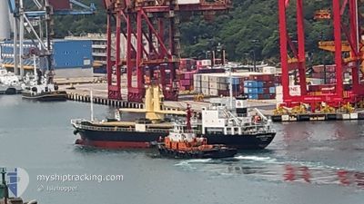
SOUTHERN ANGEL
General Cargo

Current Trip
JP M0J
| Time Travelled | 17 h, 46 mins |
|---|---|
| Remaining Time | --- |
| Distance Travelled | 159.40 nm |
| Remaining Distance | --- |
| AVG Speed | 9.3 Knots |
| MAX Speed | 11.8 Knots |
| AVG Wind | 8.7 knots |
| MAX Wind | 31 knots |
| MIN Temp | 2.7°C / 36.86°F |
| MAX Temp | 9.2°C / 48.56°F |
| Draught | 4.9 m |
| Position Received | 11 h, 23 m ago |
Current Position
| Longitude | --- |
|---|---|
| Latitude | --- |
| Status | Under way using engine |
| Speed | 9 Knots |
| Course | 305.3° |
| Area | Inland Sea |
| Station | T-AIS |
| Position Received | 11 h, 23 m ago |
Information
The current position of SOUTHERN ANGEL is in Inland Sea with coordinates 34.41713° / 134.19546° as reported on 2025-03-17 21:10 by AIS to our vessel tracker app. The vessel's current speed is 9 Knots
The vessel SOUTHERN ANGEL (IMO: 9319258, MMSI: 354587000) is a General Cargo that was built in 2004 ( 21 years old ). It's sailing under the flag of [PA] Panama.
In this page you can find informations about the vessels current position, last detected port calls, and current voyage information. If the vessels is not in coverage by AIS you will find the latest position.
The current position of SOUTHERN ANGEL is detected by our AIS receivers and we are not responsible for the reliability of the data. The last position was recorded while the vessel was in Coverage by the Ais receivers of our vessel tracking app.
The current draught of SOUTHERN ANGEL as reported by AIS is 4.9 meters
Weather
| Temperature | 6.9°C / 44.42°F |
|---|---|
| Wind Speed | 23 knots |
| Direction | 282° WNW |
| Pressure | 1013 hPa |
| Humidity | 62.8 % |
| Cloud Coverage | 100 % |


Featured Company
Last Port Calls
| Port | Arrival | Departure | Time In Port |
|---|---|---|---|
| 2025-03-17 12:01 | 2025-03-17 23:48 | 11 h | |
| 2025-03-15 11:16 | 2025-03-15 17:56 | 6 h | |
| 2025-03-14 06:14 | 2025-03-14 13:38 | 7 h | |
| 2025-03-12 07:09 | 2025-03-12 13:21 | 6 h | |
| 2025-03-11 02:21 | 2025-03-12 05:53 | 1 d | |
| 2025-03-08 14:21 | 2025-03-10 14:29 | 2 d | |
| 2025-02-27 06:49 | 2025-03-02 18:13 | 3 d | |
| 2025-02-22 11:17 | 2025-02-25 16:15 | 3 d | |
| 2025-02-16 08:13 | 2025-02-18 12:29 | 2 d | |
| 2025-02-14 07:34 | 2025-02-14 16:05 | 8 h |
Last Trips
| Origin | Departure | Destination | Arrival | Distance | |
|---|---|---|---|---|---|
| 2025-03-15 17:56 | 2025-03-17 12:01 | 353.75 nm | |||
| 2025-03-14 13:38 | 2025-03-15 11:16 | 205.18 nm | |||
| 2025-03-12 13:21 | 2025-03-14 06:14 | 236.38 nm | |||
| 2025-03-12 05:53 | 2025-03-12 07:09 | 3.01 nm | |||
| 2025-03-10 14:29 | 2025-03-11 02:21 | 108.14 nm | |||
| 2025-03-02 18:13 | 2025-03-08 14:21 | 1163.46 nm | |||
| 2025-02-25 16:15 | 2025-02-27 06:49 | 239.84 nm | |||
| 2025-02-18 12:29 | 2025-02-22 11:17 | 823.31 nm | |||
| 2025-02-14 16:05 | 2025-02-16 08:13 | 203.72 nm | |||
| 2025-02-13 16:49 | 2025-02-14 07:34 | 16.50 nm |
Events
| Time | Event | Details | Position / Dest | Info |
|---|---|---|---|---|
| 2025-03-17 21:18 | Status Changed | Default Under way using engine |
34.42505 / 134.17513
JP M0J
|
Speed: 9 kn Course: 305.3° |
| 2025-03-17 21:10 | OUT of Coverage |
34.41713 / 134.19546
Inland Sea
JP M0J
|
Speed: 9 kn Course: 305.3° |
|
| 2025-03-17 21:06 | Status Changed | Under way using engine Default |
34.41229 / 134.20514
JP M0J
|
Speed: 8.7 kn Course: 290° |
| 2025-03-17 20:22 | Status Changed | Default Under way using engine |
34.40329 / 134.33110
JP M0J
|
Speed: 8.8 kn Course: 245.4° |
| 2025-03-17 20:01 | Status Changed | Under way using engine Default |
34.41954 / 134.38910
JP M0J
|
Speed: 9.1 kn Course: 247° |
| 2025-03-17 19:54 | Status Changed | Default Under way using engine |
34.42673 / 134.40849
JP M0J
|
Speed: 8.9 kn Course: 242.7° |
| 2025-03-17 15:02 | ETA Changed | 2025/03/19 03:00 2025/03/19 02:00 |
34.61865 / 135.25469
JP M0J
|
Speed: 9.8 kn Course: 224.9° |
| 2025-03-17 14:48 | PORT DEPARTURE |
|
34.64954 / 135.26364
JP M0J
|
Speed: 9.7 kn Course: 147° |
| 2025-03-17 14:26 | START Moving |
34.67549 / 135.22197
[JP] KOBE
|
Speed: 4.4 kn Course: 69° |
|
| 2025-03-17 14:18 | Status Changed | Under way using engine Moored |
34.67497 / 135.21929
[JP] KOBE
|
Speed: 0.7 kn Course: 270° |