
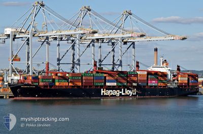
SOURCE BLESSING
Container Ship
Current Trip
| Time Travelled | 1 day |
|---|---|
| Remaining Time | --- |
| Distance Travelled | 385.90 nm |
| Remaining Distance | 376.58 nm |
| AVG Speed | 10.9 Knots |
| MAX Speed | 12.5 Knots |
| AVG Wind | 11.6 knots |
| MAX Wind | 26 knots |
| MIN Temp | 21.7°C / 71.06°F |
| MAX Temp | 25.4°C / 77.72°F |
| Draught | 11 m |
| Position Received | 7 d ago |
Current Position
| Longitude | --- |
|---|---|
| Latitude | --- |
| Status | Under way using engine |
| Speed | 12.7 Knots |
| Course | 36° |
| Area | Persian Gulf |
| Station | T-AIS |
| Position Received | 7 d ago |
Info
Information
The current position of SOURCE BLESSING is in Persian Gulf with coordinates 26.08703° / 55.78130° as reported on 2025-12-23 20:36 by AIS to our vessel tracker app. The vessel's current speed is 12.7 Knots and is heading at the port of SOHAR. The estimated time of arrival as calculated by MyShipTracking vessel tracking app is 2025-12-24 16:30 LT
The vessel SOURCE BLESSING (IMO: 9243198, MMSI: 636020939) is a Container Ship that was built in 2003 ( 22 years old ). It's sailing under the flag of [LR] Liberia.
In this page you can find informations about the vessels current position, last detected port calls, and current voyage information. If the vessels is not in coverage by AIS you will find the latest position.
The current position of SOURCE BLESSING is detected by our AIS receivers and we are not responsible for the reliability of the data. The last position was recorded while the vessel was in Coverage by the Ais receivers of our vessel tracking app.
The current draught of SOURCE BLESSING as reported by AIS is 11 meters
Weather
| Temperature | 23.3°C / 73.94°F |
|---|---|
| Wind Speed | 19 knots |
| Direction | 354° N |
| Pressure | 1013.4 hPa |
| Humidity | 52.6 % |
| Cloud Coverage | --- |
Featured Company
Last Port Calls
| Port | Arrival | Departure | Time In Port |
|---|---|---|---|
| 2025-12-28 23:56 | 2025-12-29 19:14 | 19 h | |
| 2025-12-24 20:26 | 2025-12-26 05:36 | 1 d | |
| 2025-12-22 22:48 | 2025-12-23 17:44 | 18 h | |
| 2025-12-14 22:56 | 2025-12-15 18:46 | 19 h | |
| 2025-12-10 18:40 | 2025-12-11 22:33 | 1 d | |
| 2025-12-08 18:25 | 2025-12-09 12:47 | 18 h | |
| 2025-11-30 23:19 | 2025-12-01 22:09 | 22 h | |
| 2025-11-26 18:31 | 2025-11-27 22:45 | 1 d | |
| 2025-11-24 18:56 | 2025-11-25 14:06 | 19 h | |
| 2025-11-16 22:49 | 2025-11-17 20:16 | 21 h |
Last Trips
| Origin | Departure | Destination | Arrival | Distance | |
|---|---|---|---|---|---|
| 2025-12-26 05:36 | 2025-12-28 23:56 | 752.29 nm | |||
| 2025-12-23 17:44 | 2025-12-24 20:26 | 267.73 nm | |||
| 2025-12-15 18:46 | 2025-12-22 22:48 | 1472.49 nm | |||
| 2025-12-11 22:33 | 2025-12-14 22:56 | 759.42 nm | |||
| 2025-12-09 12:47 | 2025-12-10 18:40 | 269.25 nm | |||
| 2025-12-01 22:09 | 2025-12-08 18:25 | 1429.78 nm | |||
| 2025-11-27 22:45 | 2025-11-30 23:19 | 758.48 nm | |||
| 2025-11-25 14:06 | 2025-11-26 18:31 | 265.93 nm | |||
| 2025-11-17 20:16 | 2025-11-24 18:56 | 1435.92 nm | |||
| 2025-11-13 19:12 | 2025-11-16 22:49 | 777.30 nm |
Events
| Time | Event | Details | Position / Dest | Info |
|---|---|---|---|---|
| 2025-12-29 15:14 | PORT DEPARTURE |
|
16.95045 / 54.04363
OMSOH
|
Speed: 9 kn Course: -1° |
| 2025-12-29 15:02 | START Moving |
16.94773 / 54.01683
[OM] SALALAH
|
Speed: 5.1 kn Course: 72° |
|
| 2025-12-28 20:29 | STOP Moving |
16.94500 / 54.00834
[OM] SALALAH
|
Speed: Course: -1° |
|
| 2025-12-28 19:56 | PORT ARRIVAL |
|
16.95167 / 54.02833
[OM] SALALAH
|
Speed: 6 kn Course: 259° |
| 2025-12-28 18:32 | START Moving | 13.78 nm, East of SALALAH |
16.94223 / 54.26343
OMSOH
|
Speed: 7.2 kn Course: 267° |
| 2025-12-28 10:29 | STOP Moving | 12.5 nm, East of SALALAH |
16.89667 / 54.23333
OMSOH
|
Speed: Course: -1° |
| 2025-12-26 01:36 | PORT DEPARTURE |
|
24.52883 / 56.63059
OMSOH
|
Speed: 6.6 kn Course: 356° |
| 2025-12-26 01:10 | START Moving |
24.51450 / 56.61194
[OM] SOHAR
|
Speed: 3.8 kn Course: 135° |
|
| 2025-12-24 17:10 | STOP Moving |
24.51610 / 56.60921
[OM] SOHAR
|
Speed: Course: 142° |
|
| 2025-12-24 16:26 | PORT ARRIVAL |
|
24.51672 / 56.62865
[OM] SOHAR
|
Speed: 7.7 kn Course: 179° |