

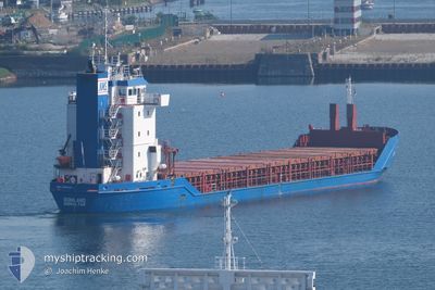
SONILAND
General Cargo

Current Trip
| Time Travelled | 16 h, 41 mins |
|---|---|
| Remaining Time | 16 h, 48 mins |
| Distance Travelled | 191.32 nm |
| Remaining Distance | 202.91 nm |
| AVG Speed | 11.8 Knots |
| MAX Speed | 12.4 Knots |
| AVG Wind | 10.2 knots |
| MAX Wind | 13.2 knots |
| MIN Temp | 1.4°C / 34.52°F |
| MAX Temp | 2.5°C / 36.5°F |
| Draught | 4.4 m |
| Position Received | 28 m ago |
Current Position
| Longitude | --- |
|---|---|
| Latitude | --- |
| Status | Under way using engine |
| Speed | 11.5 Knots |
| Course | 110.7° |
| Area | Baltic Sea |
| Station | T-AIS |
| Position Received | 28 m ago |
Information
The current position of SONILAND is in Baltic Sea with coordinates 59.59685° / 21.04158° as reported on 2025-03-21 06:22 by AIS to our vessel tracker app. The vessel's current speed is 11.5 Knots and is heading at the port of HAMINA. The estimated time of arrival as calculated by MyShipTracking vessel tracking app is 2025-03-22 01:39 LT
The vessel SONILAND (IMO: 9155949, MMSI: 236306000) is a General Cargo that was built in 1997 ( 28 years old ). It's sailing under the flag of [GI] Gibraltar.
In this page you can find informations about the vessels current position, last detected port calls, and current voyage information. If the vessels is not in coverage by AIS you will find the latest position.
The current position of SONILAND is detected by our AIS receivers and we are not responsible for the reliability of the data. The last position was recorded while the vessel was in Coverage by the Ais receivers of our vessel tracking app.
The current draught of SONILAND as reported by AIS is 4.4 meters
Weather
| Temperature | 2.5°C / 36.5°F |
|---|---|
| Wind Speed | 13 knots |
| Direction | 15° NNE |
| Pressure | 1023.6 hPa |
| Humidity | 86.1 % |
| Cloud Coverage | 7 % |


Featured Company
Last Port Calls
| Port | Arrival | Departure | Time In Port |
|---|---|---|---|
| 2025-03-19 18:50 | 2025-03-20 16:10 | 21 h | |
| 2025-03-17 00:46 | 2025-03-19 15:27 | 2 d | |
| 2025-03-10 07:16 | 2025-03-13 16:07 | 3 d | |
| 2025-03-06 06:03 | 2025-03-07 19:24 | 1 d | |
| 2025-03-02 12:30 | 2025-03-03 19:05 | 1 d | |
| 2025-02-24 09:45 | 2025-03-01 11:27 | 5 d | |
| 2025-02-19 12:05 | 2025-02-20 14:29 | 1 d | |
| 2025-02-18 03:52 | 2025-02-18 04:26 | 34 m | |
| 2025-02-16 15:45 | 2025-02-17 22:37 | 1 d | |
| 2025-02-16 10:39 | 2025-02-16 10:57 | 17 m |
Last Trips
| Origin | Departure | Destination | Arrival | Distance | |
|---|---|---|---|---|---|
| 2025-03-19 15:27 | 2025-03-19 18:50 | 35.88 nm | |||
| 2025-03-13 16:07 | 2025-03-17 00:46 | 640.25 nm | |||
| 2025-03-07 19:24 | 2025-03-10 07:16 | 384.55 nm | |||
| 2025-03-03 19:05 | 2025-03-06 06:03 | 538.19 nm | |||
| 2025-03-01 11:27 | 2025-03-02 12:30 | 272.57 nm | |||
| 2025-02-20 14:29 | 2025-02-24 09:45 | 864.31 nm | |||
| 2025-02-18 04:26 | 2025-02-19 12:05 | 318.63 nm | |||
| 2025-02-17 22:37 | 2025-02-18 03:52 | 49.29 nm | |||
| 2025-02-16 10:57 | 2025-02-16 15:45 | 49.35 nm | |||
| 2025-02-14 09:18 | 2025-02-16 10:39 | 473.27 nm |
Events
| Time | Event | Details | Position / Dest | Info |
|---|---|---|---|---|
| 2025-03-21 06:30 | Status Changed | Default Under way using engine |
59.58928 / 21.08460
FIHMN
|
Speed: 11.5 kn Course: 110.7° |
| 2025-03-21 06:01 | Status Changed | Under way using engine Default |
59.62126 / 20.91155
FIHMN
|
Speed: 11.5 kn Course: 107° |
| 2025-03-21 05:54 | IN Coverage |
59.62079 / 20.91457
Baltic Sea
FIHMN
|
Speed: 11.5 kn Course: 107.2° |
|
| 2025-03-21 05:06 | Status Changed | Default Under way using engine |
59.67487 / 20.57762
FIHMN
|
Speed: 11.9 kn Course: 135.3° |
| 2025-03-21 04:57 | OUT of Coverage |
59.68427 / 20.52814
Baltic Sea
FIHMN
|
Speed: 11.9 kn Course: 135.3° |
|
| 2025-03-21 04:28 | Change Sea Area | Finnish part of the Baltic Sea Finnish part of the Gulf of Bothnia |
59.74076 / 20.37788
Baltic Sea
FIHMN
|
Speed: 11.7 kn Course: 101° |
| 2025-03-21 04:25 | Change Sea Area | Finnish part of the Gulf of Bothnia Finnish part of the Baltic Sea |
59.74250 / 20.35891
Gulf of Bothnia
FIHMN
|
Speed: 11.7 kn Course: 92.3° |
| 2025-03-21 02:34 | Change Sea Area | Finnish part of the Baltic Sea Swedish part of the Baltic Sea |
59.79058 / 19.66101
Baltic Sea
FIHMN
|
Speed: 11.9 kn Course: 139.5° |
| 2025-03-21 02:32 | Change Sea Area | Swedish part of the Baltic Sea Swedish part of the Gulf of Bothnia |
59.79561 / 19.65249
Baltic Sea
FIHMN
|
Speed: 12 kn Course: 140° |
| 2025-03-20 21:38 | Change Sea Area | Swedish part of the Gulf of Bothnia Finnish part of the Gulf of Bothnia |
60.61259 / 19.21354
Gulf of Bothnia
FIHMN
|
Speed: 11.9 kn Course: 226.9° |