

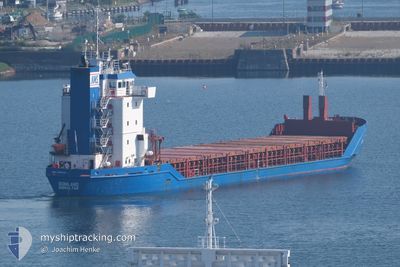
SONILAND
General Cargo

Current Trip
| Time Travelled | 4 days |
|---|---|
| Remaining Time | --- |
| Distance Travelled | 1275.75 nm |
| Remaining Distance | --- |
| AVG Speed | 10.7 Noeuds |
| MAX Speed | 17.6 Noeuds |
| AVG Wind | 12 knots |
| MAX Wind | 30.2 knots |
| MIN Temp | 0.5°C / 32.9°F |
| MAX Temp | 9.6°C / 49.28°F |
| Tirant d eau | 5.7 m |
| Position reçue | 1 h, 20 m depuis |
Current Position
| Longitude | --- |
|---|---|
| Latitude | --- |
| Etat | Under way using engine |
| Vitesse | 7.2 Noeuds |
| Parcours | 263.7° |
| Zone | North Atlantic Ocean |
| Station | T-AIS |
| Position reçue | 1 h, 20 m depuis |
Information
The current position of SONILAND is in North Atlantic Ocean with coordinates 58.67094° / -4.80059° as reported on 2025-03-27 19:08 by AIS to our vessel tracker app. The vessel's current speed is 7.2 Noeuds and is heading at the port of WARRENPOINT. The estimated time of arrival as calculated by MyShipTracking vessel tracking app is 2025-03-29 14:00 LT
The vessel SONILAND (IMO: 9155949, MMSI: 236306000) is a General Cargo that was built in 1997 ( 28 Age ). It's sailing under the flag of [GI] Gibraltar.
In this page you can find informations about the vessels current position, last detected port calls, and current voyage information. If the vessels is not in coverage by AIS you will find the latest position.
The current position of SONILAND is detected by our AIS receivers and we are not responsible for the reliability of the data. The last position was recorded while the vessel was in Coverage by the Ais receivers of our vessel tracking app.
The current draught of SONILAND as reported by AIS is 5.7 meters
Weather
| Temperature | 8.5°C / 47.3°F |
|---|---|
| Wind Speed | 27 knots |
| Direction | 229° SW |
| Pressure | 992.9 hPa |
| Humidity | 82.7 % |
| Cloud Coverage | 100 % |


Featured Company
Last Port Calls
| Port | Arrival | Departure | Time In Port |
|---|---|---|---|
| 2025-03-22 01:14 | 2025-03-22 21:20 | 20 h | |
| 2025-03-19 16:50 | 2025-03-20 14:10 | 21 h | |
| 2025-03-16 22:46 | 2025-03-19 13:27 | 2 d | |
| 2025-03-10 06:16 | 2025-03-13 15:07 | 3 d | |
| 2025-03-06 05:03 | 2025-03-07 18:24 | 1 d | |
| 2025-03-02 11:30 | 2025-03-03 18:05 | 1 d | |
| 2025-02-24 08:45 | 2025-03-01 10:27 | 5 d | |
| 2025-02-19 11:05 | 2025-02-20 13:29 | 1 d | |
| 2025-02-18 02:52 | 2025-02-18 03:26 | 34 m | |
| 2025-02-16 14:45 | 2025-02-17 21:37 | 1 d |
Last Trips
| Origin | Departure | Destination | Arrival | Distance | |
|---|---|---|---|---|---|
| 2025-03-20 16:10 | 2025-03-22 03:14 | 399.03 nm | |||
| 2025-03-19 15:27 | 2025-03-19 18:50 | 35.88 nm | |||
| 2025-03-13 16:07 | 2025-03-17 00:46 | 640.25 nm | |||
| 2025-03-07 19:24 | 2025-03-10 07:16 | 384.55 nm | |||
| 2025-03-03 19:05 | 2025-03-06 06:03 | 538.19 nm | |||
| 2025-03-01 11:27 | 2025-03-02 12:30 | 272.57 nm | |||
| 2025-02-20 14:29 | 2025-02-24 09:45 | 864.31 nm | |||
| 2025-02-18 04:26 | 2025-02-19 12:05 | 318.63 nm | |||
| 2025-02-17 22:37 | 2025-02-18 03:52 | 49.29 nm | |||
| 2025-02-16 10:57 | 2025-02-16 15:45 | 49.35 nm |
Events
| Heure | Evenement | Détails | Position/ Destination | Info |
|---|---|---|---|---|
| 2025-03-27 19:13 | Etat Changé | Default Under way using engine |
58.66821 / -4.82136
GBWPT
|
Vitesse: 7.2 kn Parcours: 263.7° |
| 2025-03-27 19:08 | Etat Changé | Under way using engine Default |
58.67094 / -4.80059
GBWPT
|
Vitesse: 7 kn Parcours: 266° |
| 2025-03-27 19:08 | Hors de la zone couverte |
58.67094 / -4.80059
North Atlantic Ocean
GBWPT
|
Vitesse: 7.2 kn Parcours: 263.7° |
|
| 2025-03-27 18:29 | Etat Changé | Default Under way using engine |
58.68015 / -4.65520
GBWPT
|
Vitesse: 6.6 kn Parcours: 259° |
| 2025-03-27 18:23 | Etat Changé | Under way using engine Default |
58.68177 / -4.63502
GBWPT
|
Vitesse: 6.5 kn Parcours: 261° |
| 2025-03-27 18:20 | Etat Changé | Default Under way using engine |
58.68274 / -4.62249
GBWPT
|
Vitesse: 6.3 kn Parcours: 262.7° |
| 2025-03-27 13:25 | Changement de zone | United Kingdom part of the North Atlantic Ocean United Kingdom part of the North Sea |
58.71223 / -3.42484
North Atlantic Ocean
GBWPT
|
Vitesse: 12.7 kn Parcours: 266.8° |
| 2025-03-27 11:24 | Etat Changé | Under way using engine Default |
58.68419 / -2.54760
GBWPT
|
Vitesse: 11.9 kn Parcours: 278° |
| 2025-03-27 11:24 | Etat Changé | Default Under way using engine |
58.68388 / -2.54330
GBWPT
|
Vitesse: 11.9 kn Parcours: 278.2° |
| 2025-03-27 11:24 | Etat Changé | Under way using engine Default |
58.68380 / -2.54226
GBWPT
|
Vitesse: 11.8 kn Parcours: 278° |