

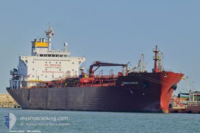
SONGA EAGLE
Oil/Chemical Tanker

Current Trip
| Time Travelled | 4 days |
|---|---|
| Remaining Time | 15 h, 9 mins |
| Distance Travelled | 368.55 nm |
| Remaining Distance | 166.91 nm |
| AVG Speed | 10 Knots |
| MAX Speed | 12 Knots |
| AVG Wind | 10.5 knots |
| MAX Wind | 26 knots |
| MIN Temp | 11.5°C / 52.7°F |
| MAX Temp | 17.1°C / 62.78°F |
| Draught | 7.9 m |
| Position Received | 6 h, 3 m ago |
Current Position
| Longitude | --- |
|---|---|
| Latitude | --- |
| Status | Under way using engine |
| Speed | 10.1 Knots |
| Course | 268° |
| Area | North Atlantic Ocean |
| Station | T-AIS |
| Position Received | 6 h, 3 m ago |
Information
The current position of SONGA EAGLE is in North Atlantic Ocean with coordinates 35.95791° / -6.23240° as reported on 2025-03-27 15:24 by AIS to our vessel tracker app. The vessel's current speed is 10.1 Knots and is heading at the port of SINES. The estimated time of arrival as calculated by MyShipTracking vessel tracking app is 2025-03-28 12:37 LT
The vessel SONGA EAGLE (IMO: 9388704, MMSI: 249512000) is a Oil/Chemical Tanker that was built in 2008 ( 17 years old ). It's sailing under the flag of [MT] Malta.
In this page you can find informations about the vessels current position, last detected port calls, and current voyage information. If the vessels is not in coverage by AIS you will find the latest position.
The current position of SONGA EAGLE is detected by our AIS receivers and we are not responsible for the reliability of the data. The last position was recorded while the vessel was in Coverage by the Ais receivers of our vessel tracking app.
The current draught of SONGA EAGLE as reported by AIS is 7.9 meters
Weather
| Temperature | 14.7°C / 58.46°F |
|---|---|
| Wind Speed | 4 knots |
| Direction | 297° WNW |
| Pressure | 1018.3 hPa |
| Humidity | 62.6 % |
| Cloud Coverage | 77 % |


Featured Company
Last Port Calls
| Port | Arrival | Departure | Time In Port |
|---|---|---|---|
| 2025-03-20 18:44 | 2025-03-23 04:43 | 2 d | |
| 2025-03-13 03:41 | 2025-03-14 04:11 | 1 d | |
| 2025-03-10 23:59 | 2025-03-12 17:20 | 1 d | |
| 2025-03-06 08:13 | 2025-03-08 04:07 | 1 d | |
| 2025-03-03 12:21 | 2025-03-05 05:23 | 1 d | |
| 2025-02-19 18:23 | 2025-02-21 15:49 | 1 d | |
| 2025-02-12 08:45 | 2025-02-15 03:33 | 2 d | |
| 2025-02-07 02:56 | 2025-02-08 08:01 | 1 d | |
| 2025-02-02 03:10 | 2025-02-03 11:27 | 1 d | |
| 2025-01-22 01:46 | 2025-01-24 00:58 | 1 d |
Last Trips
| Origin | Departure | Destination | Arrival | Distance | |
|---|---|---|---|---|---|
| 2025-03-14 04:11 | 2025-03-20 18:44 | 1690.18 nm | |||
| 2025-03-12 17:20 | 2025-03-13 03:41 | 97.00 nm | |||
| 2025-03-08 04:07 | 2025-03-10 23:59 | 794.63 nm | |||
| 2025-03-05 05:23 | 2025-03-06 08:13 | 270.19 nm | |||
| 2025-02-21 15:49 | 2025-03-03 12:21 | 1452.22 nm | |||
| 2025-02-15 03:33 | 2025-02-19 18:23 | 1005.45 nm | |||
| 2025-02-08 08:01 | 2025-02-12 08:45 | 794.83 nm | |||
| 2025-02-03 11:27 | 2025-02-07 02:56 | 7.99 nm | |||
| 2025-01-24 00:58 | 2025-02-02 03:10 | 904.64 nm | |||
| 2025-01-15 08:24 | 2025-01-22 01:46 | 529.03 nm |
Events
| Time | Event | Details | Position / Dest | Info |
|---|---|---|---|---|
| 2025-03-27 15:34 | Status Changed | Default Under way using engine |
35.95741 / -6.26503
SINES
|
Speed: 10.1 kn Course: 268° |
| 2025-03-27 15:24 | Status Changed | Under way using engine Default |
35.95791 / -6.23240
SINES
|
Speed: 10.1 kn Course: 268° |
| 2025-03-27 15:24 | OUT of Coverage |
35.95791 / -6.23240
North Atlantic Ocean
SINES
|
Speed: 10.1 kn Course: 268° |
|
| 2025-03-27 14:52 | Status Changed | Default Under way using engine |
35.96048 / -6.12232
SINES
|
Speed: 10 kn Course: 272° |
| 2025-03-27 14:42 | Status Changed | Under way using engine Default |
35.95974 / -6.08875
SINES
|
Speed: 9.9 kn Course: 273° |
| 2025-03-27 14:35 | Status Changed | Default Under way using engine |
35.95904 / -6.06372
SINES
|
Speed: 9.9 kn Course: 272° |
| 2025-03-27 14:34 | Detected in Sea | Spanish part of the North Atlantic Ocean |
35.95890 / -6.05971
North Atlantic Ocean
SINES
|
Speed: 9.9 kn Course: 272° |
| 2025-03-27 14:08 | Change Sea Area | Moroccan part of the North Atlantic Ocean Spanish part of the Strait of Gibraltar |
35.95793 / -5.97293
North Atlantic Ocean
SINES
|
Speed: 9.7 kn Course: 272° |
| 2025-03-27 10:52 | Change Sea Area | Spanish part of the Strait of Gibraltar Gibraltarian part of the Strait of Gibraltar |
36.02556 / -5.34729
Strait of Gibraltar
SINES
|
Speed: 8 kn Course: 251° |
| 2025-03-27 10:46 | Change Sea Area | Gibraltarian part of the Strait of Gibraltar Gibraltarian part of the Alboran Sea |
36.02867 / -5.33172
Strait of Gibraltar
SINES
|
Speed: 7.8 kn Course: 252° |