

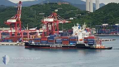
SNL NANTONG
Cargo

Current Trip
| Time Travelled | 4 days |
|---|---|
| Remaining Time | --- |
| Distance Travelled | 765.10 nm |
| Remaining Distance | 422.57 nm |
| AVG Speed | 16 Knots |
| MAX Speed | 21.1 Knots |
| AVG Wind | 14.6 knots |
| MAX Wind | 29 knots |
| MIN Temp | 10.5°C / 50.9°F |
| MAX Temp | 22.4°C / 72.32°F |
| Draught | 6.8 m |
| Position Received | 5 d ago |
Current Position
| Longitude | --- |
|---|---|
| Latitude | --- |
| Status | Under way using engine |
| Speed | 16.5 Knots |
| Course | 343° |
| Area | Eastern China Sea |
| Station | T-AIS |
| Position Received | 5 d ago |
Information
The current position of SNL NANTONG is in Eastern China Sea with coordinates 25.22761° / 121.75580° as reported on 2025-03-22 02:34 by AIS to our vessel tracker app. The vessel's current speed is 16.5 Knots and is heading at the port of TAICHUNG. The estimated time of arrival as calculated by MyShipTracking vessel tracking app is 2025-03-23 02:00 LT
The vessel SNL NANTONG (IMO: 9936898, MMSI: 477893900) is a Cargo It's sailing under the flag of [HK] Hong Kong.
In this page you can find informations about the vessels current position, last detected port calls, and current voyage information. If the vessels is not in coverage by AIS you will find the latest position.
The current position of SNL NANTONG is detected by our AIS receivers and we are not responsible for the reliability of the data. The last position was recorded while the vessel was in Coverage by the Ais receivers of our vessel tracking app.
The current draught of SNL NANTONG as reported by AIS is 6.8 meters
Weather
| Temperature | 9.7°C / 49.46°F |
|---|---|
| Wind Speed | 26 knots |
| Direction | 353° N |
| Pressure | 1017.4 hPa |
| Humidity | 69.4 % |
| Cloud Coverage | 96 % |


Featured Company
Last Port Calls
| Port | Arrival | Departure | Time In Port |
|---|---|---|---|
| 2025-03-23 16:38 | 2025-03-24 02:18 | 9 h | |
| 2025-03-22 18:09 | 2025-03-22 23:58 | 5 h | |
| 2025-03-21 17:18 | 2025-03-22 10:21 | 17 h | |
| 2025-03-20 02:03 | 2025-03-20 13:06 | 11 h | |
| 2025-03-16 13:24 | 2025-03-17 01:57 | 12 h | |
| 2025-03-15 22:05 | 2025-03-16 04:17 | 6 h | |
| 2025-03-14 23:10 | 2025-03-15 13:29 | 14 h | |
| 2025-03-13 13:27 | 2025-03-13 19:34 | 6 h | |
| 2025-03-09 00:57 | 2025-03-09 11:01 | 10 h | |
| 2025-03-08 06:45 | 2025-03-08 17:49 | 11 h |
Last Trips
| Origin | Departure | Destination | Arrival | Distance | |
|---|---|---|---|---|---|
| 2025-03-22 23:58 | 2025-03-23 16:38 | 214.25 nm | |||
| 2025-03-22 10:21 | 2025-03-22 18:09 | 127.38 nm | |||
| 2025-03-20 13:06 | 2025-03-21 17:18 | 443.79 nm | |||
| 2025-03-17 01:57 | 2025-03-20 02:03 | 781.92 nm | |||
| 2025-03-16 04:17 | 2025-03-16 13:24 | 139.19 nm | |||
| 2025-03-15 13:29 | 2025-03-15 22:05 | 122.35 nm | |||
| 2025-03-13 19:34 | 2025-03-14 23:10 | 448.93 nm | |||
| 2025-03-09 11:01 | 2025-03-13 13:27 | 593.85 nm | |||
| 2025-03-08 17:49 | 2025-03-09 00:57 | 119.13 nm | |||
| 2025-03-07 01:21 | 2025-03-08 06:45 | 447.60 nm |
Events
| Time | Event | Details | Position / Dest | Info |
|---|---|---|---|---|
| 2025-03-27 14:50 | STOP Moving | 19.76 nm, North East of SHENGSI |
31.04303 / 122.57537
TW TXG
|
Speed: 0.2 kn Course: 20° |
| 2025-03-27 07:14 | START Moving | 3.74 nm, East of NINGBO |
29.92742 / 121.91573
TW TXG
|
Speed: 7.7 kn Course: 306° |
| 2025-03-26 12:42 | STOP Moving | 4.34 nm, East of NINGBO |
29.91950 / 121.92487
TW TXG
|
Speed: Course: 160° |
| 2025-03-26 05:31 | START Moving |
30.40019 / 122.80701
TW TXG
|
Speed: 6.6 kn Course: 327° |
|
| 2025-03-25 20:52 | STOP Moving |
30.39347 / 122.81188
TW TXG
|
Speed: 0.3 kn Course: 334° |
|
| 2025-03-25 16:06 | START Moving |
29.48483 / 122.66863
TW TXG
|
Speed: 12.4 kn Course: 66° |
|
| 2025-03-24 23:01 | STOP Moving |
29.48123 / 122.64885
TW TXG
|
Speed: 0.3 kn Course: 236° |
|
| 2025-03-23 18:18 | PORT DEPARTURE |
|
22.54610 / 120.26960
TW TXG
|
Speed: 12.5 kn Course: 265° |
| 2025-03-23 18:02 | START Moving |
22.55286 / 120.31831
[TW] KAOHSIUNG
|
Speed: 4.8 kn Course: 255° |
|
| 2025-03-23 08:38 | STOP Moving |
22.55757 / 120.32709
[TW] KAOHSIUNG
|
Speed: Course: 52° |