
SIVUMUT
General Cargo
Current Trip
| Time Travelled | 3 days |
|---|---|
| Remaining Time | --- |
| Distance Travelled | 586.82 nm |
| Remaining Distance | --- |
| AVG Speed | 6.9 Knots |
| MAX Speed | 15.8 Knots |
| AVG Wind | 12.2 knots |
| MAX Wind | 20.6 knots |
| MIN Temp | 1°C / 33.8°F |
| MAX Temp | 17°C / 62.6°F |
| Draught | 6.4 m |
| Position Received | 2 d ago |
Current Position
| Longitude | -71.06542° |
|---|---|
| Latitude | 39.01618° |
| Status | Under way using engine |
| Speed | 7 Knots |
| Course | 172.3° |
| Area | North Atlantic Ocean |
| Station | T-AIS |
| Position Received | 2 d ago |
Info
Information
The current position of SIVUMUT is in North Atlantic Ocean with coordinates 39.01618° / -71.06542° as reported on 2024-04-26 14:32 by AIS to our vessel tracker app. The vessel's current speed is 7 Knots and is heading at the port of PALMA DE MALLORCA. The estimated time of arrival as calculated by MyShipTracking vessel tracking app is 2024-05-09 12:00 LT
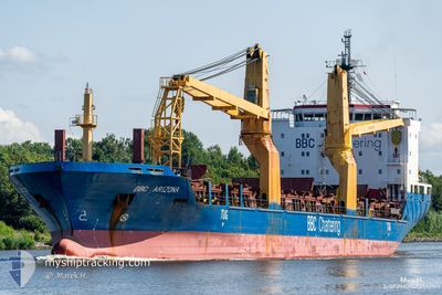
The vessel SIVUMUT (IMO: 9501253, MMSI: 244655000) is a General Cargo that was built in 2010 ( 14 years old ). It's sailing under the flag of [NL] Netherlands.
In this page you can find informations about the vessels current position, last detected port calls, and current voyage information. If the vessels is not in coverage by AIS you will find the latest position.
The current position of SIVUMUT is detected by our AIS receivers and we are not responsible for the reliability of the data. The last position was recorded while the vessel was in Coverage by the Ais receivers of our vessel tracking app.
The current draught of SIVUMUT as reported by AIS is 6.4 meters
Weather
| Temperature | 16.9°C / 62.42°F |
|---|---|
| Wind Speed | 6 knots |
| Direction | 5° N |
| Pressure | 1023.9 hPa |
| Humidity | 57.9 % |
| Cloud Coverage | 42 % |
Featured Company
Last Port Calls
| Port | Arrival | Departure | Time In Port |
|---|---|---|---|
| 2024-04-24 23:21 | 2024-04-25 06:49 | 7 h | |
| 2024-04-24 18:21 | 2024-04-24 18:49 | 28 m | |
| 2024-04-24 16:33 | 2024-04-24 17:01 | 28 m | |
| 2024-04-23 08:33 | 2024-04-23 08:49 | 15 m | |
| 2024-04-18 17:02 | 2024-04-19 19:10 | 1 d | |
| 2024-04-15 12:44 | 2024-04-18 10:49 | 2 d | |
| 2024-04-05 22:21 | 2024-04-12 23:40 | 7 d | |
| 2024-03-29 07:27 | 2024-03-30 17:21 | 1 d | |
| 2024-03-29 06:48 | 2024-03-29 06:53 | 4 m | |
| 2024-03-10 06:57 | 2024-03-12 19:22 | 2 d |
Most Visited Ports (Last year)
| Port | Arrivals | |
|---|---|---|
| 4 | ||
| 1 | ||
| 1 | ||
| 1 | ||
| 1 | ||
| 1 |
Last Trips
| Origin | Departure | Destination | Arrival | Distance | |
|---|---|---|---|---|---|
| 2024-04-24 14:49 | 2024-04-24 19:21 | 1.07 nm | |||
| 2024-04-24 13:01 | 2024-04-24 14:21 | 0.41 nm | |||
| 2024-04-23 04:49 | 2024-04-24 12:33 | 9.04 nm | |||
| 2024-04-19 15:10 | 2024-04-23 04:33 | 1017.56 nm | |||
| 2024-04-18 06:49 | 2024-04-18 13:02 | 71.61 nm | |||
| 2024-04-12 18:40 | 2024-04-15 08:44 | 816.19 nm | |||
| 2024-03-30 13:21 | 2024-04-05 17:21 | 1689.65 nm | |||
| 2024-03-29 02:53 | 2024-03-29 03:27 | 3.34 nm | |||
| 2024-03-12 20:22 | 2024-03-29 02:48 | 4389.92 nm | |||
| 2024-03-06 21:46 | 2024-03-10 07:57 | 994.16 nm |
Events
| Time | Event | Details | Position / Dest | Info |
|---|---|---|---|---|
| 2024-04-26 14:37 | Status Changed | Default Under way using engine |
39.00667 / -71.06333
ESPMI
|
Speed: 7 kn Course: 172.3° |
| 2024-04-26 14:32 | OUT of Coverage |
39.01618 / -71.06542
North Atlantic Ocean
ESPMI
|
Speed: 7 kn Course: 172.3° |
|
| 2024-04-26 14:31 | Status Changed | Under way using engine Default |
39.01877 / -71.06580
ESPMI
|
Speed: 6 kn Course: 172° |
| 2024-04-26 14:16 | IN Coverage |
39.01684 / -71.06553
North Atlantic Ocean
ESPMI
|
Speed: 7 kn Course: 173.5° |
|
| 2024-04-26 09:01 | Status Changed | Default Under way using engine |
39.59500 / -71.17167
ESPMI
|
Speed: 5.9 kn Course: 177.1° |
| 2024-04-26 08:55 | OUT of Coverage |
39.60461 / -71.17380
North Atlantic Ocean
ESPMI
|
Speed: 5.9 kn Course: 177.1° |
|
| 2024-04-26 08:11 | Status Changed | Under way using engine Default |
39.67959 / -71.18238
ESPMI
|
Speed: 6 kn Course: 174° |
| 2024-04-26 07:38 | Status Changed | Default Under way using engine |
39.73717 / -71.19046
ESPMI
|
Speed: 6.4 kn Course: 175.5° |
| 2024-04-26 07:28 | Status Changed | Under way using engine Default |
39.75539 / -71.19321
ESPMI
|
Speed: 6.3 kn Course: 174° |
| 2024-04-26 07:10 | Status Changed | Default Under way using engine |
39.78672 / -71.19782
ESPMI
|
Speed: 6.5 kn Course: 172° |