
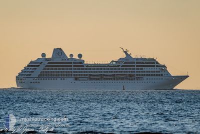
SIRENA
Passengers Ship
Current Trip
VN SGN
| Time Travelled | 15 h, 20 mins |
|---|---|
| Remaining Time | --- |
| Distance Travelled | 212.12 nm |
| Remaining Distance | --- |
| AVG Speed | 14.5 Knots |
| MAX Speed | 16.8 Knots |
| AVG Wind | 7.1 knots |
| MAX Wind | 14.2 knots |
| MIN Temp | 27°C / 80.6°F |
| MAX Temp | 28°C / 82.4°F |
| Draught | 6 m |
| Position Received | 10 d ago |
Current Position
| Longitude | --- |
|---|---|
| Latitude | --- |
| Status | Under way using engine |
| Speed | 17.7 Knots |
| Course | 80.3° |
| Area | Singapore Strait |
| Station | T-AIS |
| Position Received | 10 d ago |
Info
Information
The current position of SIRENA is in Singapore Strait with coordinates 1.28181° / 104.27520° as reported on 2025-12-27 08:40 by AIS to our vessel tracker app. The vessel's current speed is 17.7 Knots
The vessel SIRENA (IMO: 9187899, MMSI: 538006842) is a Passengers Ship that was built in 1999 ( 27 years old ). It's sailing under the flag of [MH] Marshall Is.
In this page you can find informations about the vessels current position, last detected port calls, and current voyage information. If the vessels is not in coverage by AIS you will find the latest position.
The current position of SIRENA is detected by our AIS receivers and we are not responsible for the reliability of the data. The last position was recorded while the vessel was in Coverage by the Ais receivers of our vessel tracking app.
The current draught of SIRENA as reported by AIS is 6 meters
Weather
| Temperature | 27.6°C / 81.68°F |
|---|---|
| Wind Speed | 14 knots |
| Direction | 51° NE |
| Pressure | 1011.9 hPa |
| Humidity | 63 % |
| Cloud Coverage | 96 % |
Featured Company
Last Port Calls
| Port | Arrival | Departure | Time In Port |
|---|---|---|---|
| 2026-01-04 10:03 | 2026-01-06 14:21 | 2 d | |
| 2026-01-01 06:28 | 2026-01-01 17:36 | 11 h | |
| 2025-12-26 06:49 | 2025-12-27 14:24 | 1 d | |
| 2025-12-25 07:02 | 2025-12-25 17:18 | 10 h | |
| 2025-12-24 08:58 | 2025-12-24 17:38 | 8 h | |
| 2025-12-20 05:56 | 2025-12-20 16:28 | 10 h | |
| 2025-12-19 07:07 | 2025-12-19 18:44 | 11 h | |
| 2025-12-12 07:29 | 2025-12-12 18:19 | 10 h | |
| 2025-12-11 07:25 | 2025-12-11 18:11 | 10 h | |
| 2025-12-07 06:20 | 2025-12-07 20:24 | 14 h |
Last Trips
| Origin | Departure | Destination | Arrival | Distance | |
|---|---|---|---|---|---|
| 2026-01-01 17:36 | 2026-01-04 10:03 | 601.04 nm | |||
| 2025-12-27 14:24 | 2026-01-01 06:28 | 1135.49 nm | |||
| 2025-12-25 17:18 | 2025-12-26 06:49 | 210.59 nm | |||
| 2025-12-24 17:38 | 2025-12-25 07:02 | 200.69 nm | |||
| 2025-12-20 16:28 | 2025-12-24 08:58 | 1238.20 nm | |||
| 2025-12-19 18:44 | 2025-12-20 05:56 | 155.25 nm | |||
| 2025-12-12 18:19 | 2025-12-19 07:07 | 2212.47 nm | |||
| 2025-12-11 18:11 | 2025-12-12 07:29 | 148.90 nm | |||
| 2025-12-07 20:24 | 2025-12-11 07:25 | 1344.63 nm | |||
| 2025-12-05 22:13 | 2025-12-07 06:20 | 380.17 nm |
Events
| Time | Event | Details | Position / Dest | Info |
|---|---|---|---|---|
| 2026-01-06 07:21 | PORT DEPARTURE |
|
13.07326 / 100.86206
VN SGN
|
Speed: 7 kn Course: 308° |
| 2026-01-06 07:04 | START Moving |
13.06647 / 100.89103
[TH] LAEM CHABANG
|
Speed: 6.1 kn Course: 231° |
|
| 2026-01-04 03:40 | STOP Moving |
13.06937 / 100.89445
[TH] LAEM CHABANG
|
Speed: 0.1 kn Course: 241° |
|
| 2026-01-04 03:03 | PORT ARRIVAL |
|
13.06900 / 100.87380
[TH] LAEM CHABANG
|
Speed: 8.6 kn Course: 106° |
| 2026-01-01 23:57 | STOP Moving |
11.73667 / 102.52666
VN SGN
|
Speed: Course: -1° |
|
| 2026-01-01 10:41 | START Moving | 0.86 nm, West of KRONG PREAH SIHANOUK |
10.65201 / 103.49510
VN SGN
|
Speed: 4.8 kn Course: 295° |
| 2026-01-01 10:36 | PORT DEPARTURE |
|
10.64857 / 103.49744
VN SGN
|
Speed: 1.2 kn Course: 208° |
| 2025-12-31 23:28 | STOP Moving |
10.64367 / 103.49811
[KH] KRONG PREAH SIHANOUK
|
Speed: 0.2 kn Course: 191° |
|
| 2025-12-31 23:28 | PORT ARRIVAL |
|
10.64367 / 103.49811
[KH] KRONG PREAH SIHANOUK
|
Speed: 1.1 kn Course: 181° |
| 2025-12-30 10:25 | START Moving | 19.83 nm, North West of PHU MY |
10.75997 / 106.73090
VN SGN
|
Speed: 6.9 kn Course: 63° |