
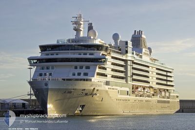
SILVER NOVA
Passenger
Current Trip
NZ NPE
| Time Travelled | 5 h, 42 mins |
|---|---|
| Remaining Time | --- |
| Distance Travelled | 55.19 nm |
| Remaining Distance | --- |
| AVG Speed | 11.3 Knots |
| MAX Speed | 12 Knots |
| AVG Wind | 8.8 knots |
| MAX Wind | 10.7 knots |
| MIN Temp | 18.6°C / 65.48°F |
| MAX Temp | 19.5°C / 67.1°F |
| Draught | 7.1 m |
| Position Received | 1 d ago |
Current Position
| Longitude | --- |
|---|---|
| Latitude | --- |
| Status | Under way using engine |
| Speed | 16.6 Knots |
| Course | 61.8° |
| Area | South Pacific Ocean |
| Station | T-AIS |
| Position Received | 1 d ago |
Info
Information
The current position of SILVER NOVA is in South Pacific Ocean with coordinates -41.64370° / 175.40251° as reported on 2026-01-06 07:46 by AIS to our vessel tracker app. The vessel's current speed is 16.6 Knots
The vessel SILVER NOVA (IMO: 9886213, MMSI: 311001189) is a Passenger It's sailing under the flag of [BS] Bahamas.
In this page you can find informations about the vessels current position, last detected port calls, and current voyage information. If the vessels is not in coverage by AIS you will find the latest position.
The current position of SILVER NOVA is detected by our AIS receivers and we are not responsible for the reliability of the data. The last position was recorded while the vessel was in Coverage by the Ais receivers of our vessel tracking app.
The current draught of SILVER NOVA as reported by AIS is 7.1 meters
Weather
| Temperature | 18.6°C / 65.48°F |
|---|---|
| Wind Speed | 9 knots |
| Direction | 44° NE |
| Pressure | 1013.5 hPa |
| Humidity | 89.7 % |
| Cloud Coverage | 75 % |
Featured Company
Last Port Calls
| Port | Arrival | Departure | Time In Port |
|---|---|---|---|
| 2026-01-07 08:15 | 2026-01-07 19:15 | 11 h | |
| 2026-01-06 07:22 | 2026-01-06 18:08 | 10 h | |
| 2026-01-05 07:07 | 2026-01-05 18:10 | 11 h | |
| 2026-01-04 07:43 | 2026-01-04 18:15 | 10 h | |
| 2025-12-30 06:51 | 2025-12-30 18:03 | 11 h | |
| 2025-12-28 11:17 | 2025-12-28 21:58 | 10 h | |
| 2025-12-27 05:56 | 2025-12-27 19:15 | 13 h | |
| 2025-12-26 06:35 | 2025-12-26 15:03 | 8 h | |
| 2025-12-22 06:17 | 2025-12-23 18:34 | 1 d | |
| 2025-12-18 07:19 | 2025-12-18 19:07 | 11 h |
Last Trips
| Origin | Departure | Destination | Arrival | Distance | |
|---|---|---|---|---|---|
| 2026-01-06 18:08 | 2026-01-07 08:15 | 218.11 nm | |||
| 2026-01-05 18:10 | 2026-01-06 07:22 | 174.65 nm | |||
| 2026-01-04 18:15 | 2026-01-05 07:07 | 197.97 nm | |||
| 2025-12-30 18:03 | 2026-01-04 07:43 | 1314.69 nm | |||
| 2025-12-28 21:58 | 2025-12-30 06:51 | 438.21 nm | |||
| 2025-12-27 19:15 | 2025-12-28 11:17 | 219.98 nm | |||
| 2025-12-26 15:03 | 2025-12-27 05:56 | 224.06 nm | |||
| 2025-12-23 18:34 | 2025-12-26 06:35 | 442.32 nm | |||
| 2025-12-18 19:07 | 2025-12-22 06:17 | 1082.74 nm | |||
| 2025-12-17 18:04 | 2025-12-18 07:19 | 198.26 nm |
Events
| Time | Event | Details | Position / Dest | Info |
|---|---|---|---|---|
| 2026-01-07 06:16 | START Moving | 0.36 nm, North of NAPIER |
-39.46704 / 176.91025
NZ NPE
|
Speed: 5.6 kn Course: 356° |
| 2026-01-07 06:15 | PORT DEPARTURE |
|
-39.46704 / 176.91025
NZ NPE
|
Speed: 2.8 kn Course: 305° |
| 2026-01-06 19:42 | STOP Moving |
-39.47440 / 176.92133
[NZ] NAPIER
|
Speed: Course: 359° |
|
| 2026-01-06 19:15 | PORT ARRIVAL |
|
-39.47189 / 176.91519
[NZ] NAPIER
|
Speed: 1.5 kn Course: 289° |
| 2026-01-06 07:47 | Status Changed | Default Under way using engine |
-41.64148 / 175.40791
NZ NPE
|
Speed: 16.6 kn Course: 61.8° |
| 2026-01-06 07:46 | OUT of Coverage |
-41.64370 / 175.40251
South Pacific Ocean
NZ NPE
|
Speed: 16.6 kn Course: 61.8° |
|
| 2026-01-06 07:01 | Change Sea Area | New Zealand part of the South Pacific Ocean New Zealand part of the Tasman Sea |
-41.63636 / 175.13991
South Pacific Ocean
NZ NPE
|
Speed: 17.3 kn Course: 123.1° |
| 2026-01-06 05:08 | PORT DEPARTURE |
|
-41.27434 / 174.81455
NZ NPE
|
Speed: 13 kn Course: 92° |
| 2026-01-06 05:00 | START Moving |
-41.27132 / 174.79027
[NZ] WELLINGTON
|
Speed: 4.3 kn Course: 139° |
|
| 2026-01-06 04:53 | Status Changed | Under way using engine Moored |
-41.26992 / 174.78749
[NZ] WELLINGTON
|
Speed: Course: 169° |