

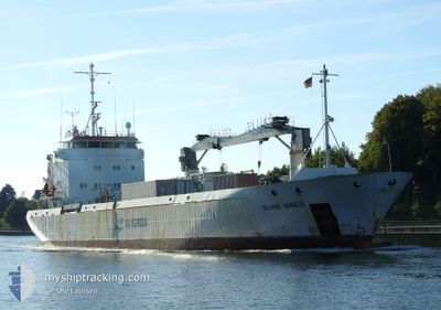
SILVER BREEZE
Reefer

Current Trip
| Trip Time | 1 day |
|---|---|
| Trip Distance | 443.80 nm |
| AVG Speed | 8.7 Knots |
| MAX Speed | 13.1 Knots |
| Draught | 3.9 m |
| AVG Wind | 10.8 knots |
| MAX Wind | 18 knots |
| MIN Temp | 3.7°C / 38.66°F |
| MAX Temp | 9.2°C / 48.56°F |
| Position Received | 3 m ago |
Current Position
| Longitude | --- |
|---|---|
| Latitude | --- |
| Status | Moored |
| Speed | |
| Course | 209° |
| Area | Kattegat |
| Station | T-AIS |
| Position Received | 3 m ago |
Information
The current position of SILVER BREEZE is in Kattegat with coordinates 55.05886° / 10.62157° as reported on 2025-03-28 03:40 by AIS to our vessel tracker app. The vessel's current speed is 0 Knots and is currently inside the port of SVENDBORG.
The vessel SILVER BREEZE (IMO: 9140932, MMSI: 257962000) is a Reefer that was built in 1997 ( 28 years old ). It's sailing under the flag of [NO] Norway.
In this page you can find informations about the vessels current position, last detected port calls, and current voyage information. If the vessels is not in coverage by AIS you will find the latest position.
The current position of SILVER BREEZE is detected by our AIS receivers and we are not responsible for the reliability of the data. The last position was recorded while the vessel was in Coverage by the Ais receivers of our vessel tracking app.
The current draught of SILVER BREEZE as reported by AIS is 3.9 meters
Weather
| Temperature | 5.1°C / 41.18°F |
|---|---|
| Wind Speed | 10 knots |
| Direction | 210° SSW |
| Pressure | 1013.1 hPa |
| Humidity | 92.6 % |
| Cloud Coverage | 15 % |


Featured Company
Last Port Calls
| Port | Arrival | Departure | Time In Port |
|---|---|---|---|
| 2025-03-25 13:24 | |||
| 2025-03-20 17:14 | 2025-03-23 18:24 | 3 d | |
| 2025-03-19 08:36 | 2025-03-19 18:22 | 9 h | |
| 2025-03-17 06:44 | 2025-03-17 12:43 | 5 h | |
| 2025-03-13 06:29 | 2025-03-14 06:36 | 1 d | |
| 2025-03-10 14:25 | 2025-03-12 18:35 | 2 d | |
| 2025-03-10 11:42 | 2025-03-10 13:21 | 1 h | |
| 2025-03-08 11:15 | 2025-03-09 18:23 | 1 d | |
| 2025-02-27 09:38 | 2025-03-01 19:20 | 2 d | |
| 2025-02-21 15:27 | 2025-02-27 02:12 | 5 d |
Most Visited Ports (Last year)
| Port | Arrivals | |
|---|---|---|
| 8 | ||
| 8 | ||
| 7 | ||
| 5 | ||
| 4 | ||
| 3 |
Last Trips
| Origin | Departure | Destination | Arrival | Distance | |
|---|---|---|---|---|---|
| 2025-03-23 18:24 | 2025-03-25 13:24 | 443.80 nm | |||
| 2025-03-19 18:22 | 2025-03-20 17:14 | 298.69 nm | |||
| 2025-03-17 12:43 | 2025-03-19 08:36 | 552.44 nm | |||
| 2025-03-14 06:36 | 2025-03-17 06:44 | 773.88 nm | |||
| 2025-03-12 18:35 | 2025-03-13 06:29 | 83.99 nm | |||
| 2025-03-10 13:21 | 2025-03-10 14:25 | 3.64 nm | |||
| 2025-03-09 18:23 | 2025-03-10 11:42 | 211.01 nm | |||
| 2025-03-01 19:20 | 2025-03-08 11:15 | 1286.80 nm | |||
| 2025-02-27 02:12 | 2025-02-27 09:38 | 85.33 nm | |||
| 2025-02-21 15:06 | 2025-02-21 15:27 | 0.91 nm |
Events
| Time | Event | Details | Position / Dest | Info |
|---|---|---|---|---|
| 2025-03-25 12:48 | Status Changed | Moored Under way using engine |
55.05892 / 10.62159
[DK] SVENDBORG
|
Speed: Course: 211° |
| 2025-03-25 12:35 | STOP Moving |
55.05878 / 10.62261
[DK] SVENDBORG
|
Speed: 0.3 kn Course: 232° |
|
| 2025-03-25 12:24 | PORT ARRIVAL |
|
55.05848 / 10.63281
[DK] SVENDBORG
|
Speed: 4.5 kn Course: 278° |
| 2025-03-25 05:08 | Change Sea Area | Danish part of the Kattegat Danish part of the Baltic Sea |
54.75073 / 10.88298
Kattegat
SVENDBORG
|
Speed: 9.2 kn Course: 355.8° |
| 2025-03-25 03:41 | Detected in Sea | Danish part of the Baltic Sea |
54.62139 / 11.16215
Baltic Sea
SVENDBORG
|
Speed: 9.5 kn Course: 296.6° |
| 2025-03-25 03:26 | Change Sea Area | German part of the Baltic Sea Danish part of the Baltic Sea |
54.60344 / 11.22153
Baltic Sea
SVENDBORG
|
Speed: 9.1 kn Course: 298.1° |
| 2025-03-24 22:04 | Change Sea Area | Danish part of the Baltic Sea German part of the Baltic Sea |
54.68302 / 12.43325
Baltic Sea
SVENDBORG
|
Speed: 10 kn Course: 236.4° |
| 2025-03-24 22:01 | Detected in Sea | German part of the Baltic Sea |
54.68796 / 12.44604
Baltic Sea
SVENDBORG
|
Speed: 10 kn Course: 236.4° |
| 2025-03-24 20:10 | Detected in Sea | Danish part of the Baltic Sea |
54.83192 / 12.92461
Baltic Sea
SVENDBORG
|
Speed: 10.4 kn Course: 248.2° |
| 2025-03-24 17:10 | Change Sea Area | German part of the Baltic Sea Swedish part of the Baltic Sea |
55.01378 / 13.80881
Baltic Sea
SVENDBORG
|
Speed: 10.6 kn Course: 249.1° |