
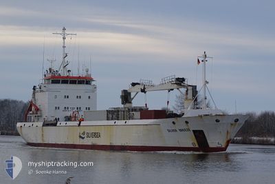
SILVER BREEZE
Reefer
Current Trip
| Time Travelled | 4 days |
|---|---|
| Remaining Time | 17 h, 12 mins |
| Distance Travelled | 1445.85 nm |
| Remaining Distance | 197.61 nm |
| AVG Speed | 12.4 Knopen |
| MAX Speed | 19.1 Knopen |
| AVG Wind | 17.6 knots |
| MAX Wind | 23 knots |
| MIN Temp | 8.9°C / 48.02°F |
| MAX Temp | 16.4°C / 61.52°F |
| Diepgang | 4.8 M |
| Positie ontvangen | 1 m geleden |
Current Position
| Lengtegraad | 28.45730° |
|---|---|
| Breedtegraat | 71.45770° |
| Status | Under way using engine |
| Snelheid | 11.6 Knopen |
| Koers | 104.3° |
| Gebied | Barentsz Sea |
| Station | T-AIS |
| Positie ontvangen | 1 m geleden |
Info
Information
The current position of SILVER BREEZE is in Barentsz Sea with coordinates 71.45770° / 28.45730° as reported on 2024-07-06 01:31 by AIS to our vessel tracker app. The vessel's current speed is 11.6 Knopen and is heading at the port of MURMANSK. The estimated time of arrival as calculated by MyShipTracking vessel tracking app is 2024-07-06 18:44 LT
The vessel SILVER BREEZE (IMO: 9140932, MMSI: 257962000) is a Reefer that was built in 1997 ( 27 Jaar oud ). It's sailing under the flag of [NO] Norway.
In this page you can find informations about the vessels current position, last detected port calls, and current voyage information. If the vessels is not in coverage by AIS you will find the latest position.
The current position of SILVER BREEZE is detected by our AIS receivers and we are not responsible for the reliability of the data. The last position was recorded while the vessel was in Coverage by the Ais receivers of our vessel tracking app.
The current draught of SILVER BREEZE as reported by AIS is 4.8 meters
Weather
| Temperature | 9.2°C / 48.56°F |
|---|---|
| Wind Speed | 15 knots |
| Direction | 111° ESE |
| Pressure | 994.2 hPa |
| Humidity | 99.5 % |
| Cloud Coverage | 100 % |
Featured Company
Last Port Calls
| Port | Arrival | Departure | Time In Port |
|---|---|---|---|
| 2024-06-27 10:48 | 2024-07-01 16:02 | 4 d | |
| 2024-06-27 09:16 | 2024-06-27 10:28 | 1 h | |
| 2024-06-11 07:38 | 2024-06-22 01:52 | 10 d | |
| 2024-05-30 14:50 | 2024-06-03 07:53 | 3 d | |
| 2024-05-23 06:57 | 2024-05-26 03:45 | 2 d | |
| 2024-05-14 07:14 | 2024-05-14 17:14 | 10 h | |
| 2024-05-09 17:47 | 2024-05-11 13:14 | 1 d |
Most Visited Ports (Last year)
| Port | Arrivals | |
|---|---|---|
| 9 | ||
| 5 | ||
| 4 | ||
| 3 | ||
| 2 | ||
| 2 |
Last Trips
| Origin | Departure | Destination | Arrival | Distance | |
|---|---|---|---|---|---|
| 2024-06-27 12:28 | 2024-06-27 12:48 | 1.21 nm | |||
| 2024-06-22 04:52 | 2024-06-27 11:16 | 1657.06 nm | |||
| 2024-06-03 10:53 | 2024-06-11 10:38 | 2306.17 nm | |||
| 2024-05-26 04:45 | 2024-05-30 17:50 | 1469.59 nm | |||
| 2024-05-14 18:14 | 2024-05-23 07:57 | 61.07 nm | |||
| 2024-05-11 14:14 | 2024-05-14 08:14 | 23.90 nm | |||
| 2024-04-29 19:48 | 2024-05-09 18:47 | 1502.60 nm |
Events
| Tijd | Evenement | Details | Positie / Bestemming | Info |
|---|---|---|---|---|
| 2024-07-05 19:15 | Wijzig zee gebeid | Norwegian part of the Barentsz Sea Norwegian part of the Norwegian Sea |
71.60517 / 24.83647
Barentsz Sea
MURMANSK
|
Snelheid: 10.2 kn Koers: 87.5° |
| 2024-07-05 16:00 | ETA Changed | 2024/07/06 18:30 2024/07/06 13:00 |
71.49218 / 23.04691
MURMANSK
|
Snelheid: 10.8 kn Koers: 80° |
| 2024-07-05 06:47 | Status Changed | Under way using engine Default |
70.53731 / 17.51728
MURMANSK
|
Snelheid: 14.2 kn Koers: 44° |
| 2024-07-05 06:37 | Status Changed | Default Under way using engine |
70.50781 / 17.43265
MURMANSK
|
Snelheid: 14.6 kn Koers: 44.3° |
| 2024-07-05 06:06 | Draught Changed | 4.8 5 |
70.42040 / 17.18034
MURMANSK
|
Snelheid: 12.9 kn Koers: 43.6° |
| 2024-07-05 06:06 | Destination Changed | MURMANSK TROMSO |
70.42040 / 17.18034
MURMANSK
|
Snelheid: 12.9 kn Koers: 43.6° |
| 2024-07-05 06:00 | ETA Changed | 2024/07/06 13:00 2024/07/06 18:00 |
70.40524 / 17.13360
TROMSO
|
Snelheid: 12.5 kn Koers: 47.2° |
| 2024-07-04 07:27 | Status Changed | Under way using engine Default |
66.33023 / 7.85940
TROMSO
|
Snelheid: 14.2 kn Koers: 21° |
| 2024-07-04 07:03 | Status Changed | Default Under way using engine |
66.24242 / 7.76795
TROMSO
|
Snelheid: 14.2 kn Koers: 21.5° |
| 2024-07-04 06:42 | Status Changed | Under way using engine Default |
66.16504 / 7.69290
TROMSO
|
Snelheid: 14.5 kn Koers: 20° |