
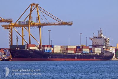
SHIBA
Container Ship
Current Trip
| Trip Time | 10 h, 59 mins |
|---|---|
| Trip Distance | 115.68 nm |
| AVG Speed | 11.4 Knots |
| MAX Speed | 12.7 Knots |
| Draught | 10.3 m |
| AVG Wind | 15 knots |
| MAX Wind | 17.6 knots |
| MIN Temp | 15.2°C / 59.36°F |
| MAX Temp | 17.3°C / 63.14°F |
| Position Received | 2025-01-10 11:27 |
Current Position
| Longitude | --- |
|---|---|
| Latitude | --- |
| Status | Under way using engine |
| Speed | 12.4 Knots |
| Course | 221.1° |
| Area | Mediterranean Sea - Eastern Basin |
| Station | T-AIS |
| Position Received | 2025-01-10 11:27 |
Info
Information
The current position of SHIBA is in Mediterranean Sea - Eastern Basin with coordinates 35.15459° / 22.78264° as reported on 2025-01-10 11:27 by AIS to our vessel tracker app. The vessel's current speed is 12.4 Knots and is currently inside the port of TRIPOLI.
The vessel SHIBA (IMO: 9270646, MMSI: 422027500) is a Container Ship that was built in 2010 ( 15 years old ). It's sailing under the flag of [IR] Iran.
In this page you can find informations about the vessels current position, last detected port calls, and current voyage information. If the vessels is not in coverage by AIS you will find the latest position.
The current position of SHIBA is detected by our AIS receivers and we are not responsible for the reliability of the data. The last position was recorded while the vessel was in Coverage by the Ais receivers of our vessel tracking app.
The current draught of SHIBA as reported by AIS is 10.3 meters
Weather
| Temperature | 16.5°C / 61.7°F |
|---|---|
| Wind Speed | 11 knots |
| Direction | 85° E |
| Pressure | 1014.9 hPa |
| Humidity | 57.2 % |
| Cloud Coverage | 100 % |
Featured Company
Last Port Calls
| Port | Arrival | Departure | Time In Port |
|---|---|---|---|
| 2025-02-16 12:01 | |||
| 2025-02-13 03:59 | 2025-02-16 01:02 | 2 d | |
| 2025-02-05 20:13 | 2025-02-12 07:57 | 6 d | |
| 2025-01-07 06:51 | 2025-01-08 19:23 | 1 d | |
| 2025-01-07 06:37 | 2025-01-07 06:43 | 6 m | |
| 2025-01-02 04:31 | 2025-01-02 13:45 | 9 h | |
| 2024-12-19 21:27 | 2024-12-22 00:50 | 2 d | |
| 2024-12-11 01:36 | 2024-12-12 12:27 | 1 d | |
| 2024-12-10 05:27 | |||
| 2024-12-06 10:52 | 2024-12-06 23:36 | 12 h |
Last Trips
| Origin | Departure | Destination | Arrival | Distance | |
|---|---|---|---|---|---|
| 2025-02-16 03:02 | 2025-02-16 14:01 | 115.68 nm | |||
| 2025-02-12 09:57 | 2025-02-13 05:59 | 246.58 nm | |||
| 2025-01-08 22:23 | 2025-02-05 22:13 | 766.71 nm | |||
| 2025-01-07 09:43 | 2025-01-07 09:51 | 0.28 nm | |||
| 2024-12-22 04:20 | 2025-01-07 09:37 | 3770.45 nm | |||
| 2024-12-22 04:20 | 2025-01-02 06:31 | 2808.34 nm | |||
| 2024-12-12 15:57 | 2024-12-20 00:57 | 310.41 nm | |||
| 2024-12-07 05:06 | 2024-12-10 08:57 | 810.22 nm | |||
| 2024-12-05 02:25 | 2024-12-06 16:22 | 462.44 nm | |||
| 2024-11-29 13:02 | 2024-12-03 00:26 | 831.85 nm |
Events
| Time | Event | Details | Position / Dest | Info |
|---|---|---|---|---|
| 2025-02-16 12:31 | STOP Moving |
32.90656 / 13.19200
[LY] TRIPOLI
|
Speed: Course: 292° |
|
| 2025-02-16 12:01 | PORT ARRIVAL |
|
32.91118 / 13.20522
[LY] TRIPOLI
|
Speed: 10.6 kn Course: 176° |
| 2025-02-16 01:02 | PORT DEPARTURE |
|
32.40122 / 15.25178
BENGHAZI
|
Speed: 6 kn Course: 80° |
| 2025-02-16 00:53 | START Moving |
32.37138 / 15.22306
[LY] MISURATA
|
Speed: 6 kn Course: 80° |
|
| 2025-02-13 04:55 | STOP Moving |
32.36182 / 15.21704
[LY] MISURATA
|
Speed: Course: 90° |
|
| 2025-02-13 03:59 | PORT ARRIVAL |
|
32.37191 / 15.22778
[LY] MISURATA
|
Speed: 4.5 kn Course: 237° |
| 2025-02-12 08:07 | START Moving | 1.14 nm, North West of BENGHAZI |
32.11297 / 20.02048
BENGHAZI
|
Speed: 8.6 kn Course: 265° |
| 2025-02-12 07:57 | PORT DEPARTURE |
|
32.11297 / 20.02048
BENGHAZI
|
Speed: Course: 131° |