

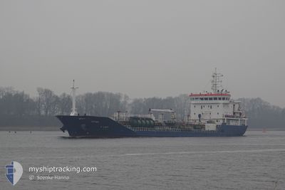
M/T SEYMA
Oil/Chemical Tanker

Current Trip
Unknown
| Time Travelled | 2 days |
|---|---|
| Remaining Time | --- |
| Distance Travelled | 362.67 nm |
| Remaining Distance | --- |
| AVG Speed | 9.6 Knots |
| MAX Speed | 11.2 Knots |
| AVG Wind | 10 knots |
| MAX Wind | 27.8 knots |
| MIN Temp | 11.2°C / 52.16°F |
| MAX Temp | 16.5°C / 61.7°F |
| Draught | 4.8 m |
| Position Received | 1 m ago |
Current Position
| Longitude | --- |
|---|---|
| Latitude | --- |
| Status | At anchor |
| Speed | |
| Course | 261° |
| Area | Sea of Marmara |
| Station | T-AIS |
| Position Received | 1 m ago |
Information
The current position of M/T SEYMA is in Sea of Marmara with coordinates 40.95978° / 28.74107° as reported on 2025-03-25 23:31 by AIS to our vessel tracker app. The vessel's current speed is 0 Knots
The vessel M/T SEYMA (IMO: 9596777, MMSI: 229546000) is a Oil/Chemical Tanker that was built in 2013 ( 12 years old ). It's sailing under the flag of [MT] Malta.
In this page you can find informations about the vessels current position, last detected port calls, and current voyage information. If the vessels is not in coverage by AIS you will find the latest position.
The current position of M/T SEYMA is detected by our AIS receivers and we are not responsible for the reliability of the data. The last position was recorded while the vessel was in Coverage by the Ais receivers of our vessel tracking app.
The current draught of M/T SEYMA as reported by AIS is 4.8 meters
Weather
| Temperature | 12.3°C / 54.14°F |
|---|---|
| Wind Speed | 5 knots |
| Direction | 201° SSW |
| Pressure | 1018.8 hPa |
| Humidity | 77.2 % |
| Cloud Coverage | 100 % |


Featured Company
Last Port Calls
| Port | Arrival | Departure | Time In Port |
|---|---|---|---|
| 2025-03-21 17:42 | 2025-03-23 21:07 | 2 d | |
| 2025-03-08 13:24 | 2025-03-08 13:55 | 31 m | |
| 2025-03-06 00:26 | 2025-03-08 12:27 | 2 d | |
| 2025-03-05 23:12 | 2025-03-05 23:45 | 33 m | |
| 2025-02-26 08:58 | 2025-02-26 09:32 | 34 m | |
| 2025-02-24 09:41 | 2025-02-26 08:02 | 1 d | |
| 2025-02-24 08:34 | 2025-02-24 09:18 | 43 m | |
| 2025-02-18 12:39 | 2025-02-18 13:22 | 42 m | |
| 2025-02-13 00:55 | 2025-02-18 12:12 | 5 d | |
| 2025-02-12 23:52 | 2025-02-13 00:31 | 38 m |
Last Trips
| Origin | Departure | Destination | Arrival | Distance | |
|---|---|---|---|---|---|
| 2025-03-08 13:55 | 2025-03-21 17:42 | 2990.68 nm | |||
| 2025-03-08 12:27 | 2025-03-08 13:24 | 6.32 nm | |||
| 2025-03-05 23:45 | 2025-03-06 00:26 | 5.34 nm | |||
| 2025-02-26 09:32 | 2025-03-05 23:12 | 787.75 nm | |||
| 2025-02-26 08:02 | 2025-02-26 08:58 | 2.20 nm | |||
| 2025-02-24 09:18 | 2025-02-24 09:41 | 1.93 nm | |||
| 2025-02-18 13:22 | 2025-02-24 08:34 | 110.53 nm | |||
| 2025-02-18 12:12 | 2025-02-18 12:39 | 1.88 nm | |||
| 2025-02-13 00:31 | 2025-02-13 00:55 | 1.33 nm | |||
| 2025-02-09 10:12 | 2025-02-12 23:52 | 711.25 nm |
Events
| Time | Event | Details | Position / Dest | Info |
|---|---|---|---|---|
| 2025-03-25 23:13 | Status Changed | At anchor Moored |
40.95986 / 28.74101
|
Speed: Course: 257° |
| 2025-03-25 23:07 | Status Changed | Moored At anchor |
40.95984 / 28.74110
|
Speed: Course: 257° |
| 2025-03-25 22:48 | Draught Changed | 4.8 0 |
40.95994 / 28.74112
|
Speed: Course: 253° |
| 2025-03-25 22:47 | Status Changed | At anchor Default |
40.95994 / 28.74112
|
Speed: Course: 245° |
| 2025-03-25 22:29 | Status Changed | Default At anchor |
40.96006 / 28.74104
|
Speed: Course: 248° |
| 2025-03-25 21:59 | Status Changed | At anchor Default |
40.96005 / 28.74107
|
Speed: Course: 246° |
| 2025-03-25 21:57 | Draught Changed | 0 4.8 |
40.96008 / 28.74107
|
Speed: Course: 245° |
| 2025-03-25 21:26 | IN Coverage |
40.96026 / 28.74096
Sea of Marmara
|
Speed: Course: 290.3° |
|
| 2025-03-25 09:40 | STOP Moving | 2.96 nm, East of AMBARLI |
40.96057 / 28.73941
TR IST
|
Speed: Course: 178° |
| 2025-03-25 08:36 | OUT of Coverage |
40.85224 / 28.72259
Sea of Marmara
TR IST
|
Speed: 10.3 kn Course: 71.2° |