

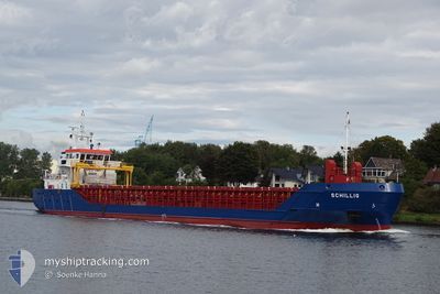
SCHILLIG
General Cargo

Current Trip
| Time Travelled | 10 h, 11 mins |
|---|---|
| Remaining Time | 1 day |
| Distance Travelled | 93.62 nm |
| Remaining Distance | 268.71 nm |
| AVG Speed | 8.9 Knots |
| MAX Speed | 9.8 Knots |
| AVG Wind | 14.1 knots |
| MAX Wind | 16 knots |
| MIN Temp | 5.2°C / 41.36°F |
| MAX Temp | 7.7°C / 45.86°F |
| Draught | 5.5 m |
| Position Received | 1 m ago |
Current Position
| Longitude | --- |
|---|---|
| Latitude | --- |
| Status | Under way using engine |
| Speed | 9.4 Knots |
| Course | 8.4° |
| Area | Kattegat |
| Station | T-AIS |
| Position Received | 1 m ago |
Information
The current position of SCHILLIG is in Kattegat with coordinates 55.73137° / 12.69270° as reported on 2025-03-26 02:17 by AIS to our vessel tracker app. The vessel's current speed is 9.4 Knots and is heading at the port of OSLO. The estimated time of arrival as calculated by MyShipTracking vessel tracking app is 2025-03-27 09:30 LT
The vessel SCHILLIG (IMO: 9505405, MMSI: 236111817) is a General Cargo that was built in 2012 ( 13 years old ). It's sailing under the flag of [GI] Gibraltar.
In this page you can find informations about the vessels current position, last detected port calls, and current voyage information. If the vessels is not in coverage by AIS you will find the latest position.
The current position of SCHILLIG is detected by our AIS receivers and we are not responsible for the reliability of the data. The last position was recorded while the vessel was in Coverage by the Ais receivers of our vessel tracking app.
The current draught of SCHILLIG as reported by AIS is 5.5 meters
Weather
| Temperature | 6°C / 42.8°F |
|---|---|
| Wind Speed | 10 knots |
| Direction | 288° WNW |
| Pressure | 1012.7 hPa |
| Humidity | 87 % |
| Cloud Coverage | 100 % |


Featured Company
Last Port Calls
| Port | Arrival | Departure | Time In Port |
|---|---|---|---|
| 2025-03-22 12:25 | 2025-03-25 17:07 | 3 d | |
| 2025-03-20 06:52 | 2025-03-20 21:05 | 14 h | |
| 2025-03-16 09:05 | 2025-03-18 16:13 | 2 d | |
| 2025-03-13 09:53 | 2025-03-14 22:11 | 1 d | |
| 2025-03-09 13:39 | 2025-03-11 17:17 | 2 d | |
| 2025-03-07 11:28 | 2025-03-08 16:13 | 1 d | |
| 2025-02-25 19:31 | 2025-02-27 22:24 | 2 d | |
| 2025-02-23 19:39 | 2025-02-25 09:19 | 1 d | |
| 2025-02-18 12:24 | 2025-02-19 03:35 | 15 h | |
| 2025-02-17 13:08 | 2025-02-17 23:21 | 10 h |
Last Trips
| Origin | Departure | Destination | Arrival | Distance | |
|---|---|---|---|---|---|
| 2025-03-20 21:05 | 2025-03-22 12:25 | 366.48 nm | |||
| 2025-03-18 16:13 | 2025-03-20 06:52 | 369.70 nm | |||
| 2025-03-14 22:11 | 2025-03-16 09:05 | 366.10 nm | |||
| 2025-03-11 17:17 | 2025-03-13 09:53 | 368.90 nm | |||
| 2025-03-08 16:13 | 2025-03-09 13:39 | 220.40 nm | |||
| 2025-02-27 22:24 | 2025-03-07 11:28 | 1491.20 nm | |||
| 2025-02-25 09:19 | 2025-02-25 19:31 | 105.28 nm | |||
| 2025-02-19 03:35 | 2025-02-23 19:39 | 878.64 nm | |||
| 2025-02-17 23:21 | 2025-02-18 12:24 | 104.07 nm | |||
| 2025-02-14 22:21 | 2025-02-17 13:08 | 572.35 nm |
Events
| Time | Event | Details | Position / Dest | Info |
|---|---|---|---|---|
| 2025-03-26 00:37 | Change Sea Area | Danish part of the Kattegat Swedish part of the Kattegat |
55.49207 / 12.70951
Kattegat
NOOSL
|
Speed: 9 kn Course: 4.5° |
| 2025-03-25 23:37 | Change Sea Area | Swedish part of the Kattegat Swedish part of the Baltic Sea |
55.33624 / 12.67564
Kattegat
NOOSL
|
Speed: 9.4 kn Course: 7.1° |
| 2025-03-25 20:30 | Detected in Sea | Swedish part of the Baltic Sea |
55.02354 / 13.29591
Baltic Sea
NOOSL
|
Speed: 9.2 kn Course: 323.6° |
| 2025-03-25 19:58 | Status Changed | Under way using engine Default |
54.95814 / 13.37923
NOOSL
|
Speed: 9.3 kn Course: 324° |
| 2025-03-25 19:46 | IN Coverage |
54.95885 / 13.37833
Baltic Sea
NOOSL
|
Speed: 9.3 kn Course: 323.4° |
|
| 2025-03-25 18:58 | Status Changed | Default Under way using engine |
54.82428 / 13.52263
NOOSL
|
Speed: 9.2 kn Course: 330.8° |
| 2025-03-25 18:52 | OUT of Coverage |
54.81194 / 13.53475
Baltic Sea
NOOSL
|
Speed: 9.2 kn Course: 330.8° |
|
| 2025-03-25 18:19 | Status Changed | Under way using engine Default |
54.73779 / 13.60504
NOOSL
|
Speed: 9.4 kn Course: 331° |
| 2025-03-25 18:18 | Status Changed | Default Under way using engine |
54.73391 / 13.60859
NOOSL
|
Speed: 9.4 kn Course: 331.5° |
| 2025-03-25 17:39 | Status Changed | Under way using engine Default |
54.64144 / 13.69342
NOOSL
|
Speed: 9.5 kn Course: 330° |