

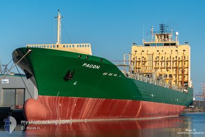
SC MARIGOT
Container Ship

Current Trip
MXVER
| Time Travelled | 1 day |
|---|---|
| Remaining Time | --- |
| Distance Travelled | 290.72 nm |
| Remaining Distance | --- |
| AVG Speed | 11.6 Knots |
| MAX Speed | 14 Knots |
| AVG Wind | 14.6 knots |
| MAX Wind | 24.3 knots |
| MIN Temp | 24.6°C / 76.28°F |
| MAX Temp | 25.8°C / 78.44°F |
| Draught | 8.4 m |
| Position Received | 2 d ago |
Current Position
| Longitude | --- |
|---|---|
| Latitude | --- |
| Status | Under way using engine |
| Speed | 14.2 Knots |
| Course | 104.1° |
| Area | Gulf of Mexico |
| Station | T-AIS |
| Position Received | 2 d ago |
Information
The current position of SC MARIGOT is in Gulf of Mexico with coordinates 22.42314° / -97.49366° as reported on 2025-03-25 14:59 by AIS to our vessel tracker app. The vessel's current speed is 14.2 Knots
The vessel SC MARIGOT (IMO: 9275115, MMSI: 636020666) is a Container Ship that was built in 2005 ( 20 years old ). It's sailing under the flag of [LR] Liberia.
In this page you can find informations about the vessels current position, last detected port calls, and current voyage information. If the vessels is not in coverage by AIS you will find the latest position.
The current position of SC MARIGOT is detected by our AIS receivers and we are not responsible for the reliability of the data. The last position was recorded while the vessel was in Coverage by the Ais receivers of our vessel tracking app.
The current draught of SC MARIGOT as reported by AIS is 8.4 meters
Weather
| Temperature | 25.1°C / 77.18°F |
|---|---|
| Wind Speed | 28 knots |
| Direction | 77° ENE |
| Pressure | 1013.7 hPa |
| Humidity | 84.4 % |
| Cloud Coverage | 3 % |


Featured Company
Last Port Calls
| Port | Arrival | Departure | Time In Port |
|---|---|---|---|
| 2025-03-26 00:50 | 2025-03-26 18:25 | 17 h | |
| 2025-03-24 18:01 | 2025-03-25 07:32 | 13 h | |
| 2025-03-18 05:24 | 2025-03-19 04:28 | 23 h | |
| 2025-03-15 11:40 | 2025-03-16 07:42 | 20 h | |
| 2025-03-12 22:32 | 2025-03-14 10:54 | 1 d | |
| 2025-03-09 17:56 | 2025-03-11 15:56 | 1 d | |
| 2025-03-05 00:02 | 2025-03-05 20:38 | 20 h | |
| 2025-03-03 18:42 | 2025-03-04 07:00 | 12 h | |
| 2025-02-25 09:19 | 2025-02-27 01:51 | 1 d | |
| 2025-02-22 11:07 | 2025-02-22 19:55 | 8 h |
Most Visited Ports (Last year)
| Port | Arrivals | |
|---|---|---|
| 29 | ||
| 17 | ||
| 16 | ||
| 14 | ||
| 14 | ||
| 10 |
Last Trips
| Origin | Departure | Destination | Arrival | Distance | |
|---|---|---|---|---|---|
| 2025-03-25 07:32 | 2025-03-26 00:50 | 238.23 nm | |||
| 2025-03-19 04:28 | 2025-03-24 18:01 | 1275.96 nm | |||
| 2025-03-16 07:42 | 2025-03-18 05:24 | 642.14 nm | |||
| 2025-03-14 10:54 | 2025-03-15 11:40 | 245.07 nm | |||
| 2025-03-11 15:56 | 2025-03-12 22:32 | 414.69 nm | |||
| 2025-03-05 20:38 | 2025-03-09 17:56 | 1218.40 nm | |||
| 2025-03-04 07:00 | 2025-03-05 00:02 | 239.59 nm | |||
| 2025-02-27 01:51 | 2025-03-03 18:42 | 1279.06 nm | |||
| 2025-02-22 19:55 | 2025-02-25 09:19 | 5.25 nm | |||
| 2025-02-20 10:38 | 2025-02-22 11:07 | 638.99 nm |
Events
| Time | Event | Details | Position / Dest | Info |
|---|---|---|---|---|
| 2025-03-27 03:10 | START Moving |
19.25896 / -95.58768
MXVER
|
Speed: 11.2 kn Course: 70° |
|
| 2025-03-27 02:55 | STOP Moving |
19.24894 / -95.61845
MXVER
|
Speed: 0.1 kn Course: 70° |
|
| 2025-03-27 00:25 | PORT DEPARTURE |
|
19.20216 / -96.11815
MXVER
|
Speed: 3.9 kn Course: 109° |
| 2025-03-27 00:19 | START Moving |
19.20536 / -96.13106
[MX] VERACRUZ
|
Speed: 3.9 kn Course: 109° |
|
| 2025-03-26 07:27 | STOP Moving |
19.21008 / -96.14015
[MX] VERACRUZ
|
Speed: Course: 239° |
|
| 2025-03-26 06:50 | PORT ARRIVAL |
|
19.20350 / -96.12605
[MX] VERACRUZ
|
Speed: 9.3 kn Course: 281° |
| 2025-03-25 15:12 | Status Changed | Default Under way using engine |
22.40937 / -97.44083
MXVER
|
Speed: 14.2 kn Course: 104.1° |
| 2025-03-25 14:59 | OUT of Coverage |
22.42314 / -97.49366
Gulf of Mexico
MXVER
|
Speed: 14.2 kn Course: 104.1° |
|
| 2025-03-25 13:32 | PORT DEPARTURE |
|
22.48727 / -97.85671
MXVER
|
Speed: 8.5 kn Course: 89° |
| 2025-03-25 13:11 | START Moving |
22.47850 / -97.88651
[MX] ALTAMIRA
|
Speed: 3.1 kn Course: 348° |