
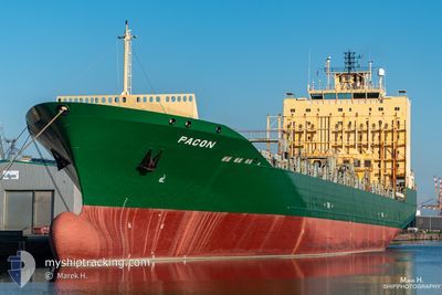
SC MARIGOT
Container Ship
Current Trip
| Trip Time | 7 days |
|---|---|
| Trip Distance | 1224.13 nm |
| AVG Speed | 9.8 Knop |
| MAX Speed | 16.2 Knop |
| Djupgående | 9.6 m |
| AVG Wind | 15.4 knots |
| MAX Wind | 25.9 knots |
| MIN Temp | 21.2°C / 70.16°F |
| MAX Temp | 28°C / 82.4°F |
| Position mottagen | 2 d sen |
Current Position
| Longitud | -89.69606° |
|---|---|
| Latitude | 21.54692° |
| Status | At anchor |
| Fart | 0.4 Knop |
| Kurs | 77° |
| Område | Gulf of Mexico |
| Station | T-AIS |
| Position mottagen | 2 d sen |
Info
Information
The current position of SC MARIGOT is in Gulf of Mexico with coordinates 21.54692° / -89.69606° as reported on 2024-04-17 05:01 by AIS to our vessel tracker app. The vessel's current speed is 0.4 Knop and is currently inside the port of PROGRESO.
The vessel SC MARIGOT (IMO: 9275115, MMSI: 636020666) is a Container Ship that was built in 2005 ( 19 År gammal ). It's sailing under the flag of [LR] Liberia.
In this page you can find informations about the vessels current position, last detected port calls, and current voyage information. If the vessels is not in coverage by AIS you will find the latest position.
The current position of SC MARIGOT is detected by our AIS receivers and we are not responsible for the reliability of the data. The last position was recorded while the vessel was in Coverage by the Ais receivers of our vessel tracking app.
The current draught of SC MARIGOT as reported by AIS is 9.6 meters
Weather
| Temperature | 26.1°C / 78.98°F |
|---|---|
| Wind Speed | 10 knots |
| Direction | 103° ESE |
| Pressure | 1013 hPa |
| Humidity | 68.6 % |
| Cloud Coverage | --- |
Featured Company
Last Port Calls
| Port | Arrival | Departure | Time In Port |
|---|---|---|---|
| 2024-04-18 13:11 | |||
| 2024-04-10 19:53 | 2024-04-11 08:13 | 12 h | |
| 2024-04-09 11:51 | 2024-04-10 04:47 | 16 h | |
| 2024-04-05 11:31 | 2024-04-06 07:07 | 19 h | |
| 2024-03-31 17:26 | 2024-04-01 04:56 | 11 h | |
| 2024-03-30 05:15 | 2024-03-30 22:51 | 17 h | |
| 2024-03-27 21:40 | 2024-03-28 22:29 | 1 d | |
| 2024-03-21 11:53 | 2024-03-22 19:28 | 1 d | |
| 2024-03-19 00:43 | |||
| 2024-03-13 04:37 | 2024-03-13 17:52 | 13 h |
Most Visited Ports (Last year)
| Port | Arrivals | |
|---|---|---|
| 17 | ||
| 16 | ||
| 16 | ||
| 16 | ||
| 15 | ||
| 15 |
Last Trips
| Origin | Departure | Destination | Arrival | Distance | |
|---|---|---|---|---|---|
| 2024-04-11 04:13 | 2024-04-18 08:11 | 1224.13 nm | |||
| 2024-04-10 00:47 | 2024-04-10 15:53 | 220.18 nm | |||
| 2024-04-06 02:07 | 2024-04-09 07:51 | 643.32 nm | |||
| 2024-03-31 22:56 | 2024-04-05 06:31 | 1270.01 nm | |||
| 2024-03-30 16:51 | 2024-03-31 11:26 | 245.11 nm | |||
| 2024-03-28 16:29 | 2024-03-29 23:15 | 393.40 nm | |||
| 2024-03-22 15:28 | 2024-03-27 15:40 | 1500.25 nm | |||
| 2024-03-18 19:43 | 2024-03-21 07:53 | 746.91 nm | |||
| 2024-03-11 10:35 | 2024-03-12 22:37 | 245.20 nm | |||
| 2024-03-04 02:42 | 2024-03-09 07:29 | 1585.65 nm |
Events
| Tid | Event | Detaljer | Position / Dest | Information |
|---|---|---|---|---|
| 2024-04-18 13:39 | STOPPAR förflyttning |
21.34469 / -89.67779
[MX] PROGRESO
|
Fart: Kurs: 267° |
|
| 2024-04-18 13:11 | ANLÄNDER HAMN |
|
21.34469 / -89.67779
[MX] PROGRESO
|
Fart: 9.3 kn Kurs: 181° |
| 2024-04-18 12:02 | STARTAR förflyttning | 12.88 nm, North of PROGRESO |
21.53711 / -89.69800
DOCAO
|
Fart: 4.6 kn Kurs: 180° |
| 2024-04-17 05:04 | Status ändrad | Default At anchor |
21.54715 / -89.69602
DOCAO
|
Fart: 0.4 kn Kurs: 77° |
| 2024-04-17 05:01 | UTANFÖR täckningsområde |
21.54692 / -89.69606
Gulf of Mexico
|
Fart: 0.4 kn Kurs: 31.5° |
|
| 2024-04-17 04:58 | Status ändrad | At anchor Default |
21.54666 / -89.69604
DOCAO
|
Fart: 0.7 kn Kurs: 81° |
| 2024-04-17 04:52 | I täckningsområde |
21.54666 / -89.69604
Gulf of Mexico
|
Fart: 0.6 kn Kurs: 197.9° |
|
| 2024-04-16 19:30 | Status ändrad | Default At anchor |
21.54858 / -89.69192
DOCAO
|
Fart: 0.7 kn Kurs: 78° |
| 2024-04-16 19:17 | Upptäckt i hav | Mexican part of the Gulf of Mexico |
21.54881 / -89.69039
Gulf of Mexico
|
Fart: 0.7 kn Kurs: 176.1° |
| 2024-04-16 19:17 | UTANFÖR täckningsområde |
21.54881 / -89.69039
Gulf of Mexico
|
Fart: 0.7 kn Kurs: 176.1° |