
SC CONNECTOR
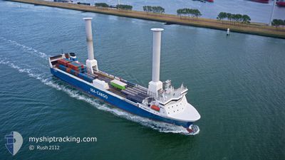
Ro-Ro Cargo
Current Trip
Current Position
| Longitude | --- |
|---|---|
| Latitude | --- |
| Status | Under way using engine |
| Speed | 0.4 Knots |
| Course | 345° |
| Area | North Sea |
| Station | T-AIS |
| Position Received | 1 m ago |
Info
Information
The current position of SC CONNECTOR is in North Sea with coordinates 58.91974° / 5.58438° as reported on 2025-12-05 21:41 by AIS to our vessel tracker app. The vessel's current speed is 0.4 Knots and is currently inside the port of TANANGER.
The vessel SC CONNECTOR (IMO: 9131993, MMSI: 256149000) is a Ro-Ro Cargo that was built in 1997 ( 28 years old ). It's sailing under the flag of [MT] Malta.
In this page you can find informations about the vessels current position, last detected port calls, and current voyage information. If the vessels is not in coverage by AIS you will find the latest position.
The current position of SC CONNECTOR is detected by our AIS receivers and we are not responsible for the reliability of the data. The last position was recorded while the vessel was in Coverage by the Ais receivers of our vessel tracking app.
The current draught of SC CONNECTOR as reported by AIS is 5.7 meters
Weather
| Temperature | 6.7°C / 44.06°F |
|---|---|
| Wind Speed | 20 knots |
| Direction | 133° SE |
| Pressure | 1008.7 hPa |
| Humidity | 89.9 % |
| Cloud Coverage | 100 % |
Featured Company
Last Port Calls
| Port | Arrival | Departure | Time In Port |
|---|---|---|---|
| 2025-12-05 22:23 | |||
| 2025-12-05 18:21 | 2025-12-05 19:59 | 1 h | |
| 2025-12-05 15:50 | 2025-12-05 18:09 | 2 h | |
| 2025-12-05 07:29 | 2025-12-05 10:58 | 3 h | |
| 2025-12-04 21:12 | 2025-12-04 23:47 | 2 h | |
| 2025-12-04 14:23 | 2025-12-04 15:43 | 1 h | |
| 2025-12-04 09:39 | 2025-12-04 12:15 | 2 h | |
| 2025-12-02 10:35 | 2025-12-02 15:47 | 5 h | |
| 2025-12-02 08:08 | 2025-12-02 10:35 | 2 h | |
| 2025-12-01 07:40 | 2025-12-01 15:16 | 7 h |
Last Trips
| Origin | Departure | Destination | Arrival | Distance | |
|---|---|---|---|---|---|
| 2025-12-05 19:59 | 2025-12-05 22:23 | 27.73 nm | |||
| 2025-12-05 18:09 | 2025-12-05 18:21 | 1.41 nm | |||
| 2025-12-05 10:58 | 2025-12-05 15:50 | 41.69 nm | |||
| 2025-12-04 23:47 | 2025-12-05 07:29 | 51.22 nm | |||
| 2025-12-04 15:43 | 2025-12-04 21:12 | 76.72 nm | |||
| 2025-12-04 12:15 | 2025-12-04 14:23 | 27.60 nm | |||
| 2025-12-02 15:47 | 2025-12-04 09:39 | 449.90 nm | |||
| 2025-12-01 15:16 | 2025-12-02 10:35 | 202.70 nm | |||
| 2025-12-01 15:16 | 2025-12-02 08:08 | 201.97 nm | |||
| 2025-11-29 17:19 | 2025-12-01 07:40 | 403.29 nm |
Events
| Time | Event | Details | Position / Dest | Info |
|---|---|---|---|---|
| 2025-12-05 21:33 | STOP Moving |
58.92295 / 5.58458
[NO] TANANGER
|
Speed: 0.3 kn Course: 334° |
|
| 2025-12-05 21:23 | PORT ARRIVAL |
|
58.92990 / 5.57249
[NO] TANANGER
|
Speed: 10.1 kn Course: 130.2° |
| 2025-12-05 19:05 | Draught Changed | 5.7 5.5 |
59.32029 / 5.32541
RISAVIKA
|
Speed: 10.8 kn Course: 165.1° |
| 2025-12-05 18:59 | START Moving | 0.44 nm, South East of HUSOYA |
59.33285 / 5.30839
RISAVIKA
|
Speed: 6.5 kn Course: 157° |
| 2025-12-05 18:59 | PORT DEPARTURE |
|
59.33285 / 5.30839
RISAVIKA
|
Speed: 4.8 kn Course: 171° |
| 2025-12-05 18:48 | Destination Changed | RISAVIKA HUSOY |
59.33709 / 5.30688
[NO] HUSOYA
|
Speed: Course: 183° |
| 2025-12-05 18:48 | ETA Changed | 2025/12/05 21:30 2025/12/05 18:00 |
59.33709 / 5.30688
[NO] HUSOYA
|
Speed: Course: 183° |
| 2025-12-05 17:22 | STOP Moving |
59.33486 / 5.30691
[NO] HUSOYA
|
Speed: 0.2 kn Course: 227° |
|
| 2025-12-05 17:21 | PORT ARRIVAL |
|
59.33504 / 5.30804
[NO] HUSOYA
|
Speed: 4.7 kn Course: 315° |
| 2025-12-05 17:09 | PORT DEPARTURE |
|
59.31547 / 5.32734
HUSOY
|
Speed: 3.5 kn Course: 52° |