
SARITA
Cargo
Current Trip
| Time Travelled | 18 days |
|---|---|
| Remaining Time | --- |
| Distance Travelled | 4844.15 nm |
| Remaining Distance | --- |
| AVG Speed | 11.2 Knots |
| MAX Speed | 14.6 Knots |
| AVG Wind | 10.5 knots |
| MAX Wind | 25.7 knots |
| MIN Temp | 14.8°C / 58.64°F |
| MAX Temp | 29.2°C / 84.56°F |
| Draught | 13.1 m |
| Position Received | 5 d ago |
Current Position
| Longitude | --- |
|---|---|
| Latitude | --- |
| Status | Under way using engine |
| Speed | 11.4 Knots |
| Course | 303.4° |
| Area | North Pacific Ocean |
| Station | T-AIS |
| Position Received | 5 d ago |
Information
The current position of SARITA is in North Pacific Ocean with coordinates 22.22519° / -110.12818° as reported on 2025-02-10 01:48 by AIS to our vessel tracker app. The vessel's current speed is 11.4 Knots and is heading at the port of LIANYUNGANG. The estimated time of arrival as calculated by MyShipTracking vessel tracking app is 2025-03-05 10:00 LT
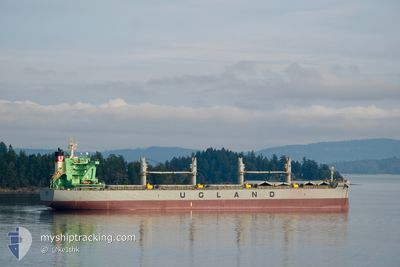
The vessel SARITA (IMO: 9836361, MMSI: 257088990) is a Cargo It's sailing under the flag of [NO] Norway.
In this page you can find informations about the vessels current position, last detected port calls, and current voyage information. If the vessels is not in coverage by AIS you will find the latest position.
The current position of SARITA is detected by our AIS receivers and we are not responsible for the reliability of the data. The last position was recorded while the vessel was in Coverage by the Ais receivers of our vessel tracking app.
The current draught of SARITA as reported by AIS is 13.1 meters
Weather
| Temperature | 18.6°C / 65.48°F |
|---|---|
| Wind Speed | 10 knots |
| Direction | 214° SW |
| Pressure | 1024.2 hPa |
| Humidity | 88.8 % |
| Cloud Coverage | 100 % |
Featured Company
Last Trips
| Origin | Departure | Destination | Arrival | Distance | |
|---|---|---|---|---|---|
| 2025-01-26 14:34 | 2025-01-27 07:29 | 146.02 nm | |||
| 2025-01-19 04:05 | 2025-01-24 09:58 | 783.70 nm | |||
| 2025-01-12 20:39 | 2025-01-16 05:12 | 387.56 nm | |||
| 2024-12-13 16:14 | 2025-01-04 06:30 | 4554.43 nm | |||
| 2024-11-08 10:07 | 2024-12-05 06:04 | 5791.03 nm |
Events
| Time | Event | Details | Position / Dest | Info |
|---|---|---|---|---|
| 2025-02-10 01:54 | Status Changed | Default Under way using engine |
22.23574 / -110.14603
CN LYG
|
Speed: 11.4 kn Course: 303.4° |
| 2025-02-10 01:48 | OUT of Coverage |
22.22519 / -110.12818
North Pacific Ocean
CN LYG
|
Speed: 11.4 kn Course: 303.4° |
|
| 2025-02-10 01:46 | Status Changed | Under way using engine Default |
22.22172 / -110.12243
CN LYG
|
Speed: 11.4 kn Course: 301° |
| 2025-02-10 01:24 | Status Changed | Default Under way using engine |
22.18491 / -110.05901
CN LYG
|
Speed: 11.3 kn Course: 302.5° |
| 2025-02-10 01:19 | Status Changed | Under way using engine Default |
22.17657 / -110.04484
CN LYG
|
Speed: 11.2 kn Course: 303° |
| 2025-02-10 01:12 | Status Changed | Default Under way using engine |
22.16449 / -110.02427
CN LYG
|
Speed: 11.3 kn Course: 303.9° |
| 2025-02-10 00:58 | Status Changed | Under way using engine Default |
22.13994 / -109.98340
CN LYG
|
Speed: 11.1 kn Course: 304° |
| 2025-02-10 00:58 | IN Coverage |
22.13994 / -109.98340
North Pacific Ocean
CN LYG
|
Speed: 11 kn Course: 302.8° |
|
| 2025-02-09 23:42 | Status Changed | Default Under way using engine |
22.00982 / -109.77266
CN LYG
|
Speed: 11 kn Course: 305.5° |
| 2025-02-09 23:28 | OUT of Coverage |
21.98413 / -109.73218
North Pacific Ocean
CN LYG
|
Speed: 11 kn Course: 305.5° |