

SARAH
Passenger

Current Trip
OOSTERDOK
| Time Travelled | 1 h, 28 mins |
|---|---|
| Remaining Time | --- |
| Distance Travelled | 4.82 nm |
| Remaining Distance | --- |
| AVG Speed | 4.4 Knots |
| MAX Speed | 6 Knots |
| AVG Wind | 4.9 knots |
| MAX Wind | 6 knots |
| MIN Temp | 11.8°C / 53.24°F |
| MAX Temp | 14.2°C / 57.56°F |
| Draught | 1.4 m |
| Position Received | 1 m ago |
Current Position
| Longitude | --- |
|---|---|
| Latitude | --- |
| Status | Under way using engine |
| Speed | 4.7 Knots |
| Course | 50.5° |
| Area | North Sea |
| Station | T-AIS |
| Position Received | 1 m ago |
Information
The current position of SARAH is in North Sea with coordinates 52.38275° / 4.90519° as reported on 2025-04-23 09:51 by AIS to our vessel tracker app. The vessel's current speed is 4.7 Knots
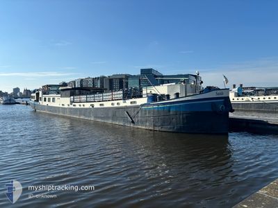
The vessel SARAH (MMSI: 244700491) is a Passenger It's sailing under the flag of [NL] Netherlands.
In this page you can find informations about the vessels current position, last detected port calls, and current voyage information. If the vessels is not in coverage by AIS you will find the latest position.
The current position of SARAH is detected by our AIS receivers and we are not responsible for the reliability of the data. The last position was recorded while the vessel was in Coverage by the Ais receivers of our vessel tracking app.
The current draught of SARAH as reported by AIS is 1.4 meters
Weather
| Temperature | 13.4°C / 56.12°F |
|---|---|
| Wind Speed | 6 knots |
| Direction | 95° E |
| Pressure | 1014.2 hPa |
| Humidity | 70.4 % |
| Cloud Coverage | 100 % |


Featured Company
Last Port Calls
| Port | Arrival | Departure | Time In Port |
|---|---|---|---|
| 2025-04-23 09:49 | 2025-04-23 10:24 | 34 m | |
| 2025-04-23 07:49 | 2025-04-23 08:55 | 1 h | |
| 2025-04-22 12:41 | 2025-04-23 07:25 | 18 h | |
| 2025-04-22 10:28 | 2025-04-22 11:12 | 43 m | |
| 2025-04-21 13:35 | 2025-04-22 09:28 | 19 h | |
| 2025-04-21 11:04 | 2025-04-21 12:01 | 56 m | |
| 2025-04-20 13:09 | 2025-04-21 10:01 | 20 h | |
| 2025-04-19 15:47 | 2025-04-19 16:07 | 19 m | |
| 2025-04-18 12:11 | 2025-04-19 14:41 | 1 d | |
| 2025-04-18 11:35 | 2025-04-18 12:11 | 35 m |
Last Trips
| Origin | Departure | Destination | Arrival | Distance | |
|---|---|---|---|---|---|
| 2025-04-23 08:55 | 2025-04-23 09:49 | 4.32 nm | |||
| 2025-04-23 07:25 | 2025-04-23 07:49 | 2.06 nm | |||
| 2025-04-22 11:12 | 2025-04-22 12:41 | 8.49 nm | |||
| 2025-04-22 09:28 | 2025-04-22 10:28 | 5.29 nm | |||
| 2025-04-21 12:01 | 2025-04-21 13:35 | 6.39 nm | |||
| 2025-04-21 10:01 | 2025-04-21 11:04 | 5.56 nm | |||
| 2025-04-19 16:07 | 2025-04-20 13:09 | 17.22 nm | |||
| 2025-04-19 14:41 | 2025-04-19 15:47 | 7.15 nm | |||
| 2025-04-18 10:43 | 2025-04-18 12:11 | 7.69 nm | |||
| 2025-04-18 10:43 | 2025-04-18 11:35 | 4.97 nm |
Events
| Time | Event | Details | Position / Dest | Info |
|---|---|---|---|---|
| 2025-04-23 08:25 | START Moving | 0.7 nm, North East of NIEUWE MEER |
52.33959 / 4.84683
OOSTERDOK
|
Speed: 3.2 kn Course: 357.3° |
| 2025-04-23 08:24 | PORT DEPARTURE |
|
52.33933 / 4.84683
OOSTERDOK
|
Speed: 2.7 kn Course: 511° |
| 2025-04-23 08:02 | STOP Moving |
52.33584 / 4.84682
[NL] NIEUWE MEER
|
Speed: 0.3 kn Course: 511° |
|
| 2025-04-23 07:49 | PORT ARRIVAL |
|
52.33082 / 4.82145
[NL] NIEUWE MEER
|
Speed: 6.9 kn Course: 42.6° |
| 2025-04-23 07:07 | Status Changed | Under way using engine Default |
52.28053 / 4.77319
OOSTERDOK
|
Speed: 5.6 kn Course: 55° |
| 2025-04-23 07:02 | START Moving | 1.55 nm, North East of AALSMEER |
52.27594 / 4.76164
OOSTERDOK
|
Speed: 5.8 kn Course: -1° |
| 2025-04-23 07:02 | IN Coverage |
52.28376 / 4.78061
North Sea
|
Speed: 5.7 kn Course: 43.9° |
|
| 2025-04-23 06:55 | PORT DEPARTURE |
|
52.27594 / 4.76164
OOSTERDOK
|
Speed: Course: -1° |
| 2025-04-23 06:10 | Status Changed | Default Under way using engine |
52.27137 / 4.74480
[NL] AALSMEER
|
Speed: 4.9 kn Course: 67° |
| 2025-04-23 05:57 | OUT of Coverage |
52.26691 / 4.73526
North Sea
[NL] AALSMEER
|
Speed: 4.9 kn Course: 67° |