

SARAH
Passenger

Current Trip
OOSTERDOK
| Time Travelled | 15 h, 6 mins |
|---|---|
| Remaining Time | --- |
| Distance Travelled | 2.08 nm |
| Remaining Distance | --- |
| AVG Speed | 3.6 Knopen |
| MAX Speed | 4 Knopen |
| AVG Wind | 8.3 knots |
| MAX Wind | 8.7 knots |
| MIN Temp | 17.5°C / 63.5°F |
| MAX Temp | 17.6°C / 63.68°F |
| Diepgang | 1.4 M |
| Positie ontvangen | 1 h, 5 m geleden |
Current Position
| Lengtegraad | --- |
|---|---|
| Breedtegraat | --- |
| Status | Under way using engine |
| Snelheid | |
| Koers | --- |
| Gebied | North Sea |
| Station | T-AIS |
| Positie ontvangen | 1 h, 5 m geleden |
Information
The current position of SARAH is in North Sea with coordinates 52.38101° / 4.64400° as reported on 2025-04-27 04:08 by AIS to our vessel tracker app. The vessel's current speed is 0 Knopen
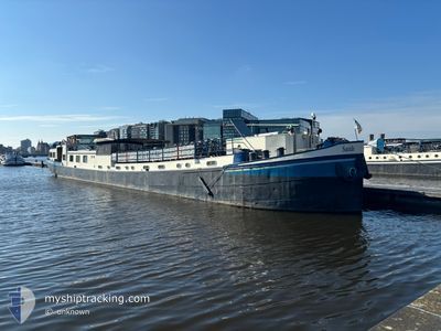
The vessel SARAH (MMSI: 244700491) is a Passenger It's sailing under the flag of [NL] Netherlands.
In this page you can find informations about the vessels current position, last detected port calls, and current voyage information. If the vessels is not in coverage by AIS you will find the latest position.
The current position of SARAH is detected by our AIS receivers and we are not responsible for the reliability of the data. The last position was recorded while the vessel was in Coverage by the Ais receivers of our vessel tracking app.
The current draught of SARAH as reported by AIS is 1.4 meters
Weather
| Temperature | 8.3°C / 46.94°F |
|---|---|
| Wind Speed | 5 knots |
| Direction | 109° ESE |
| Pressure | 1024 hPa |
| Humidity | 83.8 % |
| Cloud Coverage | 2 % |


Featured Company
Last Port Calls
| Port | Arrival | Departure | Time In Port |
|---|---|---|---|
| 2025-04-26 13:41 | 2025-04-26 14:08 | 27 m | |
| 2025-04-25 12:22 | 2025-04-26 12:45 | 1 d | |
| 2025-04-25 10:42 | 2025-04-25 11:53 | 1 h | |
| 2025-04-25 09:58 | 2025-04-25 10:08 | 9 m | |
| 2025-04-24 08:51 | 2025-04-25 08:59 | 1 d | |
| 2025-04-23 12:31 | 2025-04-24 07:00 | 18 h | |
| 2025-04-23 09:52 | 2025-04-23 11:24 | 1 h | |
| 2025-04-23 07:49 | 2025-04-23 08:24 | 34 m | |
| 2025-04-23 05:49 | 2025-04-23 06:55 | 1 h | |
| 2025-04-22 10:41 | 2025-04-23 05:25 | 18 h |
Last Trips
| Origin | Departure | Destination | Arrival | Distance | |
|---|---|---|---|---|---|
| 2025-04-26 14:45 | 2025-04-26 15:41 | 6.87 nm | |||
| 2025-04-25 13:53 | 2025-04-25 14:22 | 2.80 nm | |||
| 2025-04-25 12:08 | 2025-04-25 12:42 | 3.33 nm | |||
| 2025-04-25 10:59 | 2025-04-25 11:58 | 6.03 nm | |||
| 2025-04-24 09:00 | 2025-04-24 10:51 | 9.44 nm | |||
| 2025-04-23 13:24 | 2025-04-23 14:31 | 5.83 nm | |||
| 2025-04-23 10:24 | 2025-04-23 11:52 | 4.90 nm | |||
| 2025-04-23 08:55 | 2025-04-23 09:49 | 4.32 nm | |||
| 2025-04-23 07:25 | 2025-04-23 07:49 | 2.06 nm | |||
| 2025-04-22 11:12 | 2025-04-22 12:41 | 8.49 nm |
Events
| Tijd | Evenement | Details | Positie / Bestemming | Info |
|---|---|---|---|---|
| 2025-04-27 04:29 | Status Changed | Default Under way using engine |
52.38104 / 4.64403
OOSTERDOK
|
Snelheid: Koers: 511° |
| 2025-04-27 04:08 | Buitenbereik |
52.38101 / 4.64400
North Sea
|
Snelheid: Koers: 511° |
|
| 2025-04-27 03:26 | Status Changed | Under way using engine Default |
52.38103 / 4.64401
OOSTERDOK
|
Snelheid: Koers: -1° |
| 2025-04-27 03:16 | Status Changed | Default Under way using engine |
52.38097 / 4.64403
OOSTERDOK
|
Snelheid: Koers: 511° |
| 2025-04-27 03:08 | Status Changed | Under way using engine Default |
52.38097 / 4.64409
OOSTERDOK
|
Snelheid: Koers: -1° |
| 2025-04-27 02:50 | Binnenbereik |
52.38097 / 4.64409
North Sea
|
Snelheid: Koers: 511° |
|
| 2025-04-26 21:31 | Status Changed | Default Under way using engine |
52.38100 / 4.64400
OOSTERDOK
|
Snelheid: Koers: 511° |
| 2025-04-26 20:36 | Buitenbereik |
52.38105 / 4.64396
North Sea
|
Snelheid: Koers: 511° |
|
| 2025-04-26 18:47 | Status Changed | Under way using engine Default |
52.38103 / 4.64395
OOSTERDOK
|
Snelheid: Koers: -1° |
| 2025-04-26 18:47 | Binnenbereik |
52.38105 / 4.64393
North Sea
|
Snelheid: Koers: 511° |