
SANTA CLARA
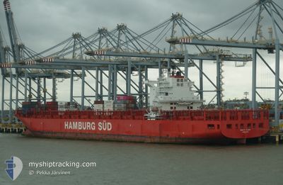
Container Ship
Current Trip
| Trip Time | 12 days |
|---|---|
| Trip Distance | 5581.24 nm |
| AVG Speed | 19 Knots |
| MAX Speed | 22 Knots |
| Draught | 13.1 m |
| AVG Wind | 12.8 knots |
| MAX Wind | 25.8 knots |
| MIN Temp | 13.8°C / 56.84°F |
| MAX Temp | 29.2°C / 84.56°F |
| Position Received | 1 d ago |
Current Position
| Longitude | 18.95448° |
|---|---|
| Latitude | -34.66465° |
| Status | Under way using engine |
| Speed | 21.2 Knots |
| Course | 114.8° |
| Area | South Atlantic Ocean |
| Station | T-AIS |
| Position Received | 1 d ago |
Info
Information
The current position of SANTA CLARA is in South Atlantic Ocean with coordinates -34.66465° / 18.95448° as reported on 2024-05-15 09:46 by AIS to our vessel tracker app. The vessel's current speed is 21.2 Knots and is currently inside the port of COEGA.
The vessel SANTA CLARA (IMO: 9444716, MMSI: 219075000) is a Container Ship that was built in 2010 ( 14 years old ). It's sailing under the flag of [DK] Denmark.
In this page you can find informations about the vessels current position, last detected port calls, and current voyage information. If the vessels is not in coverage by AIS you will find the latest position.
The current position of SANTA CLARA is detected by our AIS receivers and we are not responsible for the reliability of the data. The last position was recorded while the vessel was in Coverage by the Ais receivers of our vessel tracking app.
The current draught of SANTA CLARA as reported by AIS is 13.1 meters
Weather
| Temperature | 20.7°C / 69.26°F |
|---|---|
| Wind Speed | 15 knots |
| Direction | 241° WSW |
| Pressure | 1021.7 hPa |
| Humidity | 66.3 % |
| Cloud Coverage | 30 % |
Featured Company
Last Port Calls
| Port | Arrival | Departure | Time In Port |
|---|---|---|---|
| 2024-05-16 07:11 | |||
| 2024-05-03 09:35 | 2024-05-04 01:06 | 15 h | |
| 2024-04-30 12:40 | 2024-05-01 08:11 | 19 h | |
| 2024-04-23 02:53 | 2024-04-24 13:18 | 1 d | |
| 2024-04-20 12:16 | 2024-04-22 23:34 | 2 d | |
| 2024-04-18 12:36 | 2024-04-19 04:37 | 16 h | |
| 2024-04-14 03:01 | 2024-04-16 01:23 | 1 d | |
| 2024-03-22 12:53 | 2024-03-29 19:07 | 7 d | |
| 2024-03-14 14:04 | 2024-03-19 22:19 | 5 d | |
| 2024-03-08 09:41 |
Most Visited Ports (Last year)
| Port | Arrivals | |
|---|---|---|
| 10 | ||
| 6 | ||
| 5 | ||
| 5 | ||
| 5 | ||
| 5 |
Last Trips
| Origin | Departure | Destination | Arrival | Distance | |
|---|---|---|---|---|---|
| 2024-05-04 01:06 | 2024-05-16 07:11 | 5581.24 nm | |||
| 2024-05-01 08:11 | 2024-05-03 09:35 | 9.20 nm | |||
| 2024-04-24 13:18 | 2024-04-30 12:40 | 1682.92 nm | |||
| 2024-04-22 23:34 | 2024-04-23 02:53 | 47.63 nm | |||
| 2024-04-19 04:37 | 2024-04-20 12:16 | 372.64 nm | |||
| 2024-04-16 01:23 | 2024-04-18 12:36 | 233.06 nm | |||
| 2024-03-29 19:07 | 2024-04-14 03:01 | 6200.84 nm | |||
| 2024-03-19 22:19 | 2024-03-22 12:53 | 834.61 nm | |||
| 2024-03-08 09:41 | 2024-03-14 14:04 | 445.77 nm |
Events
| Time | Event | Details | Position / Dest | Info |
|---|---|---|---|---|
| 2024-05-16 05:23 | STOP Moving |
-33.80591 / 25.69101
[ZA] COEGA
|
Speed: 0.1 kn Course: 86° |
|
| 2024-05-16 05:11 | PORT ARRIVAL |
|
-33.81290 / 25.69203
[ZA] COEGA
|
Speed: 6.3 kn Course: 10° |
| 2024-05-16 04:51 | START Moving | 2.56 nm, South of COEGA |
-33.84670 / 25.69718
ZAPLZ
|
Speed: 5.2 kn Course: 326° |
| 2024-05-16 04:43 | STOP Moving | 2.85 nm, South of COEGA |
-33.85101 / 25.70215
ZAPLZ
|
Speed: 0.3 kn Course: 312° |
| 2024-05-15 09:48 | Status Changed | Default Under way using engine |
-34.66967 / 18.96813
ZAPLZ
|
Speed: 21.2 kn Course: 114.8° |
| 2024-05-15 09:46 | Status Changed | Under way using engine Default |
-34.66465 / 18.95448
ZAPLZ
|
Speed: 21.2 kn Course: 113° |
| 2024-05-15 09:46 | OUT of Coverage |
-34.66465 / 18.95448
South Atlantic Ocean
|
Speed: 21.2 kn Course: 114.8° |
|
| 2024-05-15 09:10 | Status Changed | Default Under way using engine |
-34.57673 / 18.71806
ZAPLZ
|
Speed: 20.9 kn Course: 112.1° |
| 2024-05-15 04:48 | Status Changed | Under way using engine Default |
-33.56449 / 17.51054
ZAPLZ
|
Speed: 20.4 kn Course: 139° |
| 2024-05-15 04:35 | Status Changed | Default Under way using engine |
-33.50818 / 17.45362
ZAPLZ
|
Speed: 20.3 kn Course: 140.5° |