
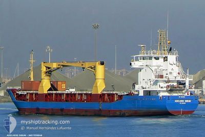
SANTA BARBARA
General Cargo
Current Trip
GYGEO
| Time Travelled | 1 day |
|---|---|
| Remaining Time | --- |
| Distance Travelled | 15.13 nm |
| Remaining Distance | --- |
| AVG Speed | 10 Knots |
| MAX Speed | 11 Knots |
| AVG Wind | 10.8 knots |
| MAX Wind | 15 knots |
| MIN Temp | 22.7°C / 72.86°F |
| MAX Temp | 27°C / 80.6°F |
| Draught | 5.9 m |
| Position Received | 10 d ago |
Current Position
| Longitude | --- |
|---|---|
| Latitude | --- |
| Status | Under way using engine |
| Speed | 8.4 Knots |
| Course | 229° |
| Area | North Atlantic Ocean |
| Station | T-AIS |
| Position Received | 10 d ago |
Info
Information
The current position of SANTA BARBARA is in North Atlantic Ocean with coordinates 7.76939° / -56.64957° as reported on 2025-12-27 20:54 by AIS to our vessel tracker app. The vessel's current speed is 8.4 Knots
The vessel SANTA BARBARA (IMO: 9210048, MMSI: 314788000) is a General Cargo that was built in 2000 ( 26 years old ). It's sailing under the flag of [BB] Barbados.
In this page you can find informations about the vessels current position, last detected port calls, and current voyage information. If the vessels is not in coverage by AIS you will find the latest position.
The current position of SANTA BARBARA is detected by our AIS receivers and we are not responsible for the reliability of the data. The last position was recorded while the vessel was in Coverage by the Ais receivers of our vessel tracking app.
The current draught of SANTA BARBARA as reported by AIS is 5.9 meters
Weather
| Temperature | 26.3°C / 79.34°F |
|---|---|
| Wind Speed | 11 knots |
| Direction | 80° E |
| Pressure | 1014 hPa |
| Humidity | 80.2 % |
| Cloud Coverage | 91 % |
Featured Company
Last Port Calls
| Port | Arrival | Departure | Time In Port |
|---|---|---|---|
| 2026-01-04 07:41 | 2026-01-05 20:17 | 1 d | |
| 2025-12-12 17:47 | 2025-12-13 01:57 | 8 h | |
| 2025-11-30 01:54 | 2025-12-02 18:41 | 2 d | |
| 2025-11-26 00:35 | |||
| 2025-11-08 02:44 | 2025-11-08 11:17 | 8 h | |
| 2025-11-04 12:34 |
Last Trips
| Origin | Departure | Destination | Arrival | Distance | |
|---|---|---|---|---|---|
| 2025-12-13 01:57 | 2026-01-04 07:41 | 3408.67 nm | |||
| 2025-12-02 18:41 | 2025-12-12 17:47 | 1812.77 nm | |||
| 2025-11-26 00:35 | 2025-11-30 01:54 | 337.22 nm | |||
| 2025-11-04 12:34 | 2025-11-08 02:44 | 498.53 nm |
Events
| Time | Event | Details | Position / Dest | Info |
|---|---|---|---|---|
| 2026-01-06 02:30 | STOP Moving | 15.47 nm, North East of GEORGETOWN |
6.94456 / -57.96620
GYGEO
|
Speed: 0.2 kn Course: 77° |
| 2026-01-06 00:17 | PORT DEPARTURE |
|
6.83063 / -58.16904
GYGEO
|
Speed: 11.4 kn Course: 3° |
| 2026-01-06 00:14 | START Moving |
6.82069 / -58.17028
[GY] GEORGETOWN
|
Speed: 11.4 kn Course: 3° |
|
| 2026-01-04 11:41 | PORT ARRIVAL |
|
6.81452 / -58.16814
[GY] GEORGETOWN
|
Speed: 4.2 kn Course: 252° |
| 2026-01-04 07:54 | START Moving | 17.48 nm, North East of GEORGETOWN |
6.96405 / -57.93866
GYGEO
|
Speed: 5.8 kn Course: 251° |
| 2026-01-04 02:27 | STOP Moving | 17.86 nm, North East of GEORGETOWN |
6.96658 / -57.93267
GYGEO
|
Speed: 0.1 kn Course: 45° |
| 2026-01-02 10:52 | STOP Moving | 17.97 nm, North East of GEORGETOWN |
6.96827 / -57.93160
GYGEO
|
Speed: 0.2 kn Course: 141° |
| 2025-12-29 09:52 | STOP Moving | 17.89 nm, North East of GEORGETOWN |
6.96675 / -57.93215
GYGEO
|
Speed: 0.2 kn Course: 82° |
| 2025-12-29 02:41 | STOP Moving | 17.91 nm, North East of GEORGETOWN |
6.96739 / -57.93209
GYGEO
|
Speed: 0.2 kn Course: 96° |
| 2025-12-29 01:02 | STOP Moving | 17.89 nm, North East of GEORGETOWN |
6.96692 / -57.93214
GYGEO
|
Speed: 0.3 kn Course: 83° |