

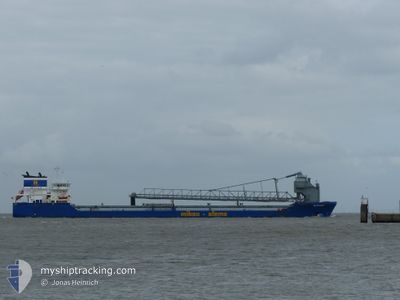
SANDNES
Self Discharging Bulk Carrier

Current Trip
| Trip Time | 1 day |
|---|---|
| Trip Distance | 421.97 nm |
| AVG Speed | 11.5 Knots |
| MAX Speed | 13.8 Knots |
| Draught | 8.3 m |
| AVG Wind | 8.9 knots |
| MAX Wind | 23 knots |
| MIN Temp | 3.6°C / 38.48°F |
| MAX Temp | 7.7°C / 45.86°F |
| Position Received | 2 m ago |
Current Position
| Longitude | --- |
|---|---|
| Latitude | --- |
| Status | Moored |
| Speed | |
| Course | 83° |
| Area | North Sea |
| Station | T-AIS |
| Position Received | 2 m ago |
Information
The current position of SANDNES is in North Sea with coordinates 59.08859° / 5.90258° as reported on 2025-03-27 07:10 by AIS to our vessel tracker app. The vessel's current speed is 0 Knots and is currently inside the port of BREIVIKEN.
The vessel SANDNES (IMO: 9306029, MMSI: 304783000) is a Self Discharging Bulk Carrier that was built in 2005 ( 20 years old ). It's sailing under the flag of [AG] Antigua Barbuda.
In this page you can find informations about the vessels current position, last detected port calls, and current voyage information. If the vessels is not in coverage by AIS you will find the latest position.
The current position of SANDNES is detected by our AIS receivers and we are not responsible for the reliability of the data. The last position was recorded while the vessel was in Coverage by the Ais receivers of our vessel tracking app.
The current draught of SANDNES as reported by AIS is 10.5 meters
Weather
| Temperature | 5.2°C / 41.36°F |
|---|---|
| Wind Speed | 7 knots |
| Direction | 145° SE |
| Pressure | 1011.1 hPa |
| Humidity | 92.2 % |
| Cloud Coverage | 100 % |


Featured Company
Last Port Calls
| Port | Arrival | Departure | Time In Port |
|---|---|---|---|
| 2025-03-26 23:11 | |||
| 2025-03-24 06:30 | 2025-03-25 03:05 | 20 h | |
| 2025-03-19 08:00 | 2025-03-20 08:38 | 1 d | |
| 2025-03-14 11:24 | 2025-03-14 21:28 | 10 h | |
| 2025-03-13 12:05 | 2025-03-14 10:56 | 22 h | |
| 2025-03-10 13:32 | 2025-03-11 00:07 | 10 h | |
| 2025-03-07 22:55 | 2025-03-08 21:44 | 22 h | |
| 2025-03-07 21:06 | 2025-03-07 21:53 | 47 m | |
| 2025-03-02 23:22 | 2025-03-03 12:56 | 13 h | |
| 2025-03-02 12:38 | 2025-03-02 18:12 | 5 h |
Last Trips
| Origin | Departure | Destination | Arrival | Distance | |
|---|---|---|---|---|---|
| 2025-03-25 03:05 | 2025-03-26 23:11 | 421.97 nm | |||
| 2025-03-20 08:38 | 2025-03-24 06:30 | 834.82 nm | |||
| 2025-03-14 21:28 | 2025-03-19 08:00 | 993.89 nm | |||
| 2025-03-14 10:56 | 2025-03-14 11:24 | 1.23 nm | |||
| 2025-03-11 00:07 | 2025-03-13 12:05 | 568.45 nm | |||
| 2025-03-08 21:44 | 2025-03-10 13:32 | 442.89 nm | |||
| 2025-03-07 21:53 | 2025-03-07 22:55 | 7.21 nm | |||
| 2025-03-03 12:56 | 2025-03-07 21:06 | 1022.48 nm | |||
| 2025-03-02 18:12 | 2025-03-02 23:22 | 38.41 nm | |||
| 2025-02-28 02:03 | 2025-03-02 12:38 | 415.91 nm |
Events
| Time | Event | Details | Position / Dest | Info |
|---|---|---|---|---|
| 2025-03-27 05:28 | ETA Changed | 2025/03/29 05:00 2025/03/29 04:00 |
59.08864 / 5.90325
[NO] BREIVIKEN
|
Speed: Course: 83° |
| 2025-03-27 03:31 | Draught Changed | 10.5 8.3 |
59.08850 / 5.90217
[NO] BREIVIKEN
|
Speed: Course: 83° |
| 2025-03-27 03:31 | Destination Changed | GBTIL NOTAU |
59.08850 / 5.90217
[NO] BREIVIKEN
|
Speed: Course: 83° |
| 2025-03-27 03:31 | ETA Changed | 2025/03/29 04:00 2025/03/26 22:00 |
59.08850 / 5.90217
[NO] BREIVIKEN
|
Speed: Course: 83° |
| 2025-03-26 22:37 | Status Changed | Moored Under way using engine |
59.08860 / 5.90270
[NO] BREIVIKEN
|
Speed: Course: 82° |
| 2025-03-26 22:18 | STOP Moving |
59.08875 / 5.90238
[NO] BREIVIKEN
|
Speed: 0.1 kn Course: 85° |
|
| 2025-03-26 22:11 | PORT ARRIVAL |
|
59.08983 / 5.90051
[NO] BREIVIKEN
|
Speed: 0.8 kn Course: 115° |
| 2025-03-26 20:12 | START Moving | 2.45 nm, North of JELSA |
59.37365 / 6.03647
NOTAU
|
Speed: 6.9 kn Course: 228° |
| 2025-03-26 19:49 | Status Changed | Under way using engine Moored |
59.37783 / 6.04683
NOTAU
|
Speed: Course: 227° |
| 2025-03-26 15:48 | Destination Changed | NOTAU NOJEL |
59.37795 / 6.04694
NOTAU
|
Speed: Course: 226° |