
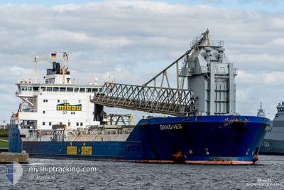
SANDNES
Self Discharging Bulk Carrier
Current Trip
| Time Travelled | 1 day |
|---|---|
| Remaining Time | 15 h, 23 mins |
| Distance Travelled | 263.52 nm |
| Remaining Distance | 253.20 nm |
| AVG Speed | 11.7 Knopen |
| MAX Speed | 13.2 Knopen |
| AVG Wind | 7.2 knots |
| MAX Wind | 14.9 knots |
| MIN Temp | -5.9°C / 21.38°F |
| MAX Temp | 2°C / 35.6°F |
| Diepgang | 10.5 M |
| Positie ontvangen | 9 h, 31 m geleden |
Current Position
| Lengtegraad | --- |
|---|---|
| Breedtegraat | --- |
| Status | Under way using engine |
| Snelheid | 11.6 Knopen |
| Koers | 189° |
| Gebied | North Sea |
| Station | T-AIS |
| Positie ontvangen | 9 h, 31 m geleden |
Info
Information
The current position of SANDNES is in North Sea with coordinates 55.36121° / 4.21493° as reported on 2025-02-17 21:32 by AIS to our vessel tracker app. The vessel's current speed is 11.6 Knopen and is heading at the port of NORTHFLEET. The estimated time of arrival as calculated by MyShipTracking vessel tracking app is 2025-02-18 22:26 LT
The vessel SANDNES (IMO: 9306029, MMSI: 304783000) is a Self Discharging Bulk Carrier that was built in 2005 ( 20 Jaar oud ). It's sailing under the flag of [AG] Antigua Barbuda.
In this page you can find informations about the vessels current position, last detected port calls, and current voyage information. If the vessels is not in coverage by AIS you will find the latest position.
The current position of SANDNES is detected by our AIS receivers and we are not responsible for the reliability of the data. The last position was recorded while the vessel was in Coverage by the Ais receivers of our vessel tracking app.
The current draught of SANDNES as reported by AIS is 10.5 meters
Weather
| Temperature | 1.9°C / 35.42°F |
|---|---|
| Wind Speed | 12 knots |
| Direction | 126° SE |
| Pressure | 1027.1 hPa |
| Humidity | 61.3 % |
| Cloud Coverage | 45 % |
Featured Company
Last Port Calls
| Port | Arrival | Departure | Time In Port |
|---|---|---|---|
| 2025-02-16 16:45 | 2025-02-17 02:04 | 9 h | |
| 2025-02-12 15:49 | 2025-02-14 13:28 | 1 d | |
| 2025-02-08 03:16 | 2025-02-08 08:31 | 5 h | |
| 2025-02-05 17:42 | 2025-02-06 17:05 | 23 h | |
| 2025-02-01 07:04 | 2025-02-02 17:12 | 1 d | |
| 2025-01-29 13:46 | 2025-01-30 16:54 | 1 d | |
| 2025-01-27 08:00 | 2025-01-27 19:17 | 11 h | |
| 2025-01-24 02:32 | 2025-01-24 03:20 | 47 m | |
| 2025-01-22 23:54 | 2025-01-24 00:59 | 1 d | |
| 2025-01-22 22:21 | 2025-01-22 22:53 | 31 m |
Last Trips
| Origin | Departure | Destination | Arrival | Distance | |
|---|---|---|---|---|---|
| 2025-02-14 13:28 | 2025-02-16 16:45 | 456.52 nm | |||
| 2025-02-08 08:31 | 2025-02-12 15:49 | 714.26 nm | |||
| 2025-02-06 17:05 | 2025-02-08 03:16 | 433.18 nm | |||
| 2025-02-02 17:12 | 2025-02-05 17:42 | 796.10 nm | |||
| 2025-01-30 16:54 | 2025-02-01 07:04 | 410.97 nm | |||
| 2025-01-27 19:17 | 2025-01-29 13:46 | 412.84 nm | |||
| 2025-01-24 03:20 | 2025-01-27 08:00 | 534.55 nm | |||
| 2025-01-24 00:59 | 2025-01-24 02:32 | 9.95 nm | |||
| 2025-01-22 22:53 | 2025-01-22 23:54 | 6.91 nm | |||
| 2025-01-21 06:40 | 2025-01-22 22:21 | 444.59 nm |
Events
| Tijd | Evenement | Details | Positie / Bestemming | Info |
|---|---|---|---|---|
| 2025-02-17 22:19 | Status Changed | Default Under way using engine |
55.21333 / 4.15317
GBNFT
|
Snelheid: 11.6 kn Koers: 189° |
| 2025-02-17 21:32 | Buitenbereik |
55.36121 / 4.21493
North Sea
GBNFT
|
Snelheid: 11.6 kn Koers: 189° |
|
| 2025-02-17 21:27 | Wijzig zee gebeid | Dutch part of the North Sea German part of the North Sea |
55.37707 / 4.21952
North Sea
GBNFT
|
Snelheid: 11.6 kn Koers: 189° |
| 2025-02-17 19:51 | Wijzig zee gebeid | German part of the North Sea Danish part of the North Sea |
55.68133 / 4.31483
North Sea
GBNFT
|
Snelheid: 11.8 kn Koers: 190° |
| 2025-02-17 15:55 | Wijzig zee gebeid | Danish part of the North Sea Norwegian part of the North Sea |
56.44571 / 4.54802
North Sea
GBNFT
|
Snelheid: 12.1 kn Koers: 189° |
| 2025-02-17 14:06 | Status Changed | Under way using engine Default |
56.80850 / 4.66236
GBNFT
|
Snelheid: 12.2 kn Koers: 191° |
| 2025-02-17 14:06 | Binnenbereik |
56.80467 / 4.66100
North Sea
GBNFT
|
Snelheid: 12.1 kn Koers: 192° |
|
| 2025-02-17 11:41 | Status Changed | Default Under way using engine |
57.28360 / 4.81764
GBNFT
|
Snelheid: 11.8 kn Koers: 189° |
| 2025-02-17 11:20 | Buitenbereik |
57.35000 / 4.83783
North Sea
GBNFT
|
Snelheid: 11.8 kn Koers: 189° |
|
| 2025-02-17 01:12 | Start beweging | 0.31 nm, North West of BREIVIKEN |
59.09327 / 5.89716
GBNFT
|
Snelheid: 3.4 kn Koers: 244° |