
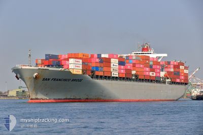
SAN FRANCISCO BRIDGE
Container Ship
Current Trip
| Time Travelled | 3 days |
|---|---|
| Remaining Time | --- |
| Distance Travelled | 913.50 nm |
| Remaining Distance | --- |
| AVG Speed | 11.9 Knots |
| MAX Speed | 20 Knots |
| AVG Wind | 12 knots |
| MAX Wind | 20.4 knots |
| MIN Temp | 28.7°C / 83.66°F |
| MAX Temp | 36.6°C / 97.88°F |
| Draught | 12.2 m |
| Position Received | 9 h, 56 m ago |
Current Position
| Longitude | 78.51585° |
|---|---|
| Latitude | 7.38290° |
| Status | Under way using engine |
| Speed | 12.4 Knots |
| Course | 110° |
| Area | Laccadive Sea |
| Station | T-AIS |
| Position Received | 9 h, 56 m ago |
Info
Information
The current position of SAN FRANCISCO BRIDGE is in Laccadive Sea with coordinates 7.38290° / 78.51585° as reported on 2024-05-02 05:41 by AIS to our vessel tracker app. The vessel's current speed is 12.4 Knots
The vessel SAN FRANCISCO BRIDGE (IMO: 9560364, MMSI: 355400000) is a Container Ship that was built in 2010 ( 14 years old ). It's sailing under the flag of [PA] Panama.
In this page you can find informations about the vessels current position, last detected port calls, and current voyage information. If the vessels is not in coverage by AIS you will find the latest position.
The current position of SAN FRANCISCO BRIDGE is detected by our AIS receivers and we are not responsible for the reliability of the data. The last position was recorded while the vessel was in Coverage by the Ais receivers of our vessel tracking app.
The current draught of SAN FRANCISCO BRIDGE as reported by AIS is 12.2 meters
Weather
| Temperature | 30.2°C / 86.36°F |
|---|---|
| Wind Speed | 10 knots |
| Direction | 209° SSW |
| Pressure | 1007.7 hPa |
| Humidity | 77.2 % |
| Cloud Coverage | 100 % |
Featured Company
Last Port Calls
| Port | Arrival | Departure | Time In Port |
|---|---|---|---|
| 2024-04-28 07:08 | 2024-04-29 07:36 | 1 d | |
| 2024-04-24 12:24 | 2024-04-25 01:39 | 13 h | |
| 2024-04-22 11:14 | 2024-04-22 22:46 | 11 h | |
| 2024-04-15 09:28 | 2024-04-16 06:11 | 20 h | |
| 2024-04-13 06:30 | 2024-04-13 19:26 | 12 h | |
| 2024-04-10 07:22 | 2024-04-11 18:08 | 1 d | |
| 2024-04-05 19:24 | 2024-04-08 04:21 | 2 d | |
| 2024-04-01 17:09 | 2024-04-02 12:14 | 19 h | |
| 2024-03-29 22:34 | 2024-03-30 22:49 | 1 d | |
| 2024-03-22 01:28 | 2024-03-22 17:05 | 15 h |
Last Trips
| Origin | Departure | Destination | Arrival | Distance | |
|---|---|---|---|---|---|
| 2024-04-25 06:39 | 2024-04-28 12:38 | 598.18 nm | |||
| 2024-04-23 04:16 | 2024-04-24 17:24 | 431.19 nm | |||
| 2024-04-16 14:11 | 2024-04-22 16:44 | 2446.78 nm | |||
| 2024-04-14 03:26 | 2024-04-15 17:28 | 20.64 nm | |||
| 2024-04-12 02:08 | 2024-04-13 14:30 | 200.47 nm | |||
| 2024-04-08 11:21 | 2024-04-10 15:22 | 809.41 nm | |||
| 2024-04-02 20:14 | 2024-04-06 02:24 | 818.57 nm | |||
| 2024-03-31 06:49 | 2024-04-02 01:09 | 208.01 nm | |||
| 2024-03-22 22:35 | 2024-03-30 06:34 | 1430.18 nm | |||
| 2024-03-18 09:44 | 2024-03-22 06:58 | 923.78 nm |
Events
| Time | Event | Details | Position / Dest | Info |
|---|---|---|---|---|
| 2024-05-02 11:52 | STOP Moving | 17.01 nm, West of COLOMBO |
7.03857 / 79.56393
LK CMB
|
Speed: 0.2 kn Course: 167° |
| 2024-05-02 06:30 | Status Changed | Default Under way using engine |
7.32732 / 78.67605
LK CMB
|
Speed: 12.4 kn Course: 110° |
| 2024-05-02 05:41 | Status Changed | Under way using engine Default |
7.38290 / 78.51585
LK CMB
|
Speed: 12.5 kn Course: 108° |
| 2024-05-02 05:41 | IN Coverage |
7.38290 / 78.51585
Laccadive Sea
LK CMB
|
Speed: 12.4 kn Course: 110° |
|
| 2024-05-02 05:41 | OUT of Coverage |
7.38290 / 78.51585
Laccadive Sea
LK CMB
|
Speed: 12.4 kn Course: 110° |
|
| 2024-05-02 03:41 | OUT of Coverage |
7.51778 / 78.11252
Laccadive Sea
LK CMB
|
Speed: 12.7 kn Course: 112° |
|
| 2024-05-01 19:19 | Draught Changed | 12.2 13.9 |
8.18462 / 76.53823
LK CMB
|
Speed: 12 kn Course: 128° |
| 2024-05-01 19:19 | Destination Changed | LK CMB IN PAV |
8.18462 / 76.53823
LK CMB
|
Speed: 12 kn Course: 128° |
| 2024-05-01 19:19 | ETA Changed | 2024/05/02 23:30 2024/04/22 12:30 |
8.18462 / 76.53823
LK CMB
|
Speed: 12 kn Course: 128° |
| 2024-05-01 18:32 | Status Changed | Under way using engine Default |
8.27195 / 76.42807
IN PAV
|
Speed: 11.6 kn Course: 128° |