
SAKIZAYA POWER
Cargo
Current Trip
| Time Travelled | 32 days |
|---|---|
| Remaining Time | --- |
| Distance Travelled | 8085.77 nm |
| Remaining Distance | --- |
| AVG Speed | 11.4 Knots |
| MAX Speed | 16.6 Knots |
| AVG Wind | 11.7 knots |
| MAX Wind | 27.8 knots |
| MIN Temp | 13.8°C / 56.84°F |
| MAX Temp | 29.3°C / 84.74°F |
| Draught | 7.2 m |
| Position Received | 7 d ago |
Current Position
| Longitude | --- |
|---|---|
| Latitude | --- |
| Status | Under way using engine |
| Speed | 13.2 Knots |
| Course | 313.4° |
| Area | Malacca Strait |
| Station | T-AIS |
| Position Received | 7 d ago |
Info
Information
The current position of SAKIZAYA POWER is in Malacca Strait with coordinates 1.26916° / 103.36930° as reported on 2025-03-10 16:15 by AIS to our vessel tracker app. The vessel's current speed is 13.2 Knots and is heading at the port of GOOD HOPE. The estimated time of arrival as calculated by MyShipTracking vessel tracking app is 2025-03-29 02:00 LT
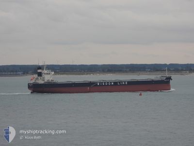
The vessel SAKIZAYA POWER (IMO: 9783136, MMSI: 372545000) is a Cargo It's sailing under the flag of [PA] Panama.
In this page you can find informations about the vessels current position, last detected port calls, and current voyage information. If the vessels is not in coverage by AIS you will find the latest position.
The current position of SAKIZAYA POWER is detected by our AIS receivers and we are not responsible for the reliability of the data. The last position was recorded while the vessel was in Coverage by the Ais receivers of our vessel tracking app.
The current draught of SAKIZAYA POWER as reported by AIS is 7.2 meters
Weather
| Temperature | 27.6°C / 81.68°F |
|---|---|
| Wind Speed | 12 knots |
| Direction | 73° ENE |
| Pressure | 1012.7 hPa |
| Humidity | 76.9 % |
| Cloud Coverage | 89 % |
Featured Company
Most Visited Ports (Last year)
| Port | Arrivals | |
|---|---|---|
| 3 | ||
| 1 | ||
| 1 | ||
| 1 | ||
| 1 | ||
| 1 |
Events
| Time | Event | Details | Position / Dest | Info |
|---|---|---|---|---|
| 2025-03-10 16:22 | Status Changed | Default Under way using engine |
1.28731 / 103.34991
CAPE OF GOOD HOPE
|
Speed: 13.2 kn Course: 313.4° |
| 2025-03-10 16:15 | OUT of Coverage |
1.26916 / 103.36930
Malacca Strait
CAPE OF GOOD HOPE
|
Speed: 13.2 kn Course: 313.4° |
|
| 2025-03-10 16:12 | Change Sea Area | Malaysian part of the Malacca Strait Indonesian part of the Malacca Strait |
1.26245 / 103.37637
Malacca Strait
CAPE OF GOOD HOPE
|
Speed: 13.1 kn Course: 313° |
| 2025-03-10 16:07 | Status Changed | Under way using engine Default |
1.24940 / 103.39090
CAPE OF GOOD HOPE
|
Speed: 13.2 kn Course: 311° |
| 2025-03-10 16:06 | Status Changed | Default Under way using engine |
1.24734 / 103.39324
CAPE OF GOOD HOPE
|
Speed: 13.2 kn Course: 311.4° |
| 2025-03-10 16:03 | Status Changed | Under way using engine Default |
1.24130 / 103.40011
CAPE OF GOOD HOPE
|
Speed: 13.1 kn Course: 310° |
| 2025-03-10 16:02 | Status Changed | Default Under way using engine |
1.23771 / 103.40420
CAPE OF GOOD HOPE
|
Speed: 13.1 kn Course: 307.6° |
| 2025-03-10 15:57 | Change Sea Area | Indonesian part of the Malacca Strait Malaysian part of the Singapore Strait |
1.22733 / 103.41997
Malacca Strait
CAPE OF GOOD HOPE
|
Speed: 13.4 kn Course: 291.4° |
| 2025-03-10 15:57 | Status Changed | Under way using engine Default |
1.22733 / 103.41997
CAPE OF GOOD HOPE
|
Speed: 13.3 kn Course: 287° |
| 2025-03-10 15:54 | Status Changed | Default Under way using engine |
1.22394 / 103.42994
CAPE OF GOOD HOPE
|
Speed: 13.4 kn Course: 279.6° |